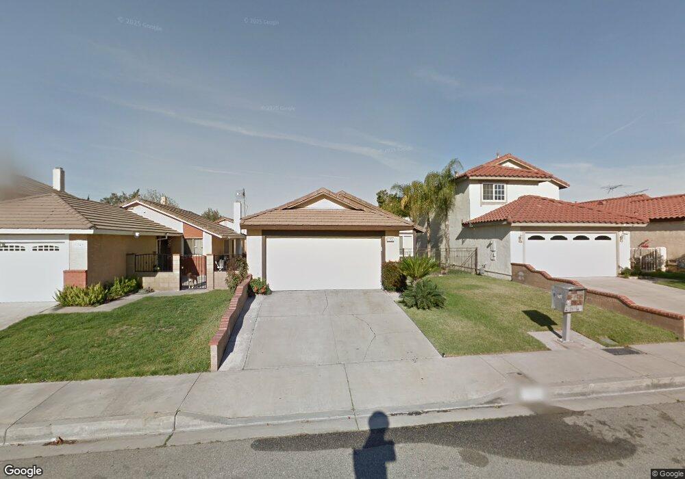
1355 Coral Tree Rd Colton, CA 92324
Estimated Value: $493,970 - $572,000
3
Beds
2
Baths
1,206
Sq Ft
$435/Sq Ft
Est. Value
About This Home
This home is located at 1355 Coral Tree Rd, Colton, CA 92324 and is currently estimated at $524,493, approximately $434 per square foot. 1355 Coral Tree Rd is a home located in San Bernardino County with nearby schools including Georgia Morris Elementary School, William G. Jehue Middle School, and Rialto High School.
Ownership History
Date
Name
Owned For
Owner Type
Purchase Details
Closed on
Feb 4, 2016
Sold by
Smith Mae E
Bought by
Smith Mae Etta and Smith Family Trust
Current Estimated Value
Purchase Details
Closed on
Apr 13, 1994
Sold by
Kroll Dennis E and Kroll Kimberly A
Bought by
Smith Burnell and Smith Mae E
Home Financials for this Owner
Home Financials are based on the most recent Mortgage that was taken out on this home.
Original Mortgage
$79,200
Interest Rate
4.15%
Create a Home Valuation Report for This Property
The Home Valuation Report is an in-depth analysis detailing your home's value as well as a comparison with similar homes in the area
Home Values in the Area
Average Home Value in this Area
Purchase History
| Date | Buyer | Sale Price | Title Company |
|---|---|---|---|
| Smith Mae Etta | -- | None Available | |
| Smith Burnell | $99,000 | United Title Co |
Source: Public Records
Mortgage History
| Date | Status | Borrower | Loan Amount |
|---|---|---|---|
| Previous Owner | Smith Burnell | $79,200 |
Source: Public Records
Tax History
| Year | Tax Paid | Tax Assessment Tax Assessment Total Assessment is a certain percentage of the fair market value that is determined by local assessors to be the total taxable value of land and additions on the property. | Land | Improvement |
|---|---|---|---|---|
| 2025 | $2,209 | $168,269 | $42,150 | $126,119 |
| 2024 | $2,135 | $164,970 | $41,324 | $123,646 |
| 2023 | $2,270 | $161,736 | $40,514 | $121,222 |
| 2022 | $2,116 | $158,565 | $39,720 | $118,845 |
| 2021 | $2,103 | $155,456 | $38,941 | $116,515 |
| 2020 | $2,116 | $153,862 | $38,542 | $115,320 |
| 2019 | $2,070 | $150,845 | $37,786 | $113,059 |
| 2018 | $2,013 | $147,887 | $37,045 | $110,842 |
| 2017 | $1,998 | $144,988 | $36,319 | $108,669 |
| 2016 | $1,977 | $142,145 | $35,607 | $106,538 |
| 2015 | $1,985 | $140,010 | $35,072 | $104,938 |
| 2014 | $1,874 | $137,267 | $34,385 | $102,882 |
Source: Public Records
Map
Nearby Homes
- 825 S Acacia Ave
- 1065 Martinez Ln
- 1972 De Anza Dr
- 993 S Date Ave
- 340 Lilly St
- 758 S Acacia Ave
- 365 E Vodden St
- 1025 S Riverside Ave Unit 66
- 1155 S Riverside Ave Unit 22
- 1155 S Riverside Ave Unit 7
- 1250 Iron Horse Cir
- 722 S Sycamore Ave
- 742 S Magnolia Ave
- 1928 Ray Abril Jr Ln
- 629 S Sage Ave
- 426 E Orchard St
- 125 W Alru St
- 731 S Orange Ave
- 225 W Alru St
- 200 W San Bernardino Ave Unit 19
- 1365 Coral Tree Rd
- 1345 Coral Tree Rd
- 1375 Coral Tree Rd
- 1335 Coral Tree Rd
- 1356 Candleberry Rd
- 1370 Candleberry Rd
- 1352 Candleberry Rd
- 1385 Coral Tree Rd
- 1333 Coral Tree Rd
- 1372 Candleberry Rd
- 1342 Candleberry Rd
- 1382 Candleberry Rd
- 1356 Coral Tree Rd
- 1395 Coral Tree Rd
- 1332 Candleberry Rd
- 1354 Coral Tree Rd
- 1360 Coral Tree Rd
- 1350 Coral Tree Rd
- 1372 Coral Tree Rd
- 1392 Candleberry Rd
Your Personal Tour Guide
Ask me questions while you tour the home.