1355 Welsh Rd Unit LOT 1 Reading, PA 19607
Pennwyn NeighborhoodEstimated Value: $572,000 - $850,000
5
Beds
4
Baths
4,576
Sq Ft
$154/Sq Ft
Est. Value
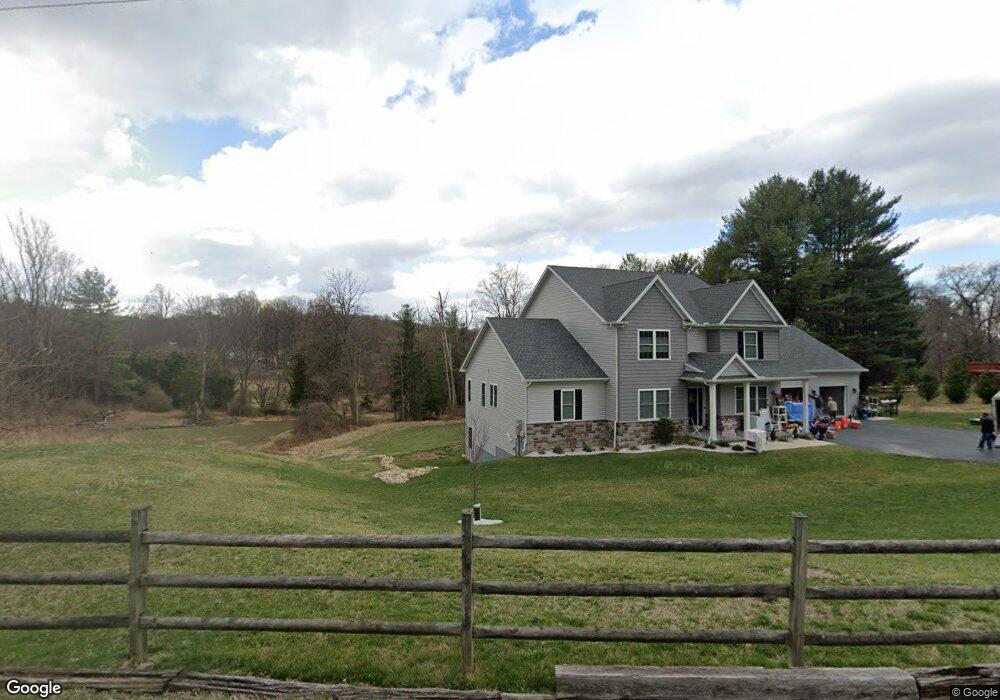
About This Home
This home is located at 1355 Welsh Rd Unit LOT 1, Reading, PA 19607 and is currently estimated at $703,895, approximately $153 per square foot. 1355 Welsh Rd Unit LOT 1 is a home located in Berks County with nearby schools including Cumru Elementary School, Governor Mifflin Intermediate School, and Governor Mifflin Middle School.
Ownership History
Date
Name
Owned For
Owner Type
Purchase Details
Closed on
Nov 2, 2020
Sold by
Hoffert James B and Hoffert Joyce A
Bought by
Santoro Tim Michael and Santoro Lisa Marie
Current Estimated Value
Home Financials for this Owner
Home Financials are based on the most recent Mortgage that was taken out on this home.
Original Mortgage
$588,288
Outstanding Balance
$526,076
Interest Rate
2.8%
Mortgage Type
Construction
Estimated Equity
$177,819
Create a Home Valuation Report for This Property
The Home Valuation Report is an in-depth analysis detailing your home's value as well as a comparison with similar homes in the area
Home Values in the Area
Average Home Value in this Area
Purchase History
| Date | Buyer | Sale Price | Title Company |
|---|---|---|---|
| Santoro Tim Michael | $67,250 | Homesale Settlement Services |
Source: Public Records
Mortgage History
| Date | Status | Borrower | Loan Amount |
|---|---|---|---|
| Open | Santoro Tim Michael | $588,288 |
Source: Public Records
Tax History Compared to Growth
Tax History
| Year | Tax Paid | Tax Assessment Tax Assessment Total Assessment is a certain percentage of the fair market value that is determined by local assessors to be the total taxable value of land and additions on the property. | Land | Improvement |
|---|---|---|---|---|
| 2025 | $6,006 | $336,500 | $48,700 | $287,800 |
| 2024 | $15,482 | $336,500 | $48,700 | $287,800 |
| 2023 | $15,049 | $336,500 | $48,700 | $287,800 |
| 2022 | $14,672 | $336,500 | $48,700 | $287,800 |
| 2021 | $1,603 | $37,500 | $37,500 | $0 |
| 2020 | $1,603 | $37,500 | $37,500 | $0 |
| 2019 | $1,583 | $37,500 | $37,500 | $0 |
| 2018 | $1,555 | $37,500 | $37,500 | $0 |
| 2017 | $1,524 | $37,500 | $37,500 | $0 |
Source: Public Records
Map
Nearby Homes
- 1970 Cedar Top Rd
- 127 Cedar Ln
- 1694 Cedar Top Rd
- 836 Scenic Dr
- 419 Holland St
- 15 Lake St
- 131 E Wyomissing Ave
- 310 4th St
- 120 E Wyomissing Ave
- 18 Front St
- 140 S Church St
- 121 E Summit St
- 320 Hillside Dr
- 322 New Holland Ave
- 3 Monroe St
- 1189 Cedar Top Rd
- 611 Maplewood Ave
- 139 Hillcrest Rd
- 26 E Mohn St
- 165 Hillcrest Rd