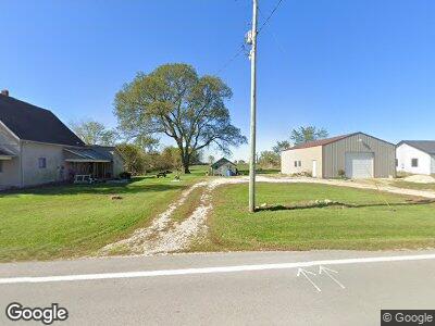
13554 State Route 49 N New Weston, OH 45348
Estimated Value: $139,000 - $249,000
3
Beds
1
Bath
1,780
Sq Ft
$112/Sq Ft
Est. Value
About This Home
This home is located at 13554 State Route 49 N, New Weston, OH 45348 and is currently estimated at $198,651, approximately $111 per square foot. 13554 State Route 49 N is a home located in Darke County with nearby schools including Mississinawa Valley Elementary School and Mississinawa Valley Junior/Senior High School.
Ownership History
Date
Name
Owned For
Owner Type
Purchase Details
Closed on
Apr 25, 2022
Sold by
Noggler Melody A
Bought by
Melody A Noggler Family Trust
Current Estimated Value
Purchase Details
Closed on
Apr 16, 2021
Sold by
Estate Of Eugene F Noggler Jr
Bought by
Noggler Melody A
Purchase Details
Closed on
Mar 29, 2021
Sold by
Noggler Melody A and Estate Of Eugene F Noggler Jr
Bought by
Noggler Melody A
Create a Home Valuation Report for This Property
The Home Valuation Report is an in-depth analysis detailing your home's value as well as a comparison with similar homes in the area
Home Values in the Area
Average Home Value in this Area
Purchase History
| Date | Buyer | Sale Price | Title Company |
|---|---|---|---|
| Melody A Noggler Family Trust | $500 | None Listed On Document | |
| Noggler Melody A | -- | None Available |
Source: Public Records
Tax History Compared to Growth
Tax History
| Year | Tax Paid | Tax Assessment Tax Assessment Total Assessment is a certain percentage of the fair market value that is determined by local assessors to be the total taxable value of land and additions on the property. | Land | Improvement |
|---|---|---|---|---|
| 2024 | $1,154 | $48,820 | $16,120 | $32,700 |
| 2023 | $1,224 | $50,500 | $17,800 | $32,700 |
| 2022 | $1,258 | $44,840 | $15,760 | $29,080 |
| 2021 | $1,278 | $44,840 | $15,760 | $29,080 |
| 2020 | $1,286 | $44,840 | $15,760 | $29,080 |
| 2019 | $1,011 | $39,020 | $15,760 | $23,260 |
| 2018 | $993 | $39,020 | $15,760 | $23,260 |
| 2017 | $740 | $39,020 | $15,760 | $23,260 |
| 2016 | $618 | $33,340 | $12,540 | $20,800 |
| 2015 | $618 | $29,250 | $12,540 | $16,710 |
| 2014 | $620 | $29,250 | $12,540 | $16,710 |
| 2013 | $649 | $29,030 | $12,320 | $16,710 |
Source: Public Records
Map
Nearby Homes
- 13747 State Route 49 N
- 4475 Ohio 705
- 203 High St
- 0 W Deerfield Rd Unit 837795
- 0 W Deerfield Rd
- 709 Lynwood Ct
- 1226 N Plum St
- 417 E Canal St
- 723 E Central St
- 223 E Caroline St
- 721 N Union St
- 811 N Howard St
- 631 N Columbia St
- 827 W Elm St
- 635 W Pearl St
- 504 Leahey St
- LOT 25 Governor Isaac P Gray Add
- LOT 9 Governor P Isaac Add
- LOT 19 & 20 Governor Isaac P Gray Add
- LOT 18 Governor Isaac P Gray Add
- 13554 State Route 49 N
- 2038 McFeeley Petry Rd
- 1998 McFeeley Petry Rd
- 13517 State Route 49 N
- 13503 State Route 49 N
- 2005 McFeeley-petry Rd
- 2007 McFeeley Petry Rd
- 1993 McFeeley Petry Rd
- 2075 McFeeley Petry Rd
- 1971 McFeeley Petry Rd
- 13468 State Route 49 N
- 13453 State Route 49 N
- 1868 McFeeley Petry Rd
- 2204 McFeeley Petry Rd
- 2223 McFeeley Petry Rd
- 13356 State Route 49 N
- 2280 McFeeley Petry Rd
- 13808 State Route 49 N
- 2335 McFeeley Petry Rd
- 13611 Light Rd
