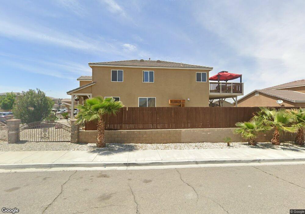
13562 Western Meadows Ln Victorville, CA 92394
Mesa Linda NeighborhoodEstimated Value: $468,979 - $509,000
5
Beds
3
Baths
2,544
Sq Ft
$193/Sq Ft
Est. Value
About This Home
This home is located at 13562 Western Meadows Ln, Victorville, CA 92394 and is currently estimated at $490,245, approximately $192 per square foot. 13562 Western Meadows Ln is a home located in San Bernardino County with nearby schools including West Creek Elementary School, Adelanto High School, and Zion Lutheran School And Preschool.
Ownership History
Date
Name
Owned For
Owner Type
Purchase Details
Closed on
Aug 26, 2013
Sold by
Victorville 115 Lots Llp
Bought by
Flores Ofelia and Murrieta Andres C
Current Estimated Value
Home Financials for this Owner
Home Financials are based on the most recent Mortgage that was taken out on this home.
Original Mortgage
$135,000
Interest Rate
4.17%
Mortgage Type
New Conventional
Create a Home Valuation Report for This Property
The Home Valuation Report is an in-depth analysis detailing your home's value as well as a comparison with similar homes in the area
Home Values in the Area
Average Home Value in this Area
Purchase History
| Date | Buyer | Sale Price | Title Company |
|---|---|---|---|
| Flores Ofelia | $220,000 | First American Title |
Source: Public Records
Mortgage History
| Date | Status | Borrower | Loan Amount |
|---|---|---|---|
| Previous Owner | Flores Ofelia | $135,000 |
Source: Public Records
Tax History Compared to Growth
Tax History
| Year | Tax Paid | Tax Assessment Tax Assessment Total Assessment is a certain percentage of the fair market value that is determined by local assessors to be the total taxable value of land and additions on the property. | Land | Improvement |
|---|---|---|---|---|
| 2025 | $4,966 | $269,688 | $53,938 | $215,750 |
| 2024 | $4,966 | $264,400 | $52,880 | $211,520 |
| 2023 | $4,935 | $259,216 | $51,843 | $207,373 |
| 2022 | $4,877 | $254,133 | $50,826 | $203,307 |
| 2021 | $5,048 | $249,150 | $49,829 | $199,321 |
| 2020 | $4,981 | $246,595 | $49,318 | $197,277 |
| 2019 | $4,960 | $241,760 | $48,351 | $193,409 |
| 2018 | $4,993 | $237,020 | $47,403 | $189,617 |
| 2017 | $4,904 | $232,373 | $46,474 | $185,899 |
| 2016 | $4,847 | $227,817 | $45,563 | $182,254 |
| 2015 | $4,708 | $224,395 | $44,879 | $179,516 |
| 2014 | $5,002 | $231,038 | $8,404 | $222,634 |
Source: Public Records
Map
Nearby Homes
- 13551 Western Meadows Ln
- 13651 Gold Stone Place
- 14964 Butler Peak Ct
- 15184 Brucite Rd
- 15203 Zircon Dr
- 14991 Mandalay Ln
- 14766 Shetland Ct
- Residence 1310 Plan at Dawson Pointe at West Creek
- Residence 1583 Plan at Dawson Pointe at West Creek
- Residence 2057 Plan at Dawson Pointe at West Creek
- Residence 2260 Plan at Dawson Pointe at West Creek
- Residence 1816 Plan at Dawson Pointe at West Creek
- 15121 Sorrel Rd
- 15255 Sunray Ct
- 15134 Paseo Verde Place
- 15165 Bluffside Ln
- 15426 Tomahawk St
- 15425 Tomahawk St
- 15432 Tomahawk St
- 15431 Tomahawk St
- 13548 Western Meadows Ln
- 15058 Hemlock
- 13536 Western Meadows Ln
- 15045 Hemlock
- 13563 Western Meadows Ln
- 13575 Western Meadows Ln
- 13537 Glen Rose Way
- 15053 Hemlock
- 15023 Hemlock
- 13539 Western Meadows Ln
- 15061 Hemlock
- 15033 Brucite Rd
- 15021 Brucite Rd
- 13554 Glen Rose Ct
- 13554 Glen Rose Way
- 15045 Brucite Rd
- 13546 Glen Rose Way
- 15032 Quicksilver Dr
- 13527 Western Meadows Ln
- 13572 Copper St