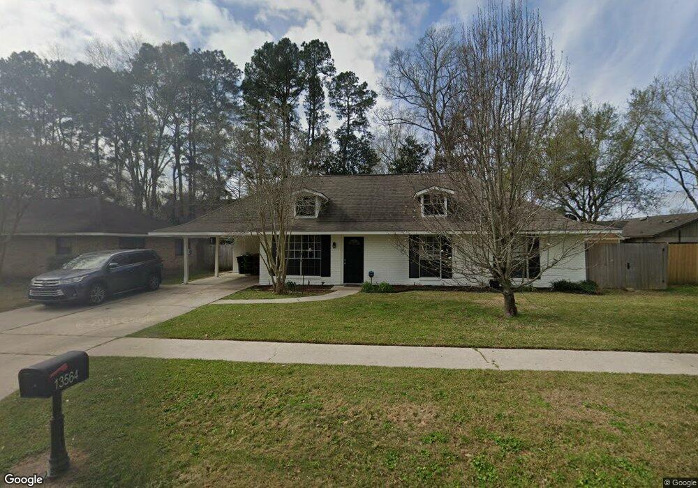
13564 Neil Ave Baton Rouge, LA 70810
Oak Hills Place NeighborhoodEstimated Value: $185,000 - $195,000
--
Bed
--
Bath
1,156
Sq Ft
$165/Sq Ft
Est. Value
About This Home
This home is located at 13564 Neil Ave, Baton Rouge, LA 70810 and is currently estimated at $190,333, approximately $164 per square foot. 13564 Neil Ave is a home located in East Baton Rouge Parish with nearby schools including Woodlawn Middle School, Woodlawn High School, and South Baton Rouge Charter Academy.
Ownership History
Date
Name
Owned For
Owner Type
Purchase Details
Closed on
Feb 3, 2025
Sold by
Hawkins Vonnie L
Bought by
Cleveland Shawn and Hawkins Vonnie L
Current Estimated Value
Purchase Details
Closed on
Sep 28, 1999
Sold by
Marie Burke Bourgeois Anthony Robert
Bought by
Hawkins Vonnie Lynn
Home Financials for this Owner
Home Financials are based on the most recent Mortgage that was taken out on this home.
Original Mortgage
$93,231
Interest Rate
8.02%
Mortgage Type
FHA
Create a Home Valuation Report for This Property
The Home Valuation Report is an in-depth analysis detailing your home's value as well as a comparison with similar homes in the area
Home Values in the Area
Average Home Value in this Area
Purchase History
| Date | Buyer | Sale Price | Title Company |
|---|---|---|---|
| Cleveland Shawn | -- | None Listed On Document | |
| Cleveland Shawn | -- | None Listed On Document | |
| Hawkins Vonnie Lynn | $94,000 | -- |
Source: Public Records
Mortgage History
| Date | Status | Borrower | Loan Amount |
|---|---|---|---|
| Previous Owner | Hawkins Vonnie Lynn | $93,231 |
Source: Public Records
Tax History Compared to Growth
Tax History
| Year | Tax Paid | Tax Assessment Tax Assessment Total Assessment is a certain percentage of the fair market value that is determined by local assessors to be the total taxable value of land and additions on the property. | Land | Improvement |
|---|---|---|---|---|
| 2024 | $895 | $15,028 | $1,200 | $13,828 |
| 2023 | $895 | $12,140 | $1,200 | $10,940 |
| 2022 | $1,394 | $12,140 | $1,200 | $10,940 |
| 2021 | $1,367 | $12,140 | $1,200 | $10,940 |
| 2020 | $1,358 | $12,140 | $1,200 | $10,940 |
| 2019 | $1,395 | $12,000 | $1,200 | $10,800 |
| 2018 | $1,377 | $12,000 | $1,200 | $10,800 |
| 2017 | $1,377 | $12,000 | $1,200 | $10,800 |
| 2016 | $523 | $12,000 | $1,200 | $10,800 |
| 2015 | $523 | $12,000 | $1,200 | $10,800 |
| 2014 | $512 | $12,000 | $1,200 | $10,800 |
| 2013 | -- | $12,000 | $1,200 | $10,800 |
Source: Public Records
Map
Nearby Homes
- 1227 Westchester Dr
- 902 Woodhue Dr
- 13524 Kimble Ave
- 13065 Briar Hollow Ave Unit 7
- 1732 Mullen Dr
- Belmont II Plan at Atwater Reserve
- Clayton Plan at Atwater Reserve
- Vacherie Plan at Atwater Reserve
- Duplessis Plan at Atwater Reserve
- Stanton Plan at Atwater Reserve
- Magnolia Plan at Atwater Reserve
- Iris Plan at Atwater Reserve
- Burnside Plan at Atwater Reserve
- Brittany Plan at Atwater Reserve
- Gramercy Plan at Atwater Reserve
- 9512 Siegen Ln
- 10242 Winterhue Dr
- 10327 Rustic Oak Dr
- 1878 Mullen Dr
- 1922 Mullen Dr
- 13572 Neil Ave
- 1330 Briarrose Dr
- 1330 Briarrose Dr
- 1320 Briarrose Dr
- 13586 Neil Ave
- 1403 S Potwin Dr
- 1310 Briarrose Dr
- 1412 Briarrose Dr
- 13489 N Amiss Rd
- 13489 N Amiss Rd
- 13489 N Amiss Rd
- 1419 S Potwin Dr
- 1238 Briarrose Dr Unit A
- 13598 Neil Ave
- 13589 Neil Ave
- 1422 Briarrose Dr
- 13602 Neil Ave
- 1329 Briarrose Dr
- 1339 Briarrose Dr
- 1420 S Potwin Dr Unit 11037