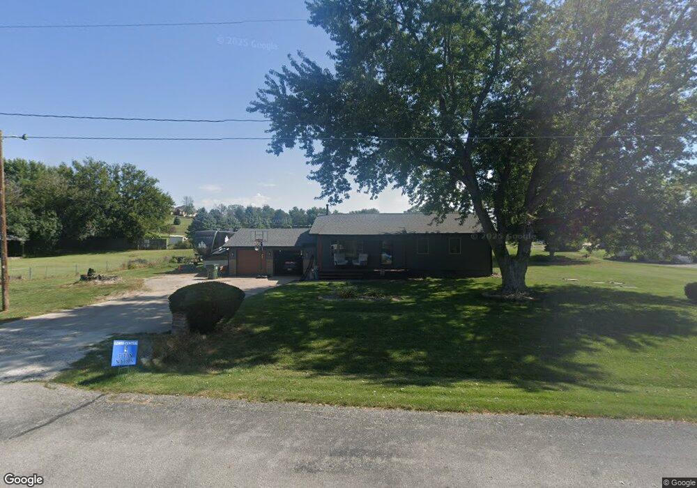
13575 220th St Council Bluffs, IA 51503
Estimated Value: $307,239 - $355,000
5
Beds
2
Baths
1,842
Sq Ft
$175/Sq Ft
Est. Value
About This Home
This home is located at 13575 220th St, Council Bluffs, IA 51503 and is currently estimated at $322,560, approximately $175 per square foot. 13575 220th St is a home located in Pottawattamie County with nearby schools including E.A. Kreft Primary School, Titan Hill Intermediate School, and Lewis Central Middle School.
Ownership History
Date
Name
Owned For
Owner Type
Purchase Details
Closed on
Jan 24, 2018
Sold by
Taylor Bret A and Taylor Tiffany
Bought by
Sturm Greg and Sturm Jana
Current Estimated Value
Home Financials for this Owner
Home Financials are based on the most recent Mortgage that was taken out on this home.
Original Mortgage
$159,600
Outstanding Balance
$134,649
Interest Rate
3.93%
Mortgage Type
New Conventional
Estimated Equity
$187,911
Create a Home Valuation Report for This Property
The Home Valuation Report is an in-depth analysis detailing your home's value as well as a comparison with similar homes in the area
Home Values in the Area
Average Home Value in this Area
Purchase History
| Date | Buyer | Sale Price | Title Company |
|---|---|---|---|
| Sturm Greg | $168,000 | None Available |
Source: Public Records
Mortgage History
| Date | Status | Borrower | Loan Amount |
|---|---|---|---|
| Open | Sturm Greg | $159,600 |
Source: Public Records
Tax History Compared to Growth
Tax History
| Year | Tax Paid | Tax Assessment Tax Assessment Total Assessment is a certain percentage of the fair market value that is determined by local assessors to be the total taxable value of land and additions on the property. | Land | Improvement |
|---|---|---|---|---|
| 2025 | $2,490 | $252,900 | $64,500 | $188,400 |
| 2024 | $2,490 | $219,700 | $56,100 | $163,600 |
| 2023 | $2,380 | $219,700 | $56,100 | $163,600 |
| 2022 | $2,306 | $181,500 | $46,400 | $135,100 |
| 2021 | $3,542 | $181,500 | $46,400 | $135,100 |
| 2020 | $2,348 | $181,500 | $46,400 | $135,100 |
| 2019 | $2,448 | $164,900 | $36,200 | $128,700 |
| 2018 | $2,072 | $164,900 | $36,200 | $128,700 |
| 2017 | $2,128 | $142,721 | $38,036 | $104,685 |
| 2015 | $2,110 | $142,721 | $38,036 | $104,685 |
| 2014 | $2,126 | $142,721 | $38,036 | $104,685 |
Source: Public Records
Map
Nearby Homes
- 21823 Chestnut Rd
- 22231 Stoneybrook Dr
- LOT 1 -2 Overland Trail
- 23267 Highway 92
- 22080 Greenview Rd
- 184 Dayan Dr
- 21337 Greenview Rd
- 100 Highland Acres Loop
- 109 Dorset Ave
- 5021 Providence Rd
- 108 Essex Ave
- 20.57 AC. M L State Orchard Rd
- 11635 Dumfries Ave
- 11749 Dumfries Ave
- 4820 Oneida Cir
- 21253 Ashwood Ln
- 20425 Greenview Rd
- 15365 Crestview Dr
- LOT 10 Fannin Cir
- 4792 Cedarbrook Dr
- 13574 Clearview Ln
- 13541 220th St
- 13580 220th St
- 13615 220th St
- 21934 Wildflower Ave
- Lot 113 Whispering Oaks
- 7 Hawthorne Blvd
- 8 Hawthorne Blvd
- 3 Lot Greenview
- Lot 25 Abercorn
- 18.51 acre Sherwood
- 4 Lot 4 Oak Forest
- 5 Lot 5 Oak Forest
- 3 Lot 3 Oak Forest
- 1 Lot 1 Oak Forest
- Lot 105 Oak Ridge
- Lot 8 Evidence Point Pioneer
- Lot 8 Evidence
- Lot 92 Millard
- Lot 1,2,3 Aud Sub