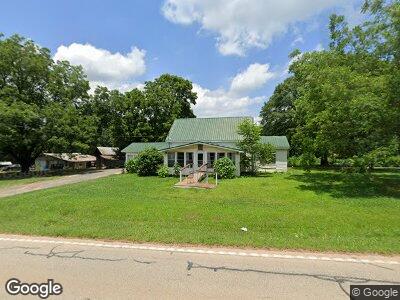
1358 Highway 211 NE Winder, GA 30680
Estimated Value: $209,000 - $377,000
4
Beds
1
Bath
1,857
Sq Ft
$157/Sq Ft
Est. Value
About This Home
This home is located at 1358 Highway 211 NE, Winder, GA 30680 and is currently estimated at $291,057, approximately $156 per square foot. 1358 Highway 211 NE is a home located in Barrow County with nearby schools including Statham Elementary School, Bear Creek Middle School, and Winder-Barrow High School.
Ownership History
Date
Name
Owned For
Owner Type
Purchase Details
Closed on
Apr 9, 2019
Sold by
Hardigree Harold P
Bought by
Yarbrough Brittany L
Current Estimated Value
Purchase Details
Closed on
Mar 7, 2018
Sold by
Hardigree Margaret L
Bought by
Taylor Stacy Lynn and Pruitt Cassidy R
Purchase Details
Closed on
Mar 2, 2018
Sold by
Hardigree Harold
Bought by
Taylor Stacy Lynn and Pruitt Cassidy R
Purchase Details
Closed on
Jan 3, 2018
Sold by
Hardigree Harold P
Bought by
Yarbrough Michael and Yarbrough Brittany
Create a Home Valuation Report for This Property
The Home Valuation Report is an in-depth analysis detailing your home's value as well as a comparison with similar homes in the area
Home Values in the Area
Average Home Value in this Area
Purchase History
| Date | Buyer | Sale Price | Title Company |
|---|---|---|---|
| Yarbrough Brittany L | $60,000 | -- | |
| Yarbrough Brittany L | $60,000 | -- | |
| Taylor Stacy Lynn | $20,000 | -- | |
| Taylor Stacy Lynn | $20,000 | -- | |
| Yarbrough Michael | $5,075 | -- |
Source: Public Records
Mortgage History
| Date | Status | Borrower | Loan Amount |
|---|---|---|---|
| Open | Yarbrough Brittany L | $199,430 | |
| Closed | Yarbrough Brittany L | $4,025 |
Source: Public Records
Tax History Compared to Growth
Tax History
| Year | Tax Paid | Tax Assessment Tax Assessment Total Assessment is a certain percentage of the fair market value that is determined by local assessors to be the total taxable value of land and additions on the property. | Land | Improvement |
|---|---|---|---|---|
| 2024 | $1,357 | $54,095 | $21,113 | $32,982 |
| 2023 | $1,350 | $54,095 | $21,113 | $32,982 |
| 2022 | $1,141 | $39,060 | $21,113 | $17,947 |
| 2021 | $971 | $31,412 | $14,890 | $16,522 |
| 2020 | $962 | $30,996 | $15,900 | $15,096 |
| 2019 | $145 | $30,996 | $15,900 | $15,096 |
| 2018 | $343 | $54,624 | $39,528 | $15,096 |
| 2017 | $3,112 | $106,893 | $94,213 | $12,680 |
| 2016 | $101 | $91,327 | $78,647 | $12,680 |
| 2015 | $153 | $91,327 | $78,647 | $12,680 |
| 2014 | $56 | $62,228 | $49,548 | $12,680 |
| 2013 | -- | $61,635 | $49,547 | $12,088 |
Source: Public Records
Map
Nearby Homes
- 216 Ballast Trail
- 1393 Highway 211 NE
- 1228 Highway 211 NE
- 385 Finch Landing Rd
- 931 Justin Dr
- 925 Justin Dr
- 2025 Emerald Pointe Dr
- 265 Mona Ct
- 130 (Tract 1) Bowman Mill Rd NE
- 130 Bowman Mill Rd NE Unit 1
- 1215 Bridge Crest Dr
- 1553 Shoal Creek Dr
- 488 Pleasant Hill Church Rd NE
- 380 Glenn Trail
- 155 Candler Park Dr
- 1630 White Oak Dr
- 861 Windward Rd
- 1358 Highway 211 NE
- 123 Bower Ct
- 120 Bower Ct
- 180 Bower Ct
- 235 Bower Ct
- 121 Bower Ct
- 116 Bower Ct
- 364 Royal Oaks Dr
- 119 Bower Ct
- 362 Royal Oaks Dr
- 431 Bowman Mill Rd NE
- 114 Bower Ct
- 117 Bower Ct
- 368 Royal Oaks Dr
- 360 Royal Oaks Dr
- 115 Bower Ct
- 363 Royal Oaks Dr
- 112 Bower Ct
- 361 Royal Oaks Dr
- 358 Royal Oaks Dr