1359 Crestview Dr Unit B Camano Island, WA 98282
Highlights
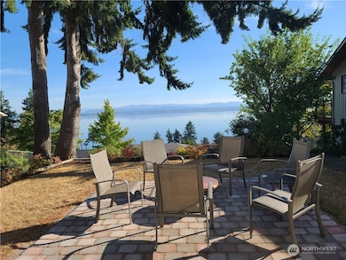
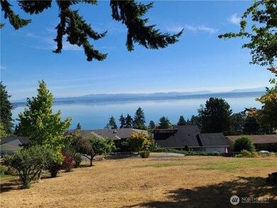
- Views of a Sound
- Bathroom on Main Level
- Washer and Dryer
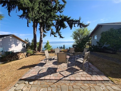
- Patio
- 1-Story Property
- East Facing Home
About This Home
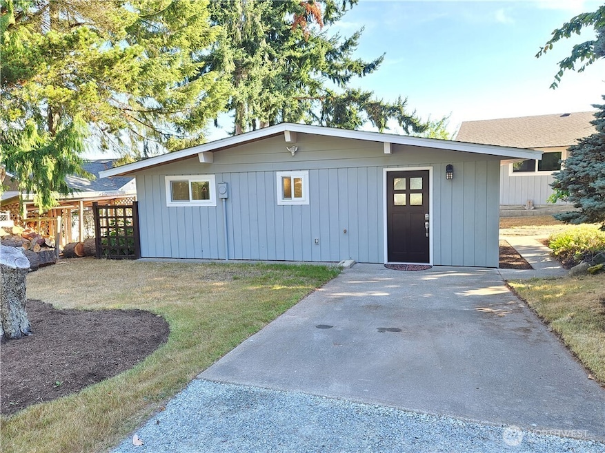
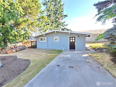
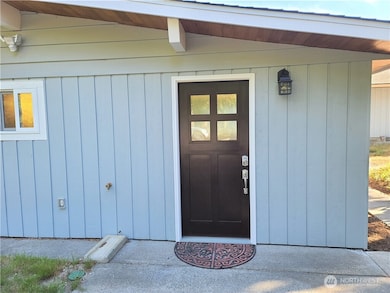
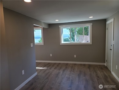
Beautifully remodeled Studio with views of Mt. Baker and Cascades. Includes all utilities, water, septic, electricity, and garbage. Galley kitchen with Stainless appliances, and quarts counters, and picture window view. Bathroom features tiled shower with glass door. All new LV flooring for easy maintenance. Ductless heat pump for comfort and efficiency. Includes washer and dryer. Back yard with patio to soak up the sun and enjoy the view. Private parking for 2 cars. Fresh clean and ready to go.
Source: Northwest Multiple Listing Service (NWMLS)
MLS#: 2404014
Home Details
Home Type
- Single Family
Est. Annual Taxes
- $6,554
Year Built
- Built in 1967
Property Views
- Views of a Sound
- Bay
- Territorial
Interior Spaces
- 600 Sq Ft Home
- 1-Story Property
- Washer and Dryer
Bedrooms and Bathrooms
- 1 Main Level Bedroom
- Bathroom on Main Level
- 1 Bathroom
Parking
- 2 Parking Spaces
- Open Parking
Schools
- Stanwood Elementary School
- Stanwood Mid Middle School
- Stanwood High School
Utilities
- Heat Pump System
- Septic Tank
- Cable TV Available
Additional Features
- Patio
- East Facing Home
Community Details
- Country Club Subdivision
Listing and Financial Details
- Assessor Parcel Number 625017160030
Map
Source: Northwest Multiple Listing Service (NWMLS)
MLS Number: 2404014
APN: S6250-17-16003-0
Disclaimer: Certain information contained herein is derived from information provided by parties other than Homes.com. All information provided is deemed reliable, but is not guaranteed to be accurate and should be independently verified.
![]() All data is obtained from various sources and may not have been verified by broker or MLS GRID. Supplied Open House Information is subject to change without notice. All information should be independently reviewed and verified for accuracy. Properties may or may not be listed by the office/agent presenting the information. Listing information is provided by the Northwest Multiple Listing Service (NWMLS). Property information is based on available data that may include MLS information, county records, and other sources. Listings marked with the 3 tree icon and provided by NWMLS. All properties are subject to prior sale or withdrawal. IDX information is provided exclusively for consumers’ personal noncommercial use, that it may not be used for any purpose other than to identify prospective properties consumers may be interested in purchasing, that the data is deemed reliable but is not guaranteed by MLS GRID. ©2025 NWMLS.
All data is obtained from various sources and may not have been verified by broker or MLS GRID. Supplied Open House Information is subject to change without notice. All information should be independently reviewed and verified for accuracy. Properties may or may not be listed by the office/agent presenting the information. Listing information is provided by the Northwest Multiple Listing Service (NWMLS). Property information is based on available data that may include MLS information, county records, and other sources. Listings marked with the 3 tree icon and provided by NWMLS. All properties are subject to prior sale or withdrawal. IDX information is provided exclusively for consumers’ personal noncommercial use, that it may not be used for any purpose other than to identify prospective properties consumers may be interested in purchasing, that the data is deemed reliable but is not guaranteed by MLS GRID. ©2025 NWMLS.
Based on information submitted to the MLS GRID
- 1345 Rainbow Ln
- 1351 Crestview Dr
- 1353 Sunrise Estate Place
- 1337 Country Club Dr
- 1336 Beach Dr
- 1433 Crestview Dr
- 1267 Beach Dr
- 1263 S View St
- 1240 Beach Dr
- 1235 View St
- 1241 SE Camano Dr
- 0 Noble Fir Ln Unit NWM2377874
- 1516 Thompson Dr
- 1266 Terrace Place
- 1481 SE Camano Dr
- 1215 S East Camano Dr
- 1490 Country Club Dr
- 1529 Thompson Dr
- 1172 Matterhorn Loop
- 1528 E Camano Dr
- 10 Vista Del Mar St
- 8401 Henning Dr
- 26031 72nd Ave NW
- 7930 272nd St NW
- 7110 265th St NW
- 7000 265th St NW
- 27408 72nd Ave SW
- 5441 Cherry St
- 9 NW Front St
- 4050 Hollyhock Ln
- 5842 Captain Vancouver Dr
- 1121 SE Dock St
- 275 SE Pioneer Way Unit 204
- 275 SE Pioneer Way Unit 103
- 380 SE Barrington Dr
- 152 NE Midway Blvd
- 890 SW Kimball Dr
- 520 E Whidbey Ave Unit 205
- 1921 174th St NE
- 2100 172nd St NE
