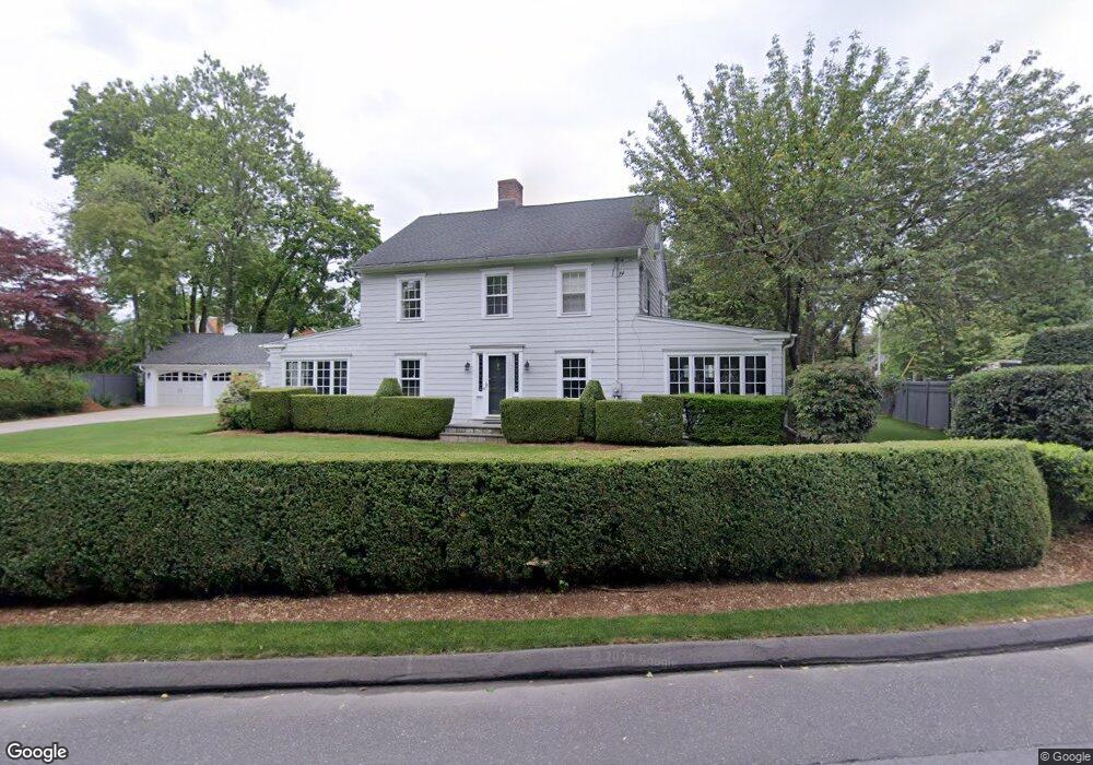
1359 Unquowa Rd Fairfield, CT 06824
Estimated Value: $1,506,000 - $1,810,000
4
Beds
3
Baths
2,654
Sq Ft
$628/Sq Ft
Est. Value
About This Home
This home is located at 1359 Unquowa Rd, Fairfield, CT 06824 and is currently estimated at $1,667,866, approximately $628 per square foot. 1359 Unquowa Rd is a home located in Fairfield County with nearby schools including Riverfield Elementary School, Roger Ludlowe Middle School, and Fairfield Ludlowe High School.
Ownership History
Date
Name
Owned For
Owner Type
Purchase Details
Closed on
Jan 22, 2004
Sold by
Lahey 3Rd Edward V and Lahey Colleen J
Bought by
Elias Karl and Elias Jennifer
Current Estimated Value
Home Financials for this Owner
Home Financials are based on the most recent Mortgage that was taken out on this home.
Original Mortgage
$252,000
Interest Rate
5.89%
Purchase Details
Closed on
Jun 1, 2000
Sold by
Mitchell Karen C
Bought by
Lahey Edward and Lahey Colleen J
Create a Home Valuation Report for This Property
The Home Valuation Report is an in-depth analysis detailing your home's value as well as a comparison with similar homes in the area
Home Values in the Area
Average Home Value in this Area
Purchase History
| Date | Buyer | Sale Price | Title Company |
|---|---|---|---|
| Elias Karl | $940,000 | -- | |
| Elias Karl | $940,000 | -- | |
| Lahey Edward | $599,000 | -- | |
| Lahey Edward V | $599,000 | -- |
Source: Public Records
Mortgage History
| Date | Status | Borrower | Loan Amount |
|---|---|---|---|
| Open | Lahey Edward V | $980,000 | |
| Closed | Lahey Edward V | $668,000 | |
| Closed | Lahey Edward V | $252,000 |
Source: Public Records
Tax History Compared to Growth
Tax History
| Year | Tax Paid | Tax Assessment Tax Assessment Total Assessment is a certain percentage of the fair market value that is determined by local assessors to be the total taxable value of land and additions on the property. | Land | Improvement |
|---|---|---|---|---|
| 2025 | $20,106 | $708,190 | $441,630 | $266,560 |
| 2024 | $19,759 | $708,190 | $441,630 | $266,560 |
| 2023 | $19,482 | $708,190 | $441,630 | $266,560 |
| 2022 | $19,291 | $708,190 | $441,630 | $266,560 |
| 2021 | $19,107 | $708,190 | $441,630 | $266,560 |
| 2020 | $18,327 | $684,110 | $407,890 | $276,220 |
| 2019 | $18,327 | $684,110 | $407,890 | $276,220 |
| 2018 | $18,033 | $684,110 | $407,890 | $276,220 |
| 2017 | $17,664 | $684,110 | $407,890 | $276,220 |
| 2016 | $17,411 | $684,110 | $407,890 | $276,220 |
| 2015 | $15,774 | $636,300 | $429,380 | $206,920 |
| 2014 | $15,526 | $636,300 | $429,380 | $206,920 |
Source: Public Records
Map
Nearby Homes
- 647 Bronson Rd
- 53 Hilltop Dr
- 476 Mill Hill Terrace
- 21 Beaumont St
- 88 Overhill Rd
- 100 Overhill Rd
- 245 Unquowa Rd Unit 34
- 245 Unquowa Rd Unit 11
- 245 Unquowa Rd Unit 33
- 65 Thorpe St Unit 65
- 65 Thorpe St
- 43 Helen St
- 28 Mill Hill Rd Unit 28
- 232 Pell Meadow Dr
- 209 S Pine Creek Rd
- 844 Mill Hill Terrace
- 57 Beaumont Place
- 226 Ruane St
- 1135 Mill Hill Rd
- 85 Patrick Dr
- 1401 Unquowa Rd
- 1333 Unquowa Rd
- 297 Sturges Rd
- 317 Sturges Rd
- 1421 Unquowa Rd
- 1400 Unquowa Rd
- 279 Sturges Rd
- 343 Sturges Rd
- 1422 Unquowa Rd
- 265 Sturges Rd
- 314 Sturges Rd
- 280 Sturges Rd
- 1435 Unquowa Rd
- 300 Sturges Rd
- 251 Sturges Rd
- 338 Sturges Rd
- 1446 Unquowa Rd
- 71 Somerset Ave
- 370 Sturges Rd
- 256 Sturges Rd