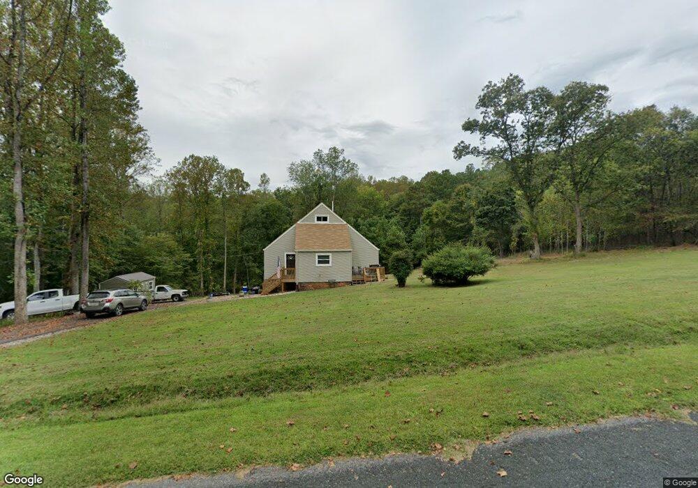
136 Bridle Path Ln Monroe, VA 24574
Estimated Value: $272,000 - $311,000
2
Beds
2
Baths
1,184
Sq Ft
$244/Sq Ft
Est. Value
About This Home
This home is located at 136 Bridle Path Ln, Monroe, VA 24574 and is currently estimated at $288,610, approximately $243 per square foot. 136 Bridle Path Ln is a home located in Amherst County with nearby schools including Amherst Elementary School, Amherst Middle School, and Amherst County High School.
Ownership History
Date
Name
Owned For
Owner Type
Purchase Details
Closed on
Apr 18, 2024
Sold by
Lichtenwalner Drema Ann
Bought by
Duncan George C and Duncan Alice B
Current Estimated Value
Purchase Details
Closed on
Nov 10, 2020
Sold by
Klichtenwalner Drema A
Bought by
Lichtenwalner Drema A
Home Financials for this Owner
Home Financials are based on the most recent Mortgage that was taken out on this home.
Original Mortgage
$123,500
Interest Rate
2.7%
Mortgage Type
New Conventional
Create a Home Valuation Report for This Property
The Home Valuation Report is an in-depth analysis detailing your home's value as well as a comparison with similar homes in the area
Purchase History
| Date | Buyer | Sale Price | Title Company |
|---|---|---|---|
| Duncan George C | $283,800 | Pike Title | |
| Lichtenwalner Drema A | -- | None Available |
Source: Public Records
Mortgage History
| Date | Status | Borrower | Loan Amount |
|---|---|---|---|
| Previous Owner | Lichtenwalner Drema A | $123,500 |
Source: Public Records
Tax History
| Year | Tax Paid | Tax Assessment Tax Assessment Total Assessment is a certain percentage of the fair market value that is determined by local assessors to be the total taxable value of land and additions on the property. | Land | Improvement |
|---|---|---|---|---|
| 2026 | $1,271 | $208,400 | $34,900 | $173,500 |
| 2025 | $876 | $143,600 | $29,100 | $114,500 |
| 2024 | $780 | $127,900 | $29,100 | $98,800 |
| 2023 | $780 | $127,900 | $29,100 | $98,800 |
| 2022 | $780 | $127,900 | $29,100 | $98,800 |
| 2021 | $780 | $127,900 | $29,100 | $98,800 |
| 2020 | $780 | $122,900 | $29,100 | $93,800 |
| 2019 | $739 | $121,100 | $35,100 | $86,000 |
| 2018 | $739 | $121,100 | $35,100 | $86,000 |
| 2017 | $739 | $121,100 | $35,100 | $86,000 |
| 2016 | $739 | $121,100 | $35,100 | $86,000 |
| 2015 | $678 | $121,100 | $35,100 | $86,000 |
| 2014 | $678 | $121,100 | $35,100 | $86,000 |
Source: Public Records
Map
Nearby Homes
- 447 Matohe Rd
- 216 Burford Farm Rd
- 506 Peters Hollow Rd
- 139 Indigo Ridge
- 0 Crawford's Hill Place
- 150 Terrapin Station Ln
- 0 Wares Gap Rd Unit 351733
- 893 Cedar Gate Rd
- 1612 S Amherst Hwy
- 1697 S Amherst Hwy
- 431 Old Stage Rd
- 0 Lavender Ln
- 65-Acres Lavender Ln
- 111 Partridge Place
- 2229 Cedar Gate Rd
- 899 Wares Gap Rd
- 12 Gun Mountain Dr
- 225 Opus Ln Unit 1 of 5 See Map
- 249 Camden Dr
- 257 Camden Dr
- 136 Bridlepath Ln
- 153 Bridle Path Ln
- 371 Foxcroft Dr
- 0 Bridle Path Ln Unit 245200
- 0 Bridle Path Ln Unit 339109
- 162 Bridle Path Ln
- 999 Foxcroft Dr
- 344 Foxcroft Dr
- 387 Foxcroft Dr
- 410 Foxcroft Dr
- 317 Foxcroft Dr
- 310 Foxcroft Dr
- 399 Foxcroft Dr
- 307 Foxcroft Dr
- 300 Foxcroft Dr
- 411 Foxcroft Dr
- 207 Cubbing Ln
- 286 Foxcroft Dr
- 295 Foxcroft Dr
- 196 Cubbing Ln
Your Personal Tour Guide
Ask me questions while you tour the home.