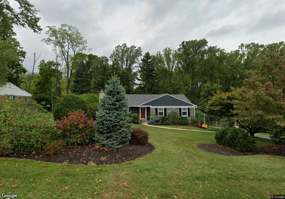
136 Brookside Rd Newtown Square, PA 19073
Estimated Value: $528,000 - $599,000
3
Beds
2
Baths
1,448
Sq Ft
$378/Sq Ft
Est. Value
About This Home
This home is located at 136 Brookside Rd, Newtown Square, PA 19073 and is currently estimated at $546,939, approximately $377 per square foot. 136 Brookside Rd is a home located in Delaware County with nearby schools including Culbertson Elementary School, Paxon Hollow Middle School, and Marple Newtown Senior High School.
Ownership History
Date
Name
Owned For
Owner Type
Purchase Details
Closed on
May 19, 1995
Sold by
Miller Nancy M
Bought by
Dubois James W and Dubois Nancy Nina
Current Estimated Value
Home Financials for this Owner
Home Financials are based on the most recent Mortgage that was taken out on this home.
Original Mortgage
$148,800
Interest Rate
8.33%
Create a Home Valuation Report for This Property
The Home Valuation Report is an in-depth analysis detailing your home's value as well as a comparison with similar homes in the area
Home Values in the Area
Average Home Value in this Area
Purchase History
| Date | Buyer | Sale Price | Title Company |
|---|---|---|---|
| Dubois James W | $186,000 | Commonwealth Land Title Ins |
Source: Public Records
Mortgage History
| Date | Status | Borrower | Loan Amount |
|---|---|---|---|
| Closed | Dubois James W | $148,800 |
Source: Public Records
Tax History Compared to Growth
Tax History
| Year | Tax Paid | Tax Assessment Tax Assessment Total Assessment is a certain percentage of the fair market value that is determined by local assessors to be the total taxable value of land and additions on the property. | Land | Improvement |
|---|---|---|---|---|
| 2025 | $6,420 | $385,800 | $142,210 | $243,590 |
| 2024 | $6,420 | $385,800 | $142,210 | $243,590 |
| 2023 | $6,218 | $385,800 | $142,210 | $243,590 |
| 2022 | $6,082 | $385,800 | $142,210 | $243,590 |
| 2021 | $9,298 | $385,800 | $142,210 | $243,590 |
| 2020 | $4,495 | $163,850 | $72,790 | $91,060 |
| 2019 | $4,423 | $163,850 | $72,790 | $91,060 |
| 2018 | $4,375 | $163,850 | $0 | $0 |
| 2017 | $4,361 | $163,850 | $0 | $0 |
| 2016 | $899 | $163,850 | $0 | $0 |
| 2015 | $918 | $163,850 | $0 | $0 |
| 2014 | $899 | $163,850 | $0 | $0 |
Source: Public Records
Map
Nearby Homes
- 133 Brookside Rd
- 126 Bryn Mawr Ave
- 135 Bryn Mawr Ave
- 212 Aronimink Dr
- 10 Bryn Mawr Ave
- 31 Barren Rd
- 202 Barren Rd
- 3500 Goshen Rd
- 217 Jeffrey Ln
- 14 Valley View Ln
- 204 Wedgewood Cir
- 115 Newby Dr
- 204 3rd Ave
- 12 Lincoln Ln
- 310 Jeffrey Ln
- 27 Mary Jane Ln
- 10 Fox Chase Cir
- 204 Media Line Rd
- 334 Foxtail Ln Unit 22D
- 326 Squire Dr Unit 21C
- 134 Brookside Rd
- 138 Brookside Rd
- 140 Brookside Rd
- 132 Brookside Rd
- 139 Brookside Rd
- 141 Brookside Rd
- 137 Brookside Rd
- 143 Brookside Rd
- 142 Brookside Rd
- 135 Brookside Rd
- 130 Brookside Rd
- 149 Ashley Rd
- 147 Ashley Rd
- 145 Brookside Rd
- 144 Brookside Rd
- 147 Brookside Rd
- 145 Ashley Rd
- 128 Brookside Rd
- 131 Brookside Rd
- 151 Ashley Rd