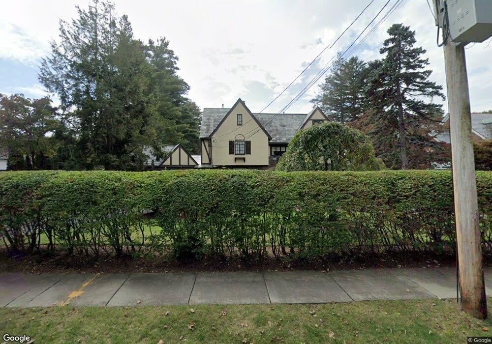
136 Fuller St West Newton, MA 02465
Waban NeighborhoodEstimated Value: $2,976,796 - $3,742,000
6
Beds
4
Baths
4,601
Sq Ft
$753/Sq Ft
Est. Value
About This Home
This home is located at 136 Fuller St, West Newton, MA 02465 and is currently estimated at $3,464,199, approximately $752 per square foot. 136 Fuller St is a home located in Middlesex County with nearby schools including Peirce Elementary School, F.A. Day Middle School, and Newton North High School.
Ownership History
Date
Name
Owned For
Owner Type
Purchase Details
Closed on
Dec 6, 2021
Sold by
Bhan Atul K and Bhan Ina
Bought by
Atul Kumar Bhan 2001 Ft
Current Estimated Value
Purchase Details
Closed on
Aug 31, 1989
Sold by
Vonkann Clifton F
Bought by
Bhan Atul K
Home Financials for this Owner
Home Financials are based on the most recent Mortgage that was taken out on this home.
Original Mortgage
$525,000
Interest Rate
9.7%
Mortgage Type
Purchase Money Mortgage
Create a Home Valuation Report for This Property
The Home Valuation Report is an in-depth analysis detailing your home's value as well as a comparison with similar homes in the area
Home Values in the Area
Average Home Value in this Area
Purchase History
| Date | Buyer | Sale Price | Title Company |
|---|---|---|---|
| Atul Kumar Bhan 2001 Ft | -- | None Available | |
| Bhan Atul K | $750,000 | -- |
Source: Public Records
Mortgage History
| Date | Status | Borrower | Loan Amount |
|---|---|---|---|
| Previous Owner | Bhan Atul K | $200,000 | |
| Previous Owner | Bhan Atul K | $485,000 | |
| Previous Owner | Bhan Atul K | $487,000 | |
| Previous Owner | Bhan Atul K | $525,000 |
Source: Public Records
Tax History Compared to Growth
Tax History
| Year | Tax Paid | Tax Assessment Tax Assessment Total Assessment is a certain percentage of the fair market value that is determined by local assessors to be the total taxable value of land and additions on the property. | Land | Improvement |
|---|---|---|---|---|
| 2025 | $26,708 | $2,725,300 | $1,420,900 | $1,304,400 |
| 2024 | $25,824 | $2,645,900 | $1,379,500 | $1,266,400 |
| 2023 | $24,982 | $2,454,000 | $1,089,400 | $1,364,600 |
| 2022 | $23,904 | $2,272,200 | $1,008,700 | $1,263,500 |
| 2021 | $23,065 | $2,143,600 | $951,600 | $1,192,000 |
| 2020 | $22,379 | $2,143,600 | $951,600 | $1,192,000 |
| 2019 | $21,749 | $2,081,200 | $923,900 | $1,157,300 |
| 2018 | $21,153 | $1,955,000 | $827,400 | $1,127,600 |
| 2017 | $20,509 | $1,844,300 | $780,600 | $1,063,700 |
| 2016 | $19,615 | $1,723,600 | $729,500 | $994,100 |
| 2015 | $18,701 | $1,610,800 | $681,800 | $929,000 |
Source: Public Records
Map
Nearby Homes
- 144 Fuller St
- 128 Fuller St
- 31 Bonnybrook Rd
- 41 Bonnybrook Rd
- 41 Bonnybrook Rd Unit 41
- 21 Bonnybrook Rd
- 152 Fuller St
- 116 Fuller St
- 145 Fuller St
- 133 Fuller St
- 45 Bonnybrook Rd
- 162 Fuller St
- 36 Bonnybrook Rd
- 157 Fuller St
- 117 Fuller St
- 108 Fuller St
- 18 Bonnybrook Rd
- 421 Chestnut St
- 421 Chestnut St + Land
- 48 Bonnybrook Rd