Estimated Value: $8,105,000 - $12,704,994
4
Beds
6
Baths
4,228
Sq Ft
$2,435/Sq Ft
Est. Value
About This Home
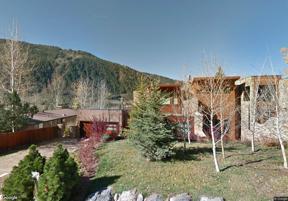
This home is located at 136 W Lupine Dr Unit B, Aspen, CO 81611 and is currently estimated at $10,294,665, approximately $2,434 per square foot. 136 W Lupine Dr Unit B is a home located in Pitkin County with nearby schools including Aspen Elementary School, Aspen Middle School, and Aspen High School.
Ownership History
Date
Name
Owned For
Owner Type
Purchase Details
Closed on
Feb 11, 2011
Sold by
Winged Foot Investments Inc
Bought by
Albers Dennis Mark
Current Estimated Value
Purchase Details
Closed on
Feb 6, 2009
Sold by
Van Aubrey Llc
Bought by
Albers Family Partnership Lp
Home Financials for this Owner
Home Financials are based on the most recent Mortgage that was taken out on this home.
Original Mortgage
$2,400,000
Interest Rate
5.62%
Mortgage Type
Purchase Money Mortgage
Create a Home Valuation Report for This Property
The Home Valuation Report is an in-depth analysis detailing your home's value as well as a comparison with similar homes in the area
Home Values in the Area
Average Home Value in this Area
Purchase History
| Date | Buyer | Sale Price | Title Company |
|---|---|---|---|
| Albers Dennis Mark | -- | None Available | |
| Albers Family Partnership Lp | $6,500,000 | Land Title Guarantee Company |
Source: Public Records
Mortgage History
| Date | Status | Borrower | Loan Amount |
|---|---|---|---|
| Previous Owner | Albers Family Partnership Lp | $2,400,000 |
Source: Public Records
Tax History Compared to Growth
Tax History
| Year | Tax Paid | Tax Assessment Tax Assessment Total Assessment is a certain percentage of the fair market value that is determined by local assessors to be the total taxable value of land and additions on the property. | Land | Improvement |
|---|---|---|---|---|
| 2024 | $24,573 | $846,120 | $0 | $846,120 |
| 2023 | $24,573 | $857,040 | $0 | $857,040 |
| 2022 | $12,908 | $403,100 | $0 | $403,100 |
| 2021 | $12,874 | $414,700 | $0 | $414,700 |
| 2020 | $11,133 | $357,500 | $0 | $357,500 |
| 2019 | $11,133 | $357,500 | $0 | $357,500 |
| 2018 | $10,899 | $399,620 | $0 | $399,620 |
| 2017 | $9,477 | $349,690 | $0 | $349,690 |
| 2016 | $9,311 | $336,900 | $0 | $336,900 |
| 2015 | $9,253 | $336,900 | $0 | $336,900 |
| 2014 | $7,579 | $269,370 | $0 | $269,370 |
Source: Public Records
Map
Nearby Homes
- 602 Mountain Laurel Dr
- 552 Mountain Laurel Dr
- 184 Mountain Laurel Dr
- 161 Stillwater Ln
- 1271 S Ute Ave
- 71 & 73 Smuggler Grove Rd
- 1212 E Hopkins Ave
- 326 Midland Ave Unit 306
- 326 Midland Ave Unit 302
- 322 Park Ave Unit 2
- 1034 E Cooper Ave Unit 19A
- 10 Ute Place
- 940 Waters Ave Unit 201
- 939 E Cooper Ave Unit B
- 1024 E Hopkins Ave Unit 16
- 610 S West End St Unit D304
- 610 S West End St Unit D 206
- 610 S West End St Unit A304
- 415 Park Cir Unit 5
- 425 Park Cir Unit A2
- 138 W Lupine Dr Unit A
- 138 W Lupine Dr
- 116 W Lupine Dr
- 93 Roaring Fork Dr
- 164 W Lupine Dr
- 135 W Lupine Dr
- 82 W Lupine Dr
- 153 W Lupine Dr
- 28 Northway Dr
- 187 W Lupine Dr
- 185 W Lupine Dr
- 36 Roaring Fork Dr
- 107 W Lupine Dr
- 182 W Lupine Dr
- 309 Mountain Laurel Dr
- 64 E Lupine Dr
- 39 Roaring Fork Dr
- 281 Mountain Laurel Dr
- 95 W Lupine Dr Unit A
- 95 W Lupine Dr Unit A