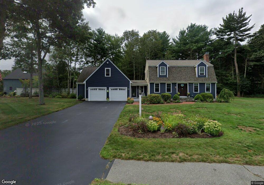
136 Woodbrook Ln Hanson, MA 02341
Estimated Value: $637,141 - $717,000
3
Beds
2
Baths
1,670
Sq Ft
$406/Sq Ft
Est. Value
About This Home
This home is located at 136 Woodbrook Ln, Hanson, MA 02341 and is currently estimated at $677,785, approximately $405 per square foot. 136 Woodbrook Ln is a home located in Plymouth County.
Ownership History
Date
Name
Owned For
Owner Type
Purchase Details
Closed on
Jan 13, 2023
Sold by
Whitman Joel G and Whitman Brooke K
Bought by
Joel & Brooke Whitman Ret
Current Estimated Value
Purchase Details
Closed on
May 15, 2002
Sold by
Wood Mary E
Bought by
Whitman Joel G and Whitman Brooke K
Purchase Details
Closed on
Feb 7, 1997
Sold by
Cousins Rt
Bought by
Cogan Mary E
Create a Home Valuation Report for This Property
The Home Valuation Report is an in-depth analysis detailing your home's value as well as a comparison with similar homes in the area
Home Values in the Area
Average Home Value in this Area
Purchase History
| Date | Buyer | Sale Price | Title Company |
|---|---|---|---|
| Joel & Brooke Whitman Ret | -- | None Available | |
| Whitman Joel G | $314,900 | -- | |
| Cogan Mary E | $169,900 | -- | |
| Cousins Rt | $62,500 | -- |
Source: Public Records
Mortgage History
| Date | Status | Borrower | Loan Amount |
|---|---|---|---|
| Previous Owner | Cousins Rt | $25,218 | |
| Previous Owner | Cousins Rt | $211,500 |
Source: Public Records
Tax History Compared to Growth
Tax History
| Year | Tax Paid | Tax Assessment Tax Assessment Total Assessment is a certain percentage of the fair market value that is determined by local assessors to be the total taxable value of land and additions on the property. | Land | Improvement |
|---|---|---|---|---|
| 2025 | $7,707 | $576,000 | $190,100 | $385,900 |
| 2024 | $7,483 | $559,300 | $184,600 | $374,700 |
| 2023 | $7,009 | $494,300 | $184,600 | $309,700 |
| 2022 | $6,837 | $453,100 | $167,800 | $285,300 |
| 2021 | $6,029 | $399,300 | $161,400 | $237,900 |
| 2020 | $5,937 | $388,800 | $155,900 | $232,900 |
| 2019 | $5,934 | $382,100 | $167,400 | $214,700 |
| 2018 | $5,860 | $370,200 | $161,000 | $209,200 |
| 2017 | $5,676 | $355,200 | $153,300 | $201,900 |
| 2016 | $5,774 | $348,900 | $153,300 | $195,600 |
| 2015 | $5,473 | $343,800 | $153,300 | $190,500 |
Source: Public Records
Map
Nearby Homes
- 248 E Washington St
- 168 Spring St
- 418 E Washington St
- 13 Hayford Trail Unit 15
- 12 Hayford Trail Unit 17
- 8 Hayford Trail Unit 19
- 7 Hayford Trail Unit 12
- 5 Hayford Trail Unit 11
- 22 Howland Trail Unit 34
- 33 Tavern Way
- Lot 5 Princeton Way
- 57 Liberty St
- 842 Whitman St
- 37 Brook St
- 417 Birchbark Dr
- 1057 Whitman St
- 842 E Washington St
- 55 Plymouth St Unit A5
- 154 Winter St
- 131 Holly Ridge Dr
- 12 Commons Ln
- 500 Whitman St
- 47 Woodbrook Ln
- 124 Woodbrook Ln
- 67 Woodbrook Ln
- 11 Commons Ln
- 55 Woodbrook Ln
- 95 Woodbrook Ln
- 7 Commons Ln
- 28 Commons Ln
- 112 Woodbrook Ln
- 9 Woodbrook Ln
- 25 Commons Ln
- 31 Woodbrook Ln
- 480 Whitman St
- 52 Woodbrook Ln
- 100 Woodbrook Ln
- 76 Woodbrook Ln
- 64 Woodbrook Ln
- 40 Woodbrook Ln