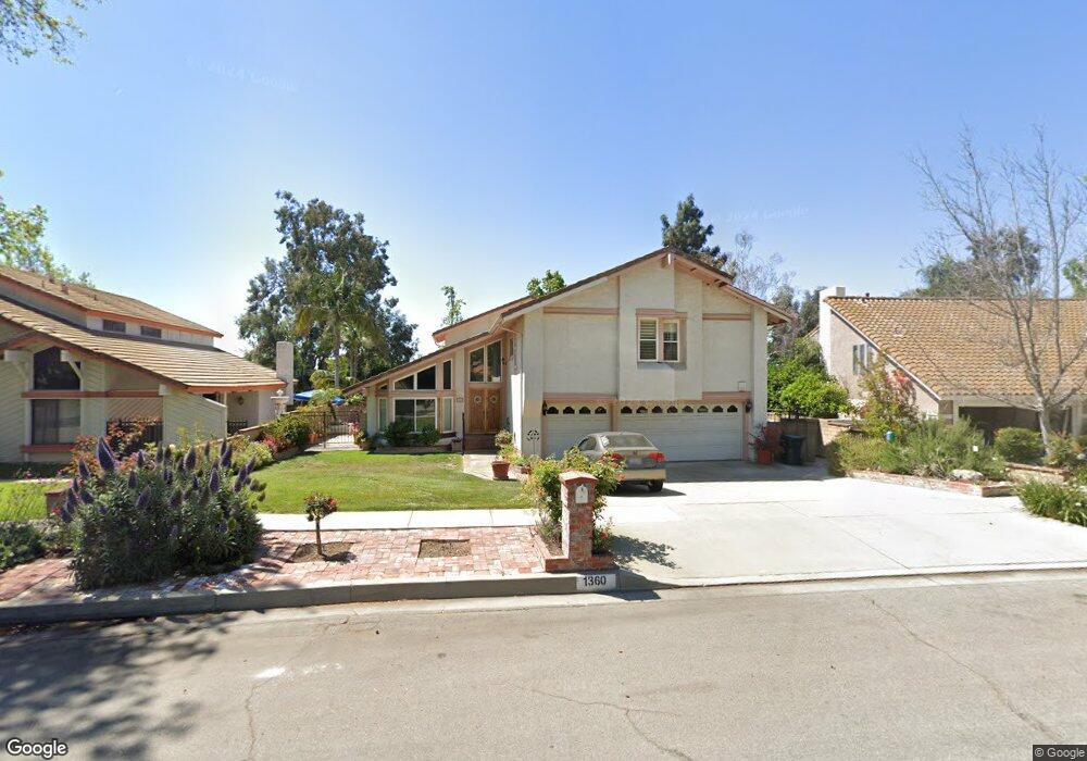
1360 Auburn St Upland, CA 91784
Estimated Value: $950,684 - $1,236,000
3
Beds
3
Baths
2,388
Sq Ft
$445/Sq Ft
Est. Value
About This Home
This home is located at 1360 Auburn St, Upland, CA 91784 and is currently estimated at $1,063,671, approximately $445 per square foot. 1360 Auburn St is a home located in San Bernardino County with nearby schools including Pepper Tree Elementary, Pioneer Junior High School, and Upland High School.
Ownership History
Date
Name
Owned For
Owner Type
Purchase Details
Closed on
Jun 15, 2024
Sold by
Gervas Cesar and Gervas Terry
Bought by
Gervas Family Trust and Gervas
Current Estimated Value
Purchase Details
Closed on
Aug 15, 2013
Sold by
Gervas Terry Lynn
Bought by
Gervas Terry Lynn and Gervas Cesar
Home Financials for this Owner
Home Financials are based on the most recent Mortgage that was taken out on this home.
Original Mortgage
$305,500
Interest Rate
4.51%
Mortgage Type
New Conventional
Create a Home Valuation Report for This Property
The Home Valuation Report is an in-depth analysis detailing your home's value as well as a comparison with similar homes in the area
Home Values in the Area
Average Home Value in this Area
Purchase History
| Date | Buyer | Sale Price | Title Company |
|---|---|---|---|
| Gervas Family Trust | -- | None Listed On Document | |
| Gervas Terry Lynn | -- | Lsi Title Agency Inc |
Source: Public Records
Mortgage History
| Date | Status | Borrower | Loan Amount |
|---|---|---|---|
| Previous Owner | Gervas Terry Lynn | $305,500 |
Source: Public Records
Tax History Compared to Growth
Tax History
| Year | Tax Paid | Tax Assessment Tax Assessment Total Assessment is a certain percentage of the fair market value that is determined by local assessors to be the total taxable value of land and additions on the property. | Land | Improvement |
|---|---|---|---|---|
| 2025 | $4,610 | $431,603 | $146,326 | $285,277 |
| 2024 | $4,610 | $423,140 | $143,457 | $279,683 |
| 2023 | $4,475 | $414,843 | $140,644 | $274,199 |
| 2022 | $4,377 | $400,822 | $137,884 | $262,938 |
| 2021 | $4,370 | $392,962 | $135,180 | $257,782 |
| 2020 | $4,251 | $388,933 | $133,794 | $255,139 |
| 2019 | $4,235 | $381,307 | $131,171 | $250,136 |
| 2018 | $4,131 | $373,830 | $128,599 | $245,231 |
| 2017 | $4,011 | $366,500 | $126,077 | $240,423 |
| 2016 | $3,803 | $359,314 | $123,605 | $235,709 |
| 2015 | $3,716 | $353,916 | $121,748 | $232,168 |
| 2014 | $3,619 | $346,983 | $119,363 | $227,620 |
Source: Public Records
Map
Nearby Homes
- 1798 Wilson Ave
- 1830 Wilson Ave
- 1226 Azalea Ct
- 1520 W Clark St
- 1675 Wilson Ave
- 1243 Jacaranda Place
- 1146 Oneil St
- 1635 Wilson Ave
- 1992 Moonbeam Cir
- 1400 Sullivan St
- 1310 Brookside Ct
- 1703 Shamrock Ave
- 1604 Redwood Way
- 1613 Erin Ave
- 1099 Sullivan St
- 1363 Running Creek Ln
- 1788 N Coolcrest Ave
- 1705 Almond Tree Place
- 1578 Brentwood Ave
- 1817 Balboa Way
- 1350 Auburn St
- 1368 Auburn St
- 1340 Auburn St
- 1814 Lakewood Ave
- 1797 Maywood Ave
- 1804 Lakewood Ave
- 1821 Maywood Ct
- 1365 Auburn St
- 1330 Auburn St
- 1796 Rosewood Way
- 1375 Auburn St
- 1789 Maywood Ave
- 1341 Beth Way
- 1827 Maywood Ct
- 1322 Auburn St
- 1820 Maywood Ct
- 1790 Rosewood Way
- 1826 Lakewood Ave
- 1875 Maywood Ct
- 1333 Beth Way