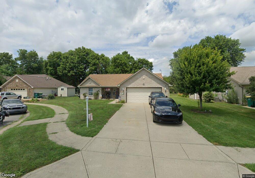
1360 Wright Ct Franklin, IN 46131
Estimated Value: $257,305 - $291,000
3
Beds
2
Baths
1,400
Sq Ft
$197/Sq Ft
Est. Value
About This Home
This home is located at 1360 Wright Ct, Franklin, IN 46131 and is currently estimated at $276,326, approximately $197 per square foot. 1360 Wright Ct is a home located in Johnson County with nearby schools including Northwood Elementary School, Custer Baker Intermediate School, and Franklin Community Middle School.
Ownership History
Date
Name
Owned For
Owner Type
Purchase Details
Closed on
Mar 7, 2022
Sold by
Burdett Candice H
Bought by
Viles Matthew A and Viles Candice H
Current Estimated Value
Purchase Details
Closed on
Nov 22, 2005
Sold by
Mitchell Gary W and Mitchell Juanita L
Bought by
Burdett Lawrence R and Burdett Candice H
Home Financials for this Owner
Home Financials are based on the most recent Mortgage that was taken out on this home.
Original Mortgage
$79,900
Interest Rate
6.2%
Mortgage Type
New Conventional
Create a Home Valuation Report for This Property
The Home Valuation Report is an in-depth analysis detailing your home's value as well as a comparison with similar homes in the area
Home Values in the Area
Average Home Value in this Area
Purchase History
| Date | Buyer | Sale Price | Title Company |
|---|---|---|---|
| Viles Matthew A | -- | New Title Company Name | |
| Burdett Lawrence R | -- | None Available |
Source: Public Records
Mortgage History
| Date | Status | Borrower | Loan Amount |
|---|---|---|---|
| Previous Owner | Burdett Lawrence R | $79,900 |
Source: Public Records
Tax History
| Year | Tax Paid | Tax Assessment Tax Assessment Total Assessment is a certain percentage of the fair market value that is determined by local assessors to be the total taxable value of land and additions on the property. | Land | Improvement |
|---|---|---|---|---|
| 2025 | $1,715 | $199,000 | $17,200 | $181,800 |
| 2024 | $1,715 | $157,000 | $17,200 | $139,800 |
| 2023 | $1,703 | $155,000 | $17,200 | $137,800 |
| 2022 | $1,594 | $143,700 | $17,200 | $126,500 |
| 2021 | $1,439 | $130,100 | $16,300 | $113,800 |
| 2020 | $1,449 | $132,900 | $16,300 | $116,600 |
| 2019 | $1,488 | $136,300 | $16,300 | $120,000 |
| 2018 | $1,357 | $134,700 | $16,300 | $118,400 |
| 2017 | $1,297 | $128,700 | $16,300 | $112,400 |
| 2016 | $1,155 | $125,100 | $16,300 | $108,800 |
| 2014 | $1,171 | $110,400 | $19,100 | $91,300 |
| 2013 | $1,171 | $117,100 | $19,100 | $98,000 |
Source: Public Records
Map
Nearby Homes
- 506 Galahad Dr
- 317 Galahad Dr
- 492 Pelenor Dr
- 1238 Atlas Ln
- 1286 Murphy Dr
- 2057 Pelican Dr
- 1455 Cecil Ln
- 1347 Swan Dr
- 1303 Crabapple Rd
- 1408 Crabapple Rd
- 1424 Crabapple Rd
- 925 Mallory Pkwy
- 1212 Crabapple Rd
- 1712 Turning Leaf Dr
- 1951 Turning Leaf Dr
- 1046 Ebony Cir
- 1985 Falcon Ct
- 21 14th St
- 1009 Foxtail Dr
- 731 Franklin Lakes Blvd
- 1390 Wright Ct
- 1350 Wright Ct
- 1370 Wright Ct
- 1339 Guenevere Ct
- 326 Galahad Dr
- 1340 Wright Ct
- 396 Galahad Dr
- 1355 Wright Ct
- 1380 Wright Ct
- 1365 Wright Ct
- 1375 Wright Ct
- 1345 Wright Ct
- 1319 Guenevere Ct
- 1350 Guenevere Ct
- 406 Galahad Dr
- 1362 Commons Way
- 1372 Commons Way
- 337 Galahad Dr
- 307 Galahad Dr
- 399 Galahad Dr
Your Personal Tour Guide
Ask me questions while you tour the home.