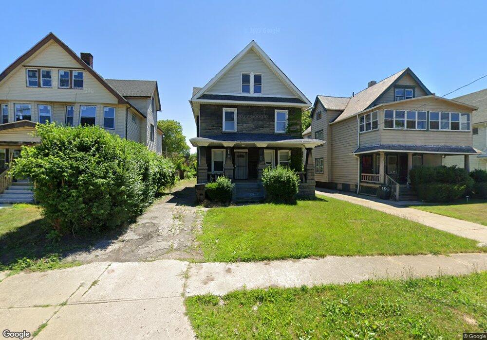
13602 Ashburton Rd Cleveland, OH 44110
South Collinwood NeighborhoodEstimated Value: $87,812 - $114,000
6
Beds
2
Baths
1,890
Sq Ft
$54/Sq Ft
Est. Value
About This Home
This home is located at 13602 Ashburton Rd, Cleveland, OH 44110 and is currently estimated at $101,453, approximately $53 per square foot. 13602 Ashburton Rd is a home located in Cuyahoga County with nearby schools including Bolton, Anton Grdina School, and Andrew J. Rickoff School.
Ownership History
Date
Name
Owned For
Owner Type
Purchase Details
Closed on
Apr 15, 2025
Sold by
Spanish Cay Llc
Bought by
Riparian Vpc Ohio Sfr Portfolio Llc
Current Estimated Value
Purchase Details
Closed on
Aug 17, 2018
Sold by
Sbar Holdings Llc
Bought by
Spanish Cay Llc
Purchase Details
Closed on
May 11, 2018
Sold by
White Lonnie
Bought by
Sbar Holdings Llc
Purchase Details
Closed on
Jan 30, 2018
Sold by
Lakeside Reo Ventures Llc
Bought by
White Lonnie
Purchase Details
Closed on
Jun 30, 2017
Sold by
Bridges Malaika
Bought by
Lakeside Reo Ventures Llc
Purchase Details
Closed on
Apr 23, 2007
Sold by
Shkolnikov Leonid
Bought by
Bridges Malaika
Home Financials for this Owner
Home Financials are based on the most recent Mortgage that was taken out on this home.
Original Mortgage
$78,200
Interest Rate
6.19%
Mortgage Type
Purchase Money Mortgage
Purchase Details
Closed on
Feb 11, 2005
Sold by
Kings Property & Management Services Llc
Bought by
Shkolnikov Leonid
Purchase Details
Closed on
Jun 3, 2004
Sold by
Flagstar Bank Fsb
Bought by
Kings Property & Management & Services L
Purchase Details
Closed on
Apr 17, 2003
Sold by
Smith Tara and Williams Kelly
Bought by
Flagstar Bank Fsb
Purchase Details
Closed on
May 10, 2000
Sold by
Upscale Properties Inc
Bought by
Smith Tara
Home Financials for this Owner
Home Financials are based on the most recent Mortgage that was taken out on this home.
Original Mortgage
$63,650
Interest Rate
8.21%
Purchase Details
Closed on
Jan 13, 2000
Sold by
Thomas Clara N
Bought by
Upscale Properties Inc
Home Financials for this Owner
Home Financials are based on the most recent Mortgage that was taken out on this home.
Original Mortgage
$200,000
Interest Rate
7.89%
Mortgage Type
Credit Line Revolving
Purchase Details
Closed on
Nov 19, 1986
Sold by
Pack Harriet C
Bought by
Thomas Clara N
Purchase Details
Closed on
May 12, 1986
Sold by
Pack William E
Bought by
Pack Harriet C
Purchase Details
Closed on
Sep 11, 1979
Bought by
Pack William E
Purchase Details
Closed on
May 24, 1978
Bought by
Adm Veterans Affairs
Purchase Details
Closed on
Jan 1, 1975
Bought by
Pack Patricia
Create a Home Valuation Report for This Property
The Home Valuation Report is an in-depth analysis detailing your home's value as well as a comparison with similar homes in the area
Home Values in the Area
Average Home Value in this Area
Purchase History
| Date | Buyer | Sale Price | Title Company |
|---|---|---|---|
| Riparian Vpc Ohio Sfr Portfolio Llc | $1,539,636 | Daniel Sicina Title | |
| Spanish Cay Llc | $55,000 | Harverfield Title Agency | |
| Sbar Holdings Llc | $20,000 | Mount Morrie Title Agency | |
| White Lonnie | $10,101 | Ohio Rela Title | |
| Lakeside Reo Ventures Llc | $25,677 | None Available | |
| Bridges Malaika | $92,000 | Action | |
| Shkolnikov Leonid | -- | Jac Management | |
| Kings Property & Management & Services L | $35,000 | Great Northern Title Agen | |
| Flagstar Bank Fsb | $32,000 | -- | |
| Smith Tara | $84,900 | -- | |
| Upscale Properties Inc | $30,000 | Executive Title Agency Corp | |
| Thomas Clara N | -- | -- | |
| Pack Harriet C | -- | -- | |
| Pack William E | -- | -- | |
| Adm Veterans Affairs | -- | -- | |
| Buffalo Sav Bank | $6,700 | -- | |
| Pack Patricia | -- | -- |
Source: Public Records
Mortgage History
| Date | Status | Borrower | Loan Amount |
|---|---|---|---|
| Previous Owner | Bridges Malaika | $78,200 | |
| Previous Owner | Smith Tara | $63,650 | |
| Previous Owner | Upscale Properties Inc | $200,000 |
Source: Public Records
Tax History Compared to Growth
Tax History
| Year | Tax Paid | Tax Assessment Tax Assessment Total Assessment is a certain percentage of the fair market value that is determined by local assessors to be the total taxable value of land and additions on the property. | Land | Improvement |
|---|---|---|---|---|
| 2024 | $1,575 | $23,555 | $3,640 | $19,915 |
| 2023 | $1,216 | $11,310 | $3,360 | $7,950 |
| 2022 | $872 | $11,305 | $3,360 | $7,945 |
| 2021 | $864 | $11,310 | $3,360 | $7,950 |
| 2020 | $875 | $9,910 | $2,940 | $6,970 |
| 2019 | $811 | $28,300 | $8,400 | $19,900 |
| 2018 | $1,031 | $9,910 | $2,940 | $6,970 |
| 2017 | $1,264 | $14,950 | $2,560 | $12,390 |
| 2016 | $1,254 | $14,950 | $2,560 | $12,390 |
| 2015 | $3,092 | $14,950 | $2,560 | $12,390 |
| 2014 | $3,092 | $17,190 | $2,940 | $14,250 |
Source: Public Records
Map
Nearby Homes
- 13519 Ashburton Ave
- 13415 Casper Rd
- 13514 Blenheim Rd
- 13805 Earlwood Rd
- 13809 Earlwood Rd
- 13802 Rugby Rd
- 14004 Idarose Ave
- 13908 Glenside Rd
- 14016 Castalia Ave
- 13806 Coit Rd
- 1738 Coit Rd
- 13401 Rugby Rd
- 469 Arbor Rd
- 417 Arbor Rd
- 14206 Glenside Rd
- 1273 E 135th St
- 1281 E 134th St
- 13912 Baldwin Ave
- 1276 E 133rd St
- 445 Cleveland Rd
- 13602 Ashburton Ave
- 13524 Ashburton Ave
- 13610 Ashburton Ave
- 13520 Ashburton Ave
- 13516 Ashburton Ave
- 13509 Casper Rd
- 13515 Casper Rd
- 13603 Ashburton Ave
- 13505 Casper Rd
- 13605 Ashburton Ave
- 13512 Ashburton Ave
- 13501 Casper Rd
- 13501 Casper Rd Unit 2
- 13501 Casper Rd Unit 1
- 13601 Ashburton Ave
- 13525 Ashburton Ave
- 13510 Ashburton Ave
- 13423 Casper Rd
- 13519 Ashburton Rd
- 13504 Ashburton Ave