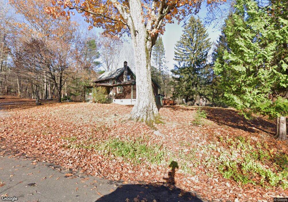
1361 Bardwells Ferry Rd Conway, MA 01341
Estimated Value: $237,145 - $328,000
3
Beds
1
Bath
856
Sq Ft
$319/Sq Ft
Est. Value
About This Home
This home is located at 1361 Bardwells Ferry Rd, Conway, MA 01341 and is currently estimated at $273,036, approximately $318 per square foot. 1361 Bardwells Ferry Rd is a home located in Franklin County with nearby schools including Frontier Regional School.
Ownership History
Date
Name
Owned For
Owner Type
Purchase Details
Closed on
Dec 22, 2006
Sold by
Warger Joseph and Warger Teresa E
Bought by
Laprade Damien E
Current Estimated Value
Home Financials for this Owner
Home Financials are based on the most recent Mortgage that was taken out on this home.
Original Mortgage
$139,500
Outstanding Balance
$83,589
Interest Rate
6.35%
Mortgage Type
Purchase Money Mortgage
Estimated Equity
$189,447
Create a Home Valuation Report for This Property
The Home Valuation Report is an in-depth analysis detailing your home's value as well as a comparison with similar homes in the area
Home Values in the Area
Average Home Value in this Area
Purchase History
| Date | Buyer | Sale Price | Title Company |
|---|---|---|---|
| Laprade Damien E | $155,000 | -- |
Source: Public Records
Mortgage History
| Date | Status | Borrower | Loan Amount |
|---|---|---|---|
| Open | Laprade Damien E | $139,500 |
Source: Public Records
Tax History Compared to Growth
Tax History
| Year | Tax Paid | Tax Assessment Tax Assessment Total Assessment is a certain percentage of the fair market value that is determined by local assessors to be the total taxable value of land and additions on the property. | Land | Improvement |
|---|---|---|---|---|
| 2025 | $2,582 | $178,800 | $36,600 | $142,200 |
| 2024 | $2,531 | $154,300 | $33,200 | $121,100 |
| 2023 | $2,646 | $154,300 | $33,200 | $121,100 |
| 2022 | $2,563 | $142,800 | $30,800 | $112,000 |
| 2021 | $3,755 | $134,700 | $29,400 | $105,300 |
| 2020 | $2,283 | $121,700 | $29,400 | $92,300 |
| 2019 | $3,361 | $121,700 | $29,400 | $92,300 |
| 2018 | $2,248 | $121,500 | $29,400 | $92,100 |
| 2017 | $2,157 | $121,500 | $29,400 | $92,100 |
| 2016 | $1,955 | $117,200 | $25,600 | $91,600 |
| 2015 | $1,895 | $117,200 | $25,600 | $91,600 |
Source: Public Records
Map
Nearby Homes
- 85 Dacey Rd
- lot 1 Shelburne Falls Rd
- 14 River St
- 163 S Shelburne Rd
- 71 Mathews Rd
- 23 Robbins Rd
- 130 Laurel St
- 414 Mohawk Trail
- 83 Newton St
- 58A Laurel St
- 6 Keegan Ln Unit E
- 22 Princeton Terrace Unit 22
- 102 Elm St
- 46 Colrain St
- 74 Petty Plain Rd
- 11 Colrain St
- 36 West St
- 345 Greenfield Rd
- 298 Deerfield St
- 116-120 Elm St
- 49 Wholey Rd
- 0 Bardwells Ferry Rd
- 1263 Bardwells Ferry Rd
- 602 Bardwells Ferry Rd
- 439 Bardwells Ferry Rd
- 595 Bardwells Ferry Rd
- 1110 Bardwells Ferry Rd
- 602A Bardwells Ferry Rd
- 1150 Bardwells Ferry Rd
- 532 Bardwells Ferry Rd
- 1049 Bardwells Ferry Rd
- 983 Bardwells Ferry Rd
- 997 Bardwells Ferry Rd
- 406 Taylor Rd
- 422 Taylor Rd
- 904 Bardwells Ferry Rd
- 442 Taylor Rd
- 727 Bardwells Ferry Rd
- 435 Bardwells Ferry Rd
- 589 Bardwells Ferry Rd