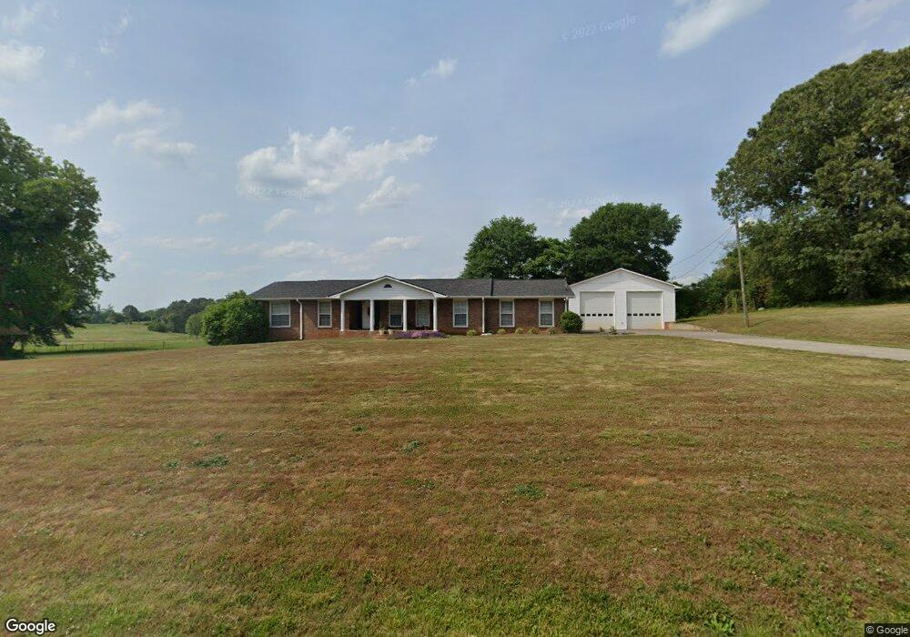
1361 Bart Manous Rd Canton, GA 30115
Union Hill NeighborhoodEstimated Value: $386,414 - $492,000
3
Beds
2
Baths
1,719
Sq Ft
$249/Sq Ft
Est. Value
About This Home
This home is located at 1361 Bart Manous Rd, Canton, GA 30115 and is currently estimated at $428,354, approximately $249 per square foot. 1361 Bart Manous Rd is a home located in Cherokee County with nearby schools including Avery Elementary School, Creekland Middle School, and Creekview High School.
Ownership History
Date
Name
Owned For
Owner Type
Purchase Details
Closed on
Mar 17, 2015
Sold by
Owen Robert L Estate
Bought by
Borden Steelman J
Current Estimated Value
Home Financials for this Owner
Home Financials are based on the most recent Mortgage that was taken out on this home.
Original Mortgage
$155,000
Outstanding Balance
$118,163
Interest Rate
3.87%
Mortgage Type
New Conventional
Estimated Equity
$310,191
Purchase Details
Closed on
Jul 28, 2008
Sold by
Owen Shirley J
Bought by
Owen Shirley J
Create a Home Valuation Report for This Property
The Home Valuation Report is an in-depth analysis detailing your home's value as well as a comparison with similar homes in the area
Home Values in the Area
Average Home Value in this Area
Purchase History
| Date | Buyer | Sale Price | Title Company |
|---|---|---|---|
| Borden Steelman J | -- | -- | |
| Borden Steelman J | $175,000 | -- | |
| Owen Shirley J | -- | -- |
Source: Public Records
Mortgage History
| Date | Status | Borrower | Loan Amount |
|---|---|---|---|
| Open | Borden Steelman J | $155,000 | |
| Closed | Borden Steelman J | $155,000 |
Source: Public Records
Tax History
| Year | Tax Paid | Tax Assessment Tax Assessment Total Assessment is a certain percentage of the fair market value that is determined by local assessors to be the total taxable value of land and additions on the property. | Land | Improvement |
|---|---|---|---|---|
| 2025 | $2,723 | $103,672 | $20,320 | $83,352 |
| 2024 | $2,525 | $97,152 | $16,400 | $80,752 |
| 2023 | $2,347 | $89,312 | $13,240 | $76,072 |
| 2022 | $2,006 | $76,312 | $12,720 | $63,592 |
| 2021 | $1,848 | $65,112 | $10,600 | $54,512 |
| 2020 | $1,715 | $60,352 | $10,600 | $49,752 |
| 2019 | $1,640 | $57,720 | $10,600 | $47,120 |
| 2018 | $1,617 | $56,560 | $10,600 | $45,960 |
| 2017 | $1,665 | $144,500 | $10,600 | $47,200 |
| 2016 | $1,572 | $135,000 | $8,800 | $45,200 |
| 2015 | $1,382 | $117,500 | $8,400 | $38,600 |
| 2014 | $420 | $113,200 | $7,000 | $38,280 |
Source: Public Records
Map
Nearby Homes
- 306 Crown Ct
- 134 Royal Oaks Dr
- 1076 Pinyan Ln
- 254 Lingefelt Ln
- 115 Old Avery Dr
- 120 Prescott Manor Dr
- 250 Randall Creek Dr
- 129 Prescott Manor Dr
- 1248 Avery Rd
- 205 Sweetbriar Ln
- 411 Royal Crescent Ln E
- 405 Royal Crescent Ln E
- 241 Royal Crescent Terrace
- 1996 Thomas Rd
- 7820 E Cherokee Dr
- 646 Royal Crest Ct
- 501 Middlebrooke Trace
- 642 Royal Crest Ct
- 337 Mcdaniel Place
- 335 Mcdaniel Place
- 1403 Bart Manous Rd
- 1313 Bart Manous Rd
- 1378 Bart Manous Rd
- 1340 Bart Manous Rd
- 1445 Bart Manous Rd
- 1434 Bart Manous Rd
- 1350 Bart Manous Rd
- 1478 Bart Manous Rd
- 1158 Bart Manous Rd
- 1154 Bart Manous Rd
- 1154 Bart Manous Rd Unit 54
- 107 Royal Oaks Dr
- L A&B Bart Manous Rd
- 1531 Bart Manous Rd
- 1191 Bart Manous Rd
- 100 Wills Ct
- 221 Lacy Rd
- 253 Lacy Rd
- 109 Royal Oaks Dr
- 111 Royal Oaks Dr
Your Personal Tour Guide
Ask me questions while you tour the home.