Estimated Value: $168,000 - $184,000
3
Beds
2
Baths
962
Sq Ft
$185/Sq Ft
Est. Value
About This Home
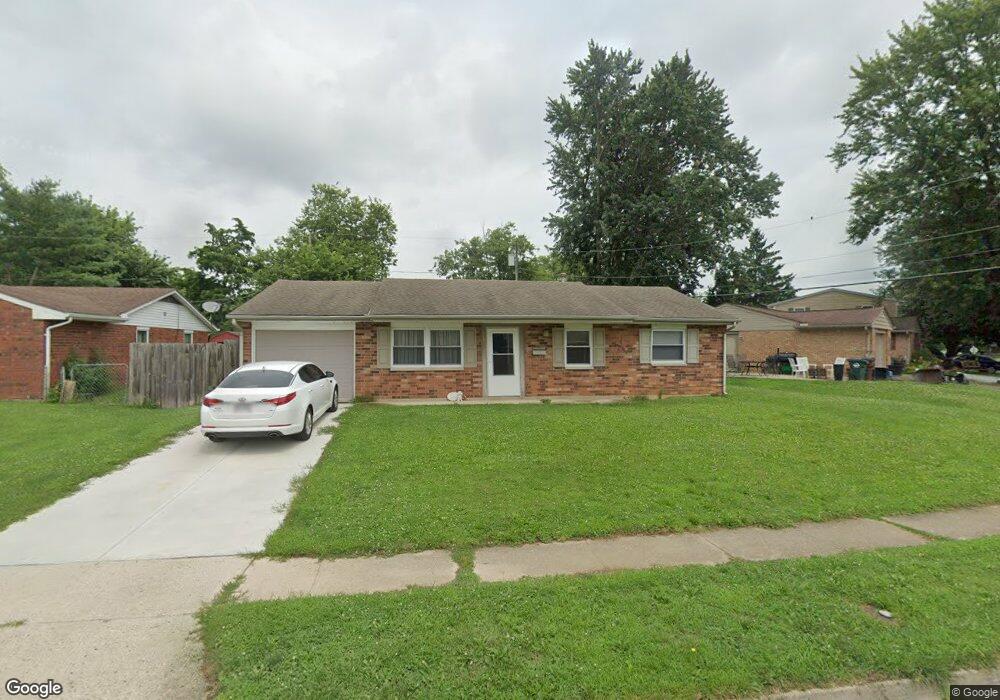
This home is located at 1361 Commonwealth Dr, Xenia, OH 45385 and is currently estimated at $177,537, approximately $184 per square foot. 1361 Commonwealth Dr is a home located in Greene County with nearby schools including Xenia High School and Summit Academy Community School for Alternative Learners - Xenia.
Ownership History
Date
Name
Owned For
Owner Type
Purchase Details
Closed on
Jan 26, 2009
Sold by
Heritage Way Properties Llc
Bought by
Ohio Valley Property Management Llc
Current Estimated Value
Purchase Details
Closed on
Oct 13, 2005
Sold by
Lefevre Lloyd Kristopher A and Lefevre Lloyd Erica N
Bought by
Heritage Way Properties Llc
Purchase Details
Closed on
Feb 7, 2002
Sold by
Shelton Karla D and Zamonski Kelly F
Bought by
Lefevre Lloyd Kristopher A and Lefevre Lloyd Erica N
Home Financials for this Owner
Home Financials are based on the most recent Mortgage that was taken out on this home.
Original Mortgage
$83,232
Interest Rate
6.93%
Mortgage Type
VA
Purchase Details
Closed on
Aug 30, 2001
Sold by
Estate Of Betty Osvath
Bought by
Shelton Karla D
Purchase Details
Closed on
Aug 17, 2001
Sold by
Estate Of Alex Osvath
Bought by
Shelton Karla D and Zamonski Kelly F
Create a Home Valuation Report for This Property
The Home Valuation Report is an in-depth analysis detailing your home's value as well as a comparison with similar homes in the area
Home Values in the Area
Average Home Value in this Area
Purchase History
| Date | Buyer | Sale Price | Title Company |
|---|---|---|---|
| Ohio Valley Property Management Llc | -- | None Available | |
| Heritage Way Properties Llc | $73,500 | -- | |
| Lefevre Lloyd Kristopher A | $81,600 | -- | |
| Shelton Karla D | -- | -- | |
| Shelton Karla D | -- | -- |
Source: Public Records
Mortgage History
| Date | Status | Borrower | Loan Amount |
|---|---|---|---|
| Previous Owner | Lefevre Lloyd Kristopher A | $83,232 |
Source: Public Records
Tax History Compared to Growth
Tax History
| Year | Tax Paid | Tax Assessment Tax Assessment Total Assessment is a certain percentage of the fair market value that is determined by local assessors to be the total taxable value of land and additions on the property. | Land | Improvement |
|---|---|---|---|---|
| 2024 | $1,896 | $44,310 | $11,620 | $32,690 |
| 2023 | $1,896 | $44,310 | $11,620 | $32,690 |
| 2022 | $1,567 | $31,230 | $6,830 | $24,400 |
| 2021 | $1,588 | $31,230 | $6,830 | $24,400 |
| 2020 | $1,521 | $31,230 | $6,830 | $24,400 |
| 2019 | $1,312 | $25,350 | $6,630 | $18,720 |
| 2018 | $1,317 | $25,350 | $6,630 | $18,720 |
| 2017 | $1,210 | $25,350 | $6,630 | $18,720 |
| 2016 | $1,211 | $22,870 | $6,630 | $16,240 |
| 2015 | $1,214 | $22,870 | $6,630 | $16,240 |
| 2014 | $1,163 | $22,870 | $6,630 | $16,240 |
Source: Public Records
Map
Nearby Homes
- 1769 Gayhart Dr
- 1829 Gayhart Dr
- 1403 Texas Dr
- 1653 Seneca Dr
- 1908 Whitt St
- 2142 Michigan Dr
- 1778 Arapaho Dr
- 1618 Navajo Dr
- 2257 Maryland Dr
- 1866 Roxbury Dr
- 414 Whisper Ln
- 1107 Arkansas Dr
- 2758 Wyoming Dr
- 1255 Colorado Dr
- 2545 Harmony Dr
- 161 Montana Dr
- 219 Kansas Dr
- 1568 Cheyenne Dr
- 2345 Tennessee Dr
- 2499 Jenny Marie Dr
- 1347 Commonwealth Dr
- 1379 Commonwealth Dr
- 3300 Wyoming Dr
- 1333 Commonwealth Dr
- 3286 Wyoming Dr
- 1399 Commonwealth Dr
- 1348 Commonwealth Dr
- 1362 Commonwealth Dr
- 3272 Wyoming Dr
- 1334 Commonwealth Dr
- 1319 Commonwealth Dr
- 1374 Commonwealth Dr
- 1320 Commonwealth Dr
- 3350 Wyoming Dr
- 3258 Wyoming Dr
- 1305 Commonwealth Dr
- 1306 Commonwealth Dr
- 3309 Wyoming Dr
- 3295 Wyoming Dr
- 1841 Nebraska Dr