Estimated Value: $209,000 - $220,000
4
Beds
2
Baths
1,432
Sq Ft
$150/Sq Ft
Est. Value
About This Home
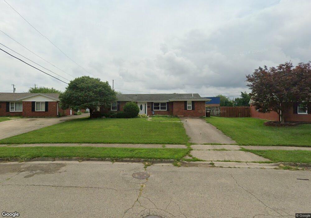
This home is located at 1362 Commonwealth Dr, Xenia, OH 45385 and is currently estimated at $214,989, approximately $150 per square foot. 1362 Commonwealth Dr is a home located in Greene County with nearby schools including Xenia High School and Summit Academy Community School for Alternative Learners - Xenia.
Ownership History
Date
Name
Owned For
Owner Type
Purchase Details
Closed on
Dec 16, 2021
Sold by
Norris Christopher M and Norris Chelsea
Bought by
Heltman Caitlin and Heitman Kurt
Current Estimated Value
Home Financials for this Owner
Home Financials are based on the most recent Mortgage that was taken out on this home.
Original Mortgage
$153,745
Outstanding Balance
$141,367
Interest Rate
3.09%
Mortgage Type
New Conventional
Estimated Equity
$73,622
Purchase Details
Closed on
Dec 31, 2013
Sold by
Chrysler Richard
Bought by
Norris Christopher M
Home Financials for this Owner
Home Financials are based on the most recent Mortgage that was taken out on this home.
Original Mortgage
$94,729
Interest Rate
4.12%
Mortgage Type
FHA
Purchase Details
Closed on
Jun 7, 2013
Sold by
Foster Daniel J and Foster Jennifer L
Bought by
Chrysler Richard
Create a Home Valuation Report for This Property
The Home Valuation Report is an in-depth analysis detailing your home's value as well as a comparison with similar homes in the area
Home Values in the Area
Average Home Value in this Area
Purchase History
| Date | Buyer | Sale Price | Title Company |
|---|---|---|---|
| Heltman Caitlin | -- | None Listed On Document | |
| Norris Christopher M | $96,500 | None Available | |
| Chrysler Richard | $47,000 | None Available |
Source: Public Records
Mortgage History
| Date | Status | Borrower | Loan Amount |
|---|---|---|---|
| Open | Heltman Caitlin | $153,745 | |
| Previous Owner | Norris Christopher M | $94,729 |
Source: Public Records
Tax History Compared to Growth
Tax History
| Year | Tax Paid | Tax Assessment Tax Assessment Total Assessment is a certain percentage of the fair market value that is determined by local assessors to be the total taxable value of land and additions on the property. | Land | Improvement |
|---|---|---|---|---|
| 2024 | $2,454 | $57,340 | $11,640 | $45,700 |
| 2023 | $2,454 | $57,340 | $11,640 | $45,700 |
| 2022 | $2,055 | $40,970 | $6,850 | $34,120 |
| 2021 | $1,765 | $35,610 | $6,850 | $28,760 |
| 2020 | $1,689 | $35,610 | $6,850 | $28,760 |
| 2019 | $1,480 | $29,370 | $6,580 | $22,790 |
| 2018 | $1,486 | $29,370 | $6,580 | $22,790 |
| 2017 | $1,361 | $29,370 | $6,580 | $22,790 |
| 2016 | $1,361 | $26,420 | $6,580 | $19,840 |
| 2015 | $1,365 | $26,420 | $6,580 | $19,840 |
| 2014 | $1,343 | $26,420 | $6,580 | $19,840 |
Source: Public Records
Map
Nearby Homes
- 1769 Gayhart Dr
- 1829 Gayhart Dr
- 1908 Whitt St
- 1403 Texas Dr
- 2142 Michigan Dr
- 2257 Maryland Dr
- 1107 Arkansas Dr
- 1653 Seneca Dr
- 1255 Colorado Dr
- 1866 Roxbury Dr
- 1778 Arapaho Dr
- 2545 Harmony Dr
- 414 Whisper Ln
- 1618 Navajo Dr
- 2345 Tennessee Dr
- 2758 Wyoming Dr
- 2499 Jenny Marie Dr
- 219 Kansas Dr
- 161 Montana Dr
- 2421 Louisiana Dr
- 1348 Commonwealth Dr
- 1374 Commonwealth Dr
- 1334 Commonwealth Dr
- 1361 Commonwealth Dr
- 1379 Commonwealth Dr
- 1347 Commonwealth Dr
- 1320 Commonwealth Dr
- 3350 Wyoming Dr
- 1333 Commonwealth Dr
- 1399 Commonwealth Dr
- 1306 Commonwealth Dr
- 3366 Wyoming Dr
- 3300 Wyoming Dr
- 1319 Commonwealth Dr
- 3286 Wyoming Dr
- 3272 Wyoming Dr
- 1305 Commonwealth Dr
- 1931 Nebraska Dr
- 1917 Nebraska Dr
- 1945 Nebraska Dr