Estimated Value: $275,280 - $292,000
3
Beds
2
Baths
1,497
Sq Ft
$191/Sq Ft
Est. Value
About This Home
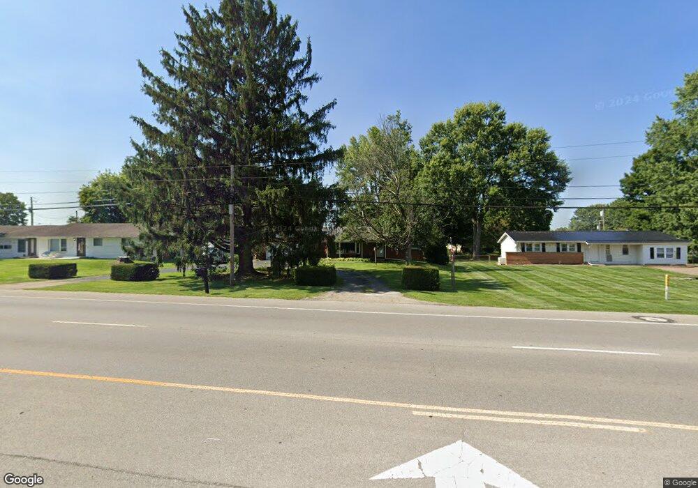
This home is located at 1363 Hebron Rd, Heath, OH 43056 and is currently estimated at $285,820, approximately $190 per square foot. 1363 Hebron Rd is a home located in Licking County with nearby schools including Garfield Elementary School, Stevenson Elementary School, and Heath Middle School.
Ownership History
Date
Name
Owned For
Owner Type
Purchase Details
Closed on
Aug 4, 2006
Sold by
Taylor Marge
Bought by
Wimer Roger M
Current Estimated Value
Home Financials for this Owner
Home Financials are based on the most recent Mortgage that was taken out on this home.
Original Mortgage
$30,000
Interest Rate
6.83%
Mortgage Type
Stand Alone Second
Purchase Details
Closed on
Oct 1, 2002
Sold by
Young Donald A
Bought by
Shock Sandra J
Home Financials for this Owner
Home Financials are based on the most recent Mortgage that was taken out on this home.
Original Mortgage
$115,000
Interest Rate
6.32%
Mortgage Type
New Conventional
Create a Home Valuation Report for This Property
The Home Valuation Report is an in-depth analysis detailing your home's value as well as a comparison with similar homes in the area
Home Values in the Area
Average Home Value in this Area
Purchase History
| Date | Buyer | Sale Price | Title Company |
|---|---|---|---|
| Wimer Roger M | $150,000 | Buckey | |
| Shock Sandra J | $145,000 | -- |
Source: Public Records
Mortgage History
| Date | Status | Borrower | Loan Amount |
|---|---|---|---|
| Closed | Wimer Roger M | $30,000 | |
| Open | Wimer Roger M | $120,000 | |
| Previous Owner | Shock Sandra J | $115,000 |
Source: Public Records
Tax History
| Year | Tax Paid | Tax Assessment Tax Assessment Total Assessment is a certain percentage of the fair market value that is determined by local assessors to be the total taxable value of land and additions on the property. | Land | Improvement |
|---|---|---|---|---|
| 2024 | $3,344 | $77,770 | $21,000 | $56,770 |
| 2023 | $3,703 | $77,770 | $21,000 | $56,770 |
| 2022 | $3,381 | $61,950 | $22,540 | $39,410 |
| 2021 | $3,451 | $61,950 | $22,540 | $39,410 |
| 2020 | $3,473 | $61,950 | $22,540 | $39,410 |
| 2019 | $3,218 | $58,380 | $22,540 | $35,840 |
| 2018 | $3,252 | $0 | $0 | $0 |
| 2017 | $3,251 | $0 | $0 | $0 |
| 2016 | $3,002 | $0 | $0 | $0 |
| 2015 | $3,053 | $0 | $0 | $0 |
| 2014 | $4,292 | $0 | $0 | $0 |
| 2013 | $2,816 | $0 | $0 | $0 |
Source: Public Records
Map
Nearby Homes
- 1094 Aldine Dr
- 105 Clark Ave
- 92 Jonathan Dr
- 1100 Thornwood Dr Unit Lot 1005
- 1100 Thornwood Dr SW Unit 1018
- 1100 Thornwood Dr SW Unit Lot 58
- 1100 Thornwood Dr SW Unit Lot 1008
- 1100 Thornwood Dr SW Unit Lot 1011
- 164 Licking View Dr
- 1285 Bluejack Ln
- 944 Fieldson Dr
- 18 Swainford Dr
- 780 Fieldson Dr
- 101 Fieldpoint Rd
- 381 Laurel Oaks Ln
- 399 Laurel Oaks Ln Unit Lot 131
- 514 S 30th St
- 403 Laurel Oaks Ln Unit Lot 132
- 2453 Ryan Rd
- 1265 Green Valley Dr
- 1357 Hebron Rd
- 1371 Hebron Rd
- 329 Clinton Dr
- 1346 Luckee Ave
- 1351 Hebron Rd
- 1336 Luckee Ave
- 341 Clinton Dr
- 1379 Hebron Rd
- 1356 Luckee Ave
- 353 Clinton Dr
- 362 Coffman Blvd
- 1366 Luckee Ave
- 1343 Hebron Rd
- 336 Clinton Dr
- 326 Clinton Dr
- 1325 Luckee Ave
- 1321 Luckee Ave
- 346 Clinton Dr
- 1331 Luckee Ave
- 1341 Luckee Ave
Your Personal Tour Guide
Ask me questions while you tour the home.