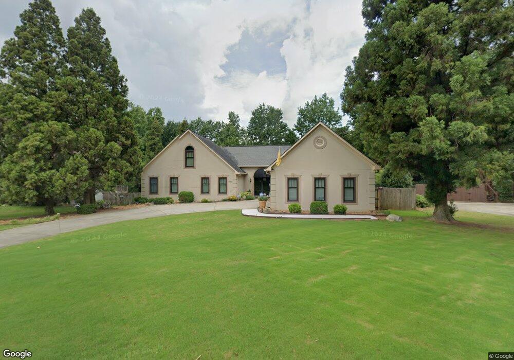
1363 Sheffield Pkwy Marietta, GA 30062
Eastern Marietta NeighborhoodEstimated Value: $539,820 - $613,000
4
Beds
4
Baths
2,658
Sq Ft
$214/Sq Ft
Est. Value
About This Home
This home is located at 1363 Sheffield Pkwy, Marietta, GA 30062 and is currently estimated at $568,955, approximately $214 per square foot. 1363 Sheffield Pkwy is a home located in Cobb County with nearby schools including Kincaid Elementary School, Simpson Middle School, and Sprayberry High School.
Ownership History
Date
Name
Owned For
Owner Type
Purchase Details
Closed on
Aug 16, 2004
Sold by
Usberghi Patsy
Bought by
Gibson Stephanie L
Current Estimated Value
Home Financials for this Owner
Home Financials are based on the most recent Mortgage that was taken out on this home.
Original Mortgage
$29,400
Outstanding Balance
$14,447
Interest Rate
5.97%
Mortgage Type
Stand Alone Refi Refinance Of Original Loan
Estimated Equity
$554,508
Create a Home Valuation Report for This Property
The Home Valuation Report is an in-depth analysis detailing your home's value as well as a comparison with similar homes in the area
Home Values in the Area
Average Home Value in this Area
Purchase History
| Date | Buyer | Sale Price | Title Company |
|---|---|---|---|
| Gibson Stephanie L | $294,000 | -- |
Source: Public Records
Mortgage History
| Date | Status | Borrower | Loan Amount |
|---|---|---|---|
| Open | Gibson Stephanie L | $29,400 |
Source: Public Records
Tax History Compared to Growth
Tax History
| Year | Tax Paid | Tax Assessment Tax Assessment Total Assessment is a certain percentage of the fair market value that is determined by local assessors to be the total taxable value of land and additions on the property. | Land | Improvement |
|---|---|---|---|---|
| 2025 | $4,583 | $190,156 | $40,000 | $150,156 |
| 2024 | $4,206 | $172,584 | $40,000 | $132,584 |
| 2023 | $3,663 | $172,584 | $40,000 | $132,584 |
| 2022 | $3,840 | $154,400 | $36,000 | $118,400 |
| 2021 | $2,562 | $96,000 | $26,000 | $70,000 |
| 2020 | $2,562 | $96,000 | $26,000 | $70,000 |
| 2019 | $2,796 | $106,720 | $26,000 | $80,720 |
| 2018 | $2,796 | $106,720 | $26,000 | $80,720 |
| 2017 | $2,591 | $102,828 | $26,000 | $76,828 |
| 2016 | $2,656 | $105,656 | $26,000 | $79,656 |
| 2015 | $2,127 | $81,024 | $26,000 | $55,024 |
| 2014 | $2,145 | $81,024 | $0 | $0 |
Source: Public Records
Map
Nearby Homes
- 1580 Reids Ferry Way
- 1701 Smithwood Dr
- 2112 Allgood Rd
- 1511 Emerald Glen Dr
- 1833 Tree Top Ct
- 1237 Blackjack Ct
- 1900 Branch View Dr
- 1769 Millview Dr
- 1391 Brentwood Ln
- 1941 Pine Bluff
- 1599 Cambridge Place
- 1442 Glenover Cir
- 1582 Cambridge
- 1519 Evanston Ln
- 1822 Hasty Rd
- 873 Edgewater Cir
- 951 Woodmont Dr
- 943 Crestmanor Dr
- 939 Crestmanor Dr
- 931 Crestmanor Dr
- 1361 Sheffield Pkwy
- 1365 Sheffield Pkwy
- 1368 Merrifield Ln
- 1364 Merrifield Ln
- 0 Sheffield Pkwy Unit 7354936
- 0 Sheffield Pkwy Unit 8341393
- 0 Sheffield Pkwy Unit 8185302
- 0 Sheffield Pkwy Unit 8012141
- 0 Sheffield Pkwy Unit 3227827
- 1360 Sheffield Pkwy
- 1359 Sheffield Pkwy
- 1367 Sheffield Pkwy
- 1376 Merrifield Ln
- 1360 Merrifield Ln
- 1362 Sheffield Pkwy
- 1358 Sheffield Pkwy
- 1372 Merrifield Ln
- 1380 Merrifield Ln
- 1364 Sheffield Pkwy
- 1356 Sheffield Pkwy