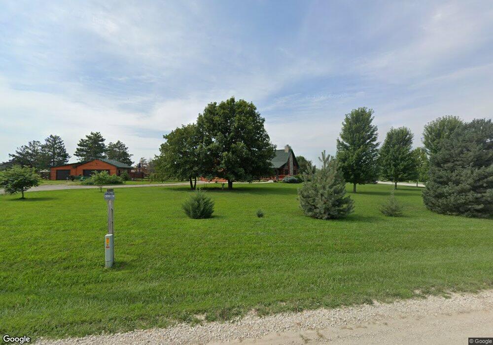
13630 Burr Oak Rd Wamego, KS 66547
Estimated Value: $424,000 - $553,575
5
Beds
3
Baths
3,366
Sq Ft
$152/Sq Ft
Est. Value
About This Home
This home is located at 13630 Burr Oak Rd, Wamego, KS 66547 and is currently estimated at $510,644, approximately $151 per square foot. 13630 Burr Oak Rd is a home located in Pottawatomie County with nearby schools including Rock Creek Junior/Senior High School.
Ownership History
Date
Name
Owned For
Owner Type
Purchase Details
Closed on
Nov 10, 2010
Sold by
Elliott Development Llc
Bought by
Harris Claib B and Harris Cheryl S
Current Estimated Value
Purchase Details
Closed on
Feb 16, 2006
Sold by
Elliott Development Llc
Bought by
Miner Randy R and Miner Staci L
Home Financials for this Owner
Home Financials are based on the most recent Mortgage that was taken out on this home.
Original Mortgage
$231,000
Interest Rate
6.09%
Create a Home Valuation Report for This Property
The Home Valuation Report is an in-depth analysis detailing your home's value as well as a comparison with similar homes in the area
Home Values in the Area
Average Home Value in this Area
Purchase History
| Date | Buyer | Sale Price | Title Company |
|---|---|---|---|
| Harris Claib B | -- | None Available | |
| Elliott Development Llc | -- | None Available | |
| Miner Randy R | -- | None Available |
Source: Public Records
Mortgage History
| Date | Status | Borrower | Loan Amount |
|---|---|---|---|
| Previous Owner | Miner Randy R | $231,000 |
Source: Public Records
Tax History Compared to Growth
Tax History
| Year | Tax Paid | Tax Assessment Tax Assessment Total Assessment is a certain percentage of the fair market value that is determined by local assessors to be the total taxable value of land and additions on the property. | Land | Improvement |
|---|---|---|---|---|
| 2025 | $4,760 | $51,898 | $4,649 | $47,249 |
| 2024 | $48 | $50,696 | $4,740 | $45,956 |
| 2023 | $4,801 | $49,128 | $4,740 | $44,388 |
| 2022 | $3,889 | $43,380 | $4,311 | $39,069 |
| 2021 | $3,889 | $39,839 | $4,172 | $35,667 |
| 2020 | $3,889 | $39,601 | $4,172 | $35,429 |
| 2019 | $3,936 | $39,573 | $4,000 | $35,573 |
| 2018 | $3,992 | $38,953 | $4,000 | $34,953 |
| 2017 | $3,478 | $38,479 | $3,593 | $34,886 |
| 2016 | $3,249 | $37,264 | $3,965 | $33,299 |
| 2015 | -- | $35,963 | $3,965 | $31,998 |
| 2014 | -- | $35,087 | $3,004 | $32,083 |
Source: Public Records
Map
Nearby Homes
- 13318 Woodland Dr
- 13880 Berry Ln
- 506 Prairie Meadow Rd
- 120 Prairie Meadow Rd
- 115 Prairie Meadow Rd
- 518 Shady Oak Dr
- 516 Shady Oak Dr
- 00000 Countryside Ln Unit Lot 26
- 00000 Countryside Ln Unit Lot 24
- 00000 Countryside Ln Unit Lot 22
- 00000 Countryside Ln Unit Lot 20
- 00000 Countryside Ln Unit Lot 19
- 00000 Countryside Ln Unit Lot 18
- 00000 Countryside Ln Unit Lot 17
- 00000 Countryside Ln Unit Lot 15
- 00000 Countryside Ln Unit Lot 16
- 00000 Countryside Ln Unit Lot 14
- 00000 Countryside Ln Unit Lot 11
- 00000 Countryside Ln Unit Lot 10
- 00000 Countryside Ln Unit Lot 9
- 3541 Vineyard Rd
- 3575 Vineyard Rd
- 3546 Alicia Cir
- 3568 Alicia Cir
- 13625 Burr Oak Rd
- 3524 Alicia Cir
- 3620 Crystal Horse Rd
- 3485 Vineyard Rd
- 3652 Crystal Horse Rd
- 3571 Alicia Cir
- 3559 Alicia Cir
- 3502 Alicia Cir
- 3673 Vineyard Rd
- 13725 Burr Oak Rd
- 3650 Vineyard Rd
- 3674 Crystal Horse Rd
- 3537 Alicia Cir
- 3495 Alicia Cir
- 3511 Alicia Cir
- 3425 Pin Oak Dr