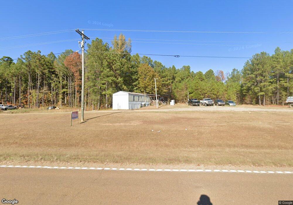
13631 Ms Highway 12 W Starkville, MS 39759
Estimated Value: $371,265 - $466,000
--
Bed
--
Bath
3,239
Sq Ft
$127/Sq Ft
Est. Value
About This Home
This home is located at 13631 Ms Highway 12 W, Starkville, MS 39759 and is currently estimated at $410,316, approximately $126 per square foot. 13631 Ms Highway 12 W is a home with nearby schools including Sudduth Elementary School, Overstreet Elementary School, and Henderson/Ward-Stewart Elementary School.
Ownership History
Date
Name
Owned For
Owner Type
Purchase Details
Closed on
May 25, 2022
Sold by
Starkville Landscape Co Llc
Bought by
Starkville Landscape Company L
Current Estimated Value
Home Financials for this Owner
Home Financials are based on the most recent Mortgage that was taken out on this home.
Original Mortgage
$327,750
Outstanding Balance
$311,300
Interest Rate
5.23%
Mortgage Type
Construction
Estimated Equity
$99,016
Purchase Details
Closed on
Dec 14, 2006
Bought by
Edwards Mickey D
Create a Home Valuation Report for This Property
The Home Valuation Report is an in-depth analysis detailing your home's value as well as a comparison with similar homes in the area
Home Values in the Area
Average Home Value in this Area
Purchase History
| Date | Buyer | Sale Price | Title Company |
|---|---|---|---|
| Starkville Landscape Company L | $409,687 | Attorney Only | |
| Edwards Mickey D | -- | -- |
Source: Public Records
Mortgage History
| Date | Status | Borrower | Loan Amount |
|---|---|---|---|
| Open | Starkville Landscape Company L | $327,750 |
Source: Public Records
Tax History Compared to Growth
Tax History
| Year | Tax Paid | Tax Assessment Tax Assessment Total Assessment is a certain percentage of the fair market value that is determined by local assessors to be the total taxable value of land and additions on the property. | Land | Improvement |
|---|---|---|---|---|
| 2024 | $3,281 | $28,739 | $0 | $0 |
| 2023 | $2,121 | $19,427 | $0 | $0 |
| 2022 | $3,630 | $29,128 | $0 | $0 |
| 2021 | $3,356 | $26,935 | $0 | $0 |
| 2020 | $3,333 | $26,964 | $0 | $0 |
| 2019 | $3,332 | $26,967 | $0 | $0 |
| 2018 | $1,305 | $18,061 | $0 | $0 |
| 2017 | $1,238 | $17,675 | $0 | $0 |
| 2016 | $1,238 | $17,670 | $0 | $0 |
| 2015 | $1,209 | $17,664 | $0 | $0 |
| 2014 | $1,215 | $17,661 | $0 | $0 |
| 2013 | -- | $17,046 | $0 | $0 |
Source: Public Records
Map
Nearby Homes
- 123 Densbrook Ln
- 11 W Union Rd
- 52 Alpine Dr
- 92 Ashwood Dr
- 72 Ashwood Dr
- 0 Old Hwy 12 Unit 25-1575
- 0 Longview Rd Unit 25-623
- 0 Longview Rd
- 1501 Horseshoe Cir
- 158 Cow Creek Rd
- 363 Lakeview Dr
- 0 Old Highway 12
- 1410 Pinecrest Rd
- 668 John White Rd
- 1081 Warrior Dr
- 1170 Meadowlark Dr
- 0 Highway 82 Rd Unit 25-2168
- 0 Highway 82 Rd Unit 25-2167
- 0 Highway 82 Rd Unit 25-1866
- 214 Graham Rd-Unit 301
- 13746 Ms Highway 12 W
- 105 Monroe Ln
- 125 Monroe Ln
- 13393 Ms Highway 12 W
- 265 Densbrook Ln
- 243 Densbrook Ln
- 240 Densbrook Ln
- 175 Densbrook Ln
- 151 Densbrook Ln
- 13104 Ms Highway 12 W
- 150 Densbrook Ln
- 190 Densbrook Ln
- 94 Densbrook Ln
- 0 Densbrook Ln
- 81 Densbrook Ln
- 13037 Ms Highway 12 W
- 73 Lisa Ln
- 2744 Old Highway 12
- 32 Densbrook Ln
- 49 Densbrook Ln