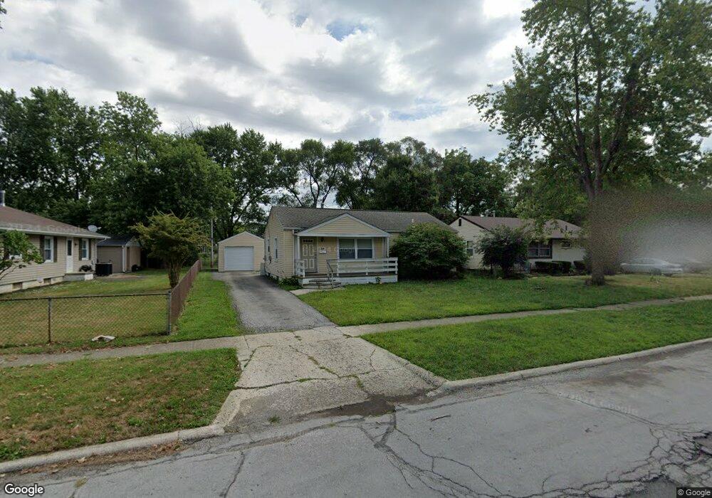
1364 Simpson Dr Columbus, OH 43227
Shady Lane NeighborhoodEstimated Value: $162,000 - $183,000
3
Beds
1
Bath
912
Sq Ft
$188/Sq Ft
Est. Value
About This Home
This home is located at 1364 Simpson Dr, Columbus, OH 43227 and is currently estimated at $171,543, approximately $188 per square foot. 1364 Simpson Dr is a home located in Franklin County with nearby schools including Shady Lane Elementary School, Sherwood Middle School, and Walnut Ridge High School.
Ownership History
Date
Name
Owned For
Owner Type
Purchase Details
Closed on
Apr 14, 2008
Sold by
Hud
Bought by
Nutter Trenton
Current Estimated Value
Home Financials for this Owner
Home Financials are based on the most recent Mortgage that was taken out on this home.
Original Mortgage
$58,000
Outstanding Balance
$36,311
Interest Rate
6.09%
Mortgage Type
Purchase Money Mortgage
Estimated Equity
$135,232
Purchase Details
Closed on
Aug 24, 2007
Sold by
Cartwright Larrietta N and Chase Home Finance Llc
Bought by
Hud
Purchase Details
Closed on
Jun 18, 2003
Sold by
Vanest Clark W and Clark W Vanest Trust
Bought by
Cartwright Larrietta N
Home Financials for this Owner
Home Financials are based on the most recent Mortgage that was taken out on this home.
Original Mortgage
$82,348
Interest Rate
5.36%
Mortgage Type
FHA
Purchase Details
Closed on
Jul 22, 1998
Sold by
Vanest Clark and Vanest Viola M
Bought by
Vanest Clark W and Clark W Vanest Trust
Purchase Details
Closed on
Oct 1, 1992
Create a Home Valuation Report for This Property
The Home Valuation Report is an in-depth analysis detailing your home's value as well as a comparison with similar homes in the area
Home Values in the Area
Average Home Value in this Area
Purchase History
| Date | Buyer | Sale Price | Title Company |
|---|---|---|---|
| Nutter Trenton | $58,000 | Lakeside Ti | |
| Hud | $56,000 | None Available | |
| Cartwright Larrietta N | $83,000 | Amerititle East | |
| Vanest Clark W | -- | -- | |
| -- | $58,000 | -- |
Source: Public Records
Mortgage History
| Date | Status | Borrower | Loan Amount |
|---|---|---|---|
| Open | Nutter Trenton | $58,000 | |
| Previous Owner | Cartwright Larrietta N | $82,348 |
Source: Public Records
Tax History
| Year | Tax Paid | Tax Assessment Tax Assessment Total Assessment is a certain percentage of the fair market value that is determined by local assessors to be the total taxable value of land and additions on the property. | Land | Improvement |
|---|---|---|---|---|
| 2025 | $2,189 | $45,500 | $17,150 | $28,350 |
| 2024 | $2,189 | $45,500 | $17,150 | $28,350 |
| 2023 | $2,523 | $55,755 | $17,150 | $38,605 |
| 2022 | $1,209 | $22,750 | $6,440 | $16,310 |
| 2021 | $1,371 | $22,750 | $6,440 | $16,310 |
| 2020 | $1,497 | $26,080 | $6,440 | $19,640 |
| 2019 | $1,265 | $20,340 | $5,150 | $15,190 |
| 2018 | $1,173 | $20,340 | $5,150 | $15,190 |
| 2017 | $1,227 | $20,340 | $5,150 | $15,190 |
| 2016 | $1,189 | $17,500 | $5,950 | $11,550 |
| 2015 | $1,082 | $17,500 | $5,950 | $11,550 |
| 2014 | $1,085 | $17,500 | $5,950 | $11,550 |
| 2013 | $738 | $24,115 | $5,950 | $18,165 |
Source: Public Records
Map
Nearby Homes
- 1284 Thurston Dr
- 1243 Simpson Dr
- 1229 Simpson Dr
- 4467 Grimsby Rd
- 1281 Maetzel Dr
- 1193 Marble Dr
- 4472 Aragon Ave
- 4677 E Livingston Ave
- 1356 Harlow Rd
- 1612 Simpson Dr
- 4859 Folger Dr
- 1607 Baxter Dr
- 1639 Shady Lane Rd
- 1260 Country Club Rd
- 4701 Janis Dr
- 1301 Bernhard Rd
- 1691 Shady Lane Rd
- 4649 Dundee Ave
- 1085 S Hamilton Rd
- 1472 Blaine Dr
- 1372 Simpson Dr
- 4621 Amesbury Rd
- 1380 Simpson Dr
- 1361 Marble Dr
- 4637 Amesbury Rd
- 1365 Simpson Dr
- 1388 Simpson Dr
- 1355 Simpson Dr
- 1367 Marble Dr
- 4596 Rodney Rd
- 4638 Amesbury Rd
- 1396 Simpson Dr
- 4591 Amesbury Rd
- 1373 Marble Dr
- 4588 Rodney Rd
- 1330 Simpson Dr
- 4598 Amesbury Rd
- 1356 Marble Dr
- 1327 Marble Dr
- 4583 Amesbury Rd
Your Personal Tour Guide
Ask me questions while you tour the home.