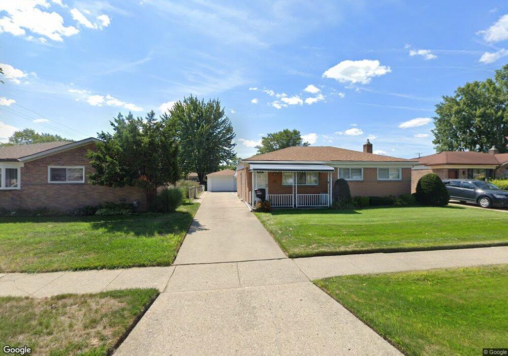
13646 Edwin Ct Warren, MI 48088
Northeast Warren NeighborhoodEstimated Value: $218,142 - $251,000
3
Beds
1
Bath
1,025
Sq Ft
$227/Sq Ft
Est. Value
About This Home
This home is located at 13646 Edwin Ct, Warren, MI 48088 and is currently estimated at $232,786, approximately $227 per square foot. 13646 Edwin Ct is a home located in Macomb County with nearby schools including Warren Woods Tower High School, Frontier International Academy Elementary, and Warren Woods Christian School.
Ownership History
Date
Name
Owned For
Owner Type
Purchase Details
Closed on
Mar 22, 2004
Sold by
Estate Of Catherine Mcgovern
Bought by
Myers Todd A and Myers Victoria L
Current Estimated Value
Home Financials for this Owner
Home Financials are based on the most recent Mortgage that was taken out on this home.
Original Mortgage
$114,800
Outstanding Balance
$53,615
Interest Rate
5.66%
Mortgage Type
Purchase Money Mortgage
Estimated Equity
$179,171
Create a Home Valuation Report for This Property
The Home Valuation Report is an in-depth analysis detailing your home's value as well as a comparison with similar homes in the area
Home Values in the Area
Average Home Value in this Area
Purchase History
| Date | Buyer | Sale Price | Title Company |
|---|---|---|---|
| Myers Todd A | $143,500 | Philip R Seaver Title Co Inc |
Source: Public Records
Mortgage History
| Date | Status | Borrower | Loan Amount |
|---|---|---|---|
| Open | Myers Todd A | $114,800 |
Source: Public Records
Tax History
| Year | Tax Paid | Tax Assessment Tax Assessment Total Assessment is a certain percentage of the fair market value that is determined by local assessors to be the total taxable value of land and additions on the property. | Land | Improvement |
|---|---|---|---|---|
| 2025 | $2,521 | $102,670 | $0 | $0 |
| 2024 | $25 | $93,220 | $0 | $0 |
| 2023 | $2,324 | $89,980 | $0 | $0 |
| 2022 | $2,279 | $78,470 | $0 | $0 |
| 2021 | $2,236 | $71,790 | $0 | $0 |
| 2020 | $2,143 | $68,180 | $0 | $0 |
| 2019 | $2,047 | $65,200 | $0 | $0 |
| 2018 | $0 | $54,390 | $0 | $0 |
| 2017 | $1,956 | $46,730 | $9,660 | $37,070 |
| 2016 | $1,941 | $46,730 | $0 | $0 |
| 2015 | -- | $42,700 | $0 | $0 |
| 2012 | -- | $37,480 | $0 | $0 |
Source: Public Records
Map
Nearby Homes
- 29088 Yorkshire Ln Unit 28
- 29531 Eiffel Ave
- 29417 Scarborough Dr Unit 28
- 29226 Scarborough Dr
- 29454 Scarborough Dr Unit 7
- 29251 Bon Mar Dr
- 29143 Dover Ave
- 29579 Fairfield Dr
- 28625 Bradner Dr
- 13015 Walter Ave
- 13325 Iowa Dr
- 30139 Flanders Ave
- 28771 Bunert Rd
- 29134 Palomino Dr
- 54765 Palomino Ave
- 30507 Moulin Ave
- 29105 Palomino Dr
- 12531 Common Rd
- 14066 Castle Ave
- 28263 Newport Dr
- 13634 Edwin Ct
- 13658 Edwin Ct
- 13622 Edwin Ct
- 13657 Geoffry Dr
- 13633 Geoffry Dr
- 29263 Malvina Dr
- 29249 Malvina Dr
- 29237 Malvina Dr
- 13621 Geoffry Dr
- 13610 Edwin Ct
- 13647 Edwin Ct
- 13659 Edwin Ct
- 13635 Edwin Ct
- 29311 Malvina Dr
- 29225 Malvina Dr
- 13609 Geoffry Dr
- 13623 Edwin Ct
- 13611 Edwin Ct
- 29323 Malvina Dr
- 29335 Malvina Dr
Your Personal Tour Guide
Ask me questions while you tour the home.