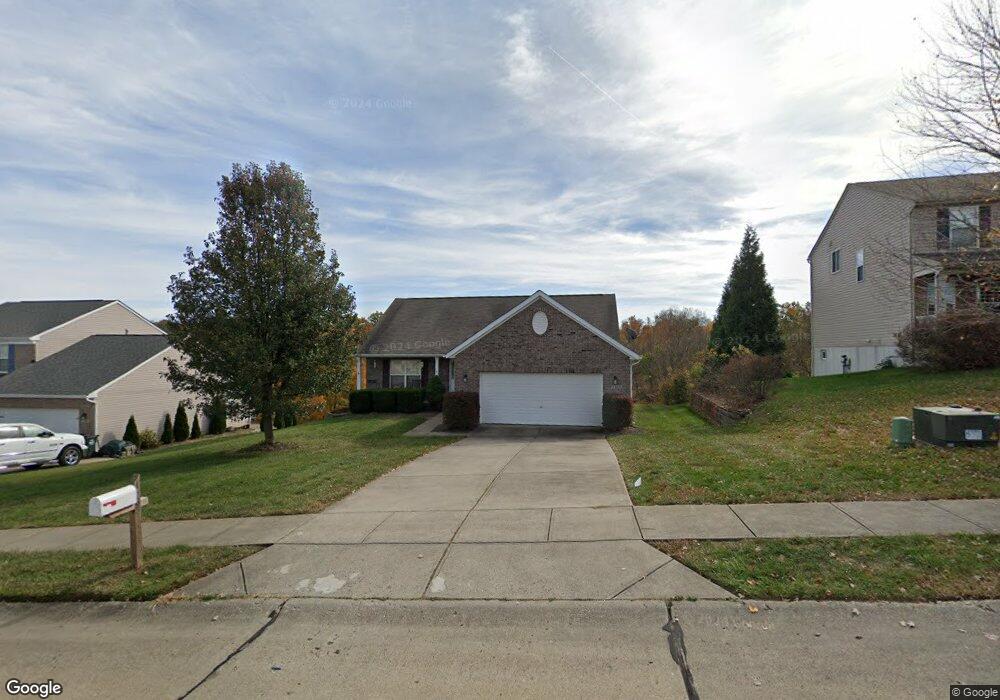
1365 Cairns Ct Unit 20 Independence, KY 41051
Estimated Value: $334,000 - $348,000
3
Beds
2
Baths
1,530
Sq Ft
$222/Sq Ft
Est. Value
About This Home
This home is located at 1365 Cairns Ct Unit 20, Independence, KY 41051 and is currently estimated at $339,335, approximately $221 per square foot. 1365 Cairns Ct Unit 20 is a home located in Kenton County with nearby schools including Simon Kenton High School and St. Cecilia Catholic School.
Ownership History
Date
Name
Owned For
Owner Type
Purchase Details
Closed on
Sep 4, 2012
Sold by
Cole Tammy J
Bought by
Cole Tammy J
Current Estimated Value
Purchase Details
Closed on
Sep 10, 2007
Sold by
Charleston Signature Homes Llc
Bought by
Cole Jerry L and Cole Tammy J
Home Financials for this Owner
Home Financials are based on the most recent Mortgage that was taken out on this home.
Original Mortgage
$140,000
Outstanding Balance
$88,052
Interest Rate
6.62%
Mortgage Type
Purchase Money Mortgage
Estimated Equity
$251,283
Purchase Details
Closed on
Apr 19, 2007
Sold by
Land Liquidators Llc
Bought by
Charleston Signature Homes Llc
Purchase Details
Closed on
Nov 28, 2006
Sold by
Holiday Builders Of Ohio Llc
Bought by
Land Liquidators Llc
Purchase Details
Closed on
Feb 28, 2005
Sold by
Independence Station Road Llc
Bought by
Holiday Builders Of Ohio Llc and Hb Home Builders
Create a Home Valuation Report for This Property
The Home Valuation Report is an in-depth analysis detailing your home's value as well as a comparison with similar homes in the area
Home Values in the Area
Average Home Value in this Area
Purchase History
| Date | Buyer | Sale Price | Title Company |
|---|---|---|---|
| Cole Tammy J | -- | None Available | |
| Cole Jerry L | $175,000 | First Title Agency | |
| Charleston Signature Homes Llc | -- | None Available | |
| Land Liquidators Llc | $1,242,118 | First Title Inc | |
| Holiday Builders Of Ohio Llc | $72,500 | Kentucky Land Title Agency |
Source: Public Records
Mortgage History
| Date | Status | Borrower | Loan Amount |
|---|---|---|---|
| Open | Cole Jerry L | $140,000 |
Source: Public Records
Tax History
| Year | Tax Paid | Tax Assessment Tax Assessment Total Assessment is a certain percentage of the fair market value that is determined by local assessors to be the total taxable value of land and additions on the property. | Land | Improvement |
|---|---|---|---|---|
| 2025 | $3,269 | $281,100 | $50,000 | $231,100 |
| 2024 | $2,648 | $216,200 | $35,000 | $181,200 |
| 2023 | $2,728 | $216,200 | $35,000 | $181,200 |
| 2022 | $2,787 | $216,200 | $35,000 | $181,200 |
| 2021 | $2,828 | $216,200 | $35,000 | $181,200 |
| 2020 | $2,352 | $175,000 | $26,000 | $149,000 |
| 2019 | $2,358 | $175,000 | $26,000 | $149,000 |
| 2018 | $2,371 | $175,000 | $26,000 | $149,000 |
| 2017 | $2,306 | $175,000 | $26,000 | $149,000 |
| 2015 | $2,239 | $175,000 | $35,000 | $140,000 |
| 2014 | $2,208 | $175,000 | $35,000 | $140,000 |
Source: Public Records
Map
Nearby Homes
- 1365 Cairns Ct
- 1346 Brisbane Ct
- 10363 Canberra Dr
- 64 Sherwood Dr
- 9971 Meadow Glen Dr
- 9980 Meadow Glen Dr
- 1884 Bridle Path
- 2037 Patriot Way
- 4828 Far Hills Dr
- 1381 Poplartree Place
- 2072 Crown Vetch Dr
- 10362 Petersburg Ct
- 1247 Monocacy Ct
- 10434 Sharpsburg Dr
- 6500 Julia Meadow
- 1197 Catletts Ct
- 4758 Fowler Creek Rd
- 1217 Cannonball Way
- 3981 Sherbourne Dr
- 3828 Sherbourne Dr
- 1361 Cairns Ct
- 1369 Cairns Ct
- 1369 Cairns Ct Unit 21
- 1357 Cairns Ct
- 1373 Cairns Ct
- 1362 Cairns Ct
- 1366 Cairns Ct
- 1377 Cairns Ct
- 1370 Cairns Ct
- 1353 Cairns Ct
- 1354 Cairns Ct
- 1351 Cairns Ct Unit 15
- 1374 Cairns Ct
- 1374 Cairns Ct Unit 27
- 1349 Cairns Ct
- 1381 Cairns Ct
- 1343 Lismore Ct
- 1350 Cairns Ct
- 1339 Lismore Ct
- 131 Sylvan Dr
Your Personal Tour Guide
Ask me questions while you tour the home.