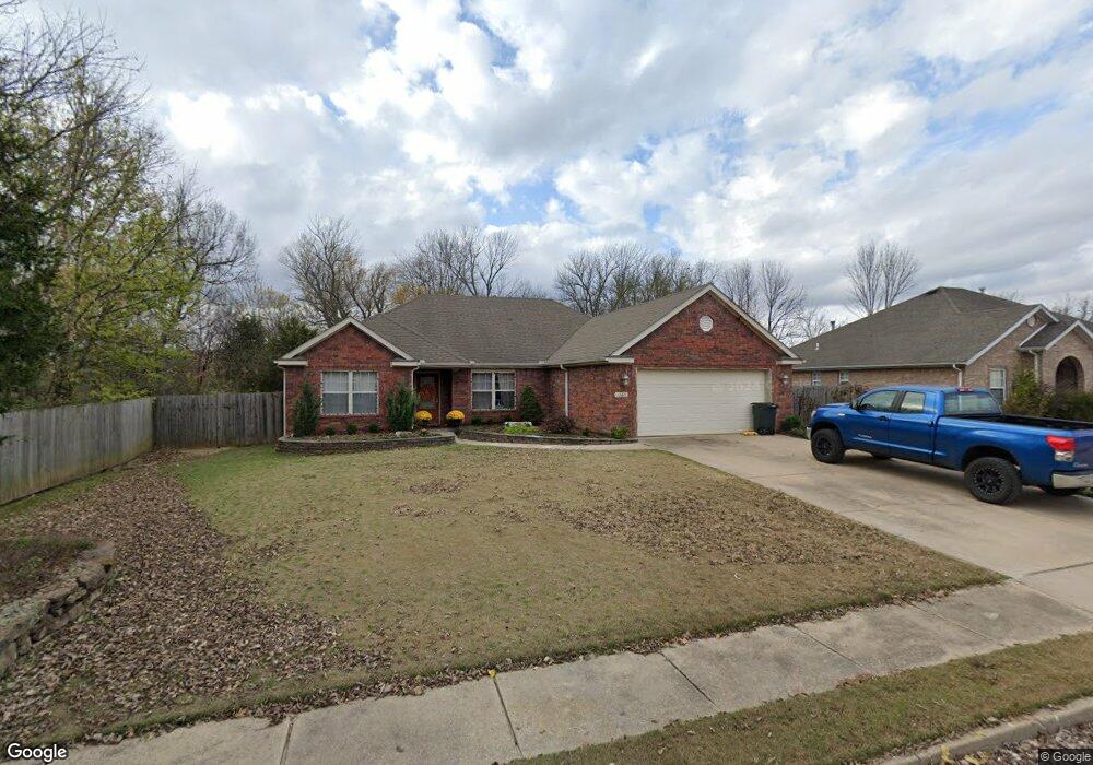
1365 Homestead Ln West Fork, AR 72774
Estimated Value: $298,000
3
Beds
2
Baths
1,854
Sq Ft
$161/Sq Ft
Est. Value
About This Home
This home is located at 1365 Homestead Ln, West Fork, AR 72774 and is currently priced at $298,000, approximately $160 per square foot. 1365 Homestead Ln is a home located in Washington County with nearby schools including Greenland Middle School, Greenland Elementary School, and Greenland High School.
Ownership History
Date
Name
Owned For
Owner Type
Purchase Details
Closed on
Apr 6, 2007
Sold by
Snively Construction Inc
Bought by
Schoggin Nicholas Vaughn
Current Estimated Value
Home Financials for this Owner
Home Financials are based on the most recent Mortgage that was taken out on this home.
Original Mortgage
$170,000
Outstanding Balance
$103,294
Interest Rate
6.24%
Mortgage Type
Purchase Money Mortgage
Create a Home Valuation Report for This Property
The Home Valuation Report is an in-depth analysis detailing your home's value as well as a comparison with similar homes in the area
Home Values in the Area
Average Home Value in this Area
Purchase History
| Date | Buyer | Sale Price | Title Company |
|---|---|---|---|
| Schoggin Nicholas Vaughn | $170,000 | Ltc |
Source: Public Records
Mortgage History
| Date | Status | Borrower | Loan Amount |
|---|---|---|---|
| Open | Schoggin Nicholas Vaughn | $170,000 |
Source: Public Records
Tax History Compared to Growth
Tax History
| Year | Tax Paid | Tax Assessment Tax Assessment Total Assessment is a certain percentage of the fair market value that is determined by local assessors to be the total taxable value of land and additions on the property. | Land | Improvement |
|---|---|---|---|---|
| 2023 | $1,149 | $55,790 | $7,200 | $48,590 |
| 2022 | $1,493 | $33,670 | $4,800 | $28,870 |
| 2021 | $1,430 | $33,670 | $4,800 | $28,870 |
| 2020 | $1,367 | $33,670 | $4,800 | $28,870 |
| 2019 | $1,304 | $27,310 | $3,200 | $24,110 |
| 2018 | $1,329 | $27,310 | $3,200 | $24,110 |
| 2017 | $893 | $27,310 | $3,200 | $24,110 |
| 2016 | $1,316 | $27,310 | $3,200 | $24,110 |
| 2015 | $1,240 | $27,310 | $3,200 | $24,110 |
| 2014 | $1,182 | $25,470 | $4,000 | $21,470 |
Source: Public Records
Map
Nearby Homes
- 1329 Homestead Ln
- TBD Stockburger Ave
- 0 W Carrol St
- TBD Butterfield Ave
- 0 Path Trail Rd
- 316 S Napier Ave
- 215/215B/219 S Peerson St
- 333 S Napier Ave
- 602 N Centennial Ave
- 451 W Horn St
- 14630 E Wallin Mountain Rd
- 424 W Tanner Dr
- 19.7 Acres Arkansas 156
- 0 W Napier Dr Unit Tract 1 1262191
- 0 W Napier Dr Unit 1322099
- 0 W Napier Dr Unit Tract 4 1262201
- 11084 Pearce Rd
- 10845 SW Campbell Rd
- 12284 Flowers Rd
- 50 Northwood St
- 1353 Homestead Ln
- 522 Ralph Phelps Dr
- 522 Ralph Phelps Dr
- 443 Buckboard Rd
- 1341 Homestead Ln
- 442 Buckboard Rd
- 447 Buckboard Rd
- 460 Ralph Phelps Dr
- 448 Buckboard Rd
- 441 Harness Ln
- 461 Buckboard Rd
- 1317 Homestead Ln
- 449 Harness Ln
- 462 Buckboard Rd
- 475 Buckboard
- 475 Buckboard Rd
- 1305 Homestead
- 1305 Homestead Ln
- 463 Harness Ln
- 476 Buckboard Rd