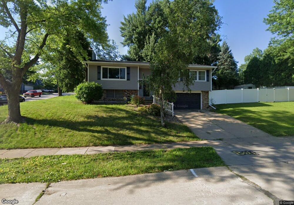
1365 Meadow Lane Dr Bettendorf, IA 52722
Estimated Value: $254,011 - $279,000
3
Beds
2
Baths
1,623
Sq Ft
$165/Sq Ft
Est. Value
About This Home
This home is located at 1365 Meadow Lane Dr, Bettendorf, IA 52722 and is currently estimated at $267,503, approximately $164 per square foot. 1365 Meadow Lane Dr is a home located in Scott County with nearby schools including Mark Twain Elementary School, Bettendorf Middle School, and Bettendorf High School.
Ownership History
Date
Name
Owned For
Owner Type
Purchase Details
Closed on
Jul 15, 2019
Sold by
Weckel Jamie and Weckel Julie A
Bought by
Sweetland Jessica L and Sweetland Robert C
Current Estimated Value
Home Financials for this Owner
Home Financials are based on the most recent Mortgage that was taken out on this home.
Original Mortgage
$180,000
Outstanding Balance
$158,582
Interest Rate
4.2%
Mortgage Type
Adjustable Rate Mortgage/ARM
Estimated Equity
$108,921
Create a Home Valuation Report for This Property
The Home Valuation Report is an in-depth analysis detailing your home's value as well as a comparison with similar homes in the area
Home Values in the Area
Average Home Value in this Area
Purchase History
| Date | Buyer | Sale Price | Title Company |
|---|---|---|---|
| Sweetland Jessica L | -- | -- |
Source: Public Records
Mortgage History
| Date | Status | Borrower | Loan Amount |
|---|---|---|---|
| Open | Sweetland Jessica L | $180,000 |
Source: Public Records
Tax History Compared to Growth
Tax History
| Year | Tax Paid | Tax Assessment Tax Assessment Total Assessment is a certain percentage of the fair market value that is determined by local assessors to be the total taxable value of land and additions on the property. | Land | Improvement |
|---|---|---|---|---|
| 2025 | $3,440 | $270,300 | $53,600 | $216,700 |
| 2024 | $3,410 | $232,700 | $28,700 | $204,000 |
| 2023 | $3,448 | $232,700 | $28,700 | $204,000 |
| 2022 | $3,412 | $204,800 | $28,680 | $176,120 |
| 2021 | $3,412 | $204,800 | $28,680 | $176,120 |
| 2020 | $3,232 | $186,910 | $28,680 | $158,230 |
| 2019 | $3,246 | $182,300 | $28,680 | $153,620 |
| 2018 | $3,242 | $182,300 | $28,680 | $153,620 |
| 2017 | $3,184 | $182,300 | $28,680 | $153,620 |
| 2016 | $3,108 | $175,340 | $0 | $0 |
| 2015 | $3,108 | $160,230 | $0 | $0 |
| 2014 | $2,862 | $160,230 | $0 | $0 |
| 2013 | $2,796 | $0 | $0 | $0 |
| 2012 | -- | $161,790 | $29,990 | $131,800 |
Source: Public Records
Map
Nearby Homes
- 1 Oak Park Dr
- 1212 Meadow Lane Dr
- 60 Parklane Cir
- 1209 Meadow Lane Dr
- 1520 Parklane Dr
- 1705 Elmwood Dr
- 1101 Hawthorne Dr
- 1902 Parkway Dr
- 2507 Holly Dr
- 1718 Fairmeadows Dr
- 16 Wildwood Trail
- 2612 Crestview Dr
- 2625 Holly Dr
- 2620 Harmony Dr
- 1834 Anderson Ct
- 1503 Alcoa Ave
- 1219 16th St
- 2704 Magnolia Dr
- 3418 Middle Rd
- 1360 Heights Ct
- 1950 14th St
- 1335 Meadow Lane Dr
- 1360 Meadow Lane Dr
- 1930 14th St
- 1975 14th St
- 1301 Meadow Lane Dr
- 1330 Meadow Lane Dr
- 1325 Middle Rd
- 1979 14th St
- 1945 14th St
- 1304 Meadow Lane Dr
- 1401 Middle Rd
- 1241 Meadow Lane Dr
- 1925 14th St
- 1915 San Jose Ct
- 1909 San Jose Ct
- 1921 San Jose Ct
- 1890 14th St
- 1237 Meadow Lane Dr
- 1905 14th St