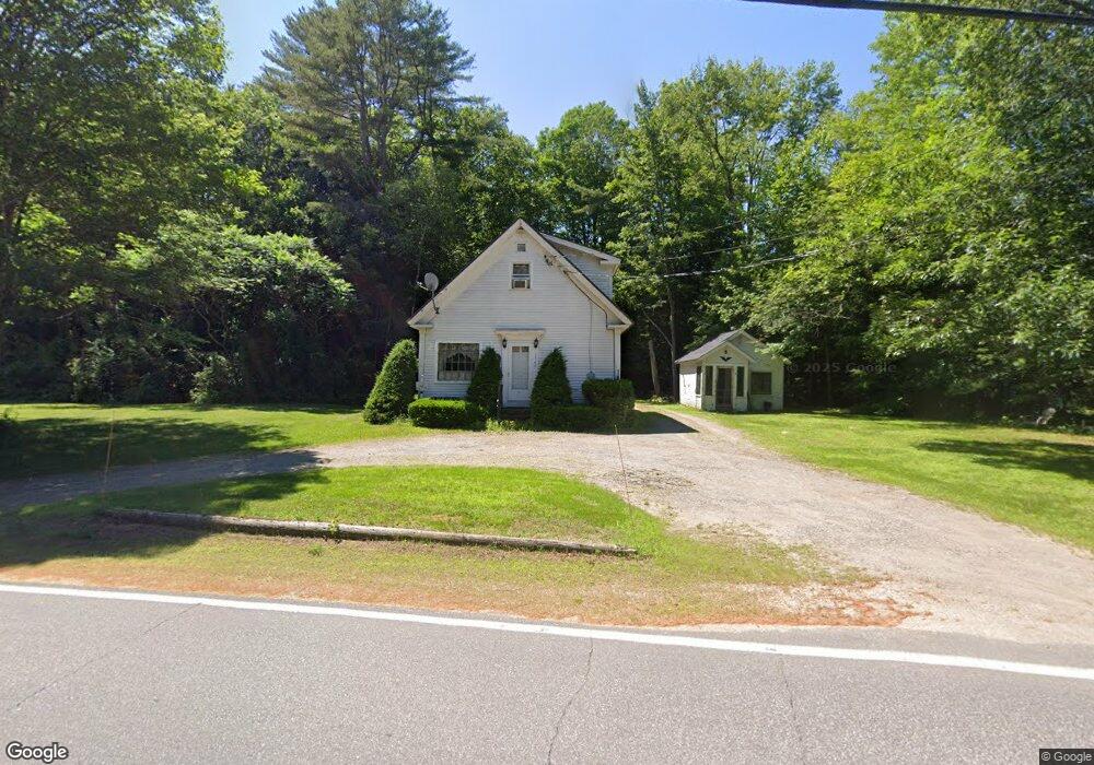
1365 Us Route 3 Campton, NH 03223
Estimated Value: $308,000 - $386,000
2
Beds
2
Baths
1,372
Sq Ft
$252/Sq Ft
Est. Value
About This Home
This home is located at 1365 Us Route 3, Campton, NH 03223 and is currently estimated at $345,162, approximately $251 per square foot. 1365 Us Route 3 is a home located in Grafton County with nearby schools including Campton Elementary School, Plymouth Regional High School, and Plymouth State University CD & FC.
Ownership History
Date
Name
Owned For
Owner Type
Purchase Details
Closed on
Sep 15, 2000
Sold by
King-Jenning Darlene M
Bought by
Lorenz Michael J
Current Estimated Value
Home Financials for this Owner
Home Financials are based on the most recent Mortgage that was taken out on this home.
Original Mortgage
$83,000
Outstanding Balance
$30,186
Interest Rate
8.07%
Estimated Equity
$314,976
Create a Home Valuation Report for This Property
The Home Valuation Report is an in-depth analysis detailing your home's value as well as a comparison with similar homes in the area
Home Values in the Area
Average Home Value in this Area
Purchase History
| Date | Buyer | Sale Price | Title Company |
|---|---|---|---|
| Lorenz Michael J | $87,000 | -- |
Source: Public Records
Mortgage History
| Date | Status | Borrower | Loan Amount |
|---|---|---|---|
| Open | Lorenz Michael J | $83,000 |
Source: Public Records
Tax History Compared to Growth
Tax History
| Year | Tax Paid | Tax Assessment Tax Assessment Total Assessment is a certain percentage of the fair market value that is determined by local assessors to be the total taxable value of land and additions on the property. | Land | Improvement |
|---|---|---|---|---|
| 2024 | $4,823 | $280,100 | $132,900 | $147,200 |
| 2023 | $4,557 | $158,400 | $63,700 | $94,700 |
| 2022 | $4,003 | $158,400 | $63,700 | $94,700 |
| 2021 | $3,955 | $158,400 | $63,700 | $94,700 |
| 2020 | $3,869 | $159,400 | $63,700 | $95,700 |
| 2019 | $3,700 | $159,400 | $63,700 | $95,700 |
| 2018 | $3,498 | $137,000 | $49,500 | $87,500 |
| 2017 | $3,398 | $137,000 | $49,500 | $87,500 |
| 2016 | $3,273 | $137,000 | $49,500 | $87,500 |
| 2015 | $3,139 | $137,000 | $49,500 | $87,500 |
| 2014 | $3,214 | $137,000 | $49,500 | $87,500 |
| 2013 | $2,909 | $145,500 | $51,900 | $93,600 |
Source: Public Records
Map
Nearby Homes
- 5 Wildwood Dr
- 71 Carla Ct
- 72 Crescent St
- 20 Wildflower Ln Unit 208-97-9-2
- 20 Wildflower Ln Unit 208-97-9-1
- 18 Wildflower Ln Unit 208-97-8-01
- 0 Lower Beech Hill Rd Unit 5029667
- Lot 15 Kelly Way
- 10-6 Page Rd
- 4 Seven Sisters Cir
- 14 Heritage Hill Rd
- 73 Ellsworth Hill Rd
- 23 Cider Mill Dr
- 000 Smith Rd Unit 2
- 000 Smith Rd
- 263 Highland St
- 10 Hawthorne St
- 3 Webster St
- 9 Blueberry Hill Rd Unit 8
- 51 Turkey Jim Rd
- 1365 Us Route 3
- 1373 Us Route 3
- 1368 Us Route 3
- 6 Colonel Spencer Rd
- 1346 Us Route 3
- 1346 Us Route 3
- 16 Colonel Spencer Rd
- 1360 Us Route 3
- 1333 Us Route 3
- 1333 Us Route 3
- 1333 U S 3
- 1398 Us Route 3
- 1398 Daniel Webster Hwy
- 116 Bog Rd
- 150 Bog Rd
- 1397 Us Route 3
- 1319 Us Route 3
- 2 Beaver Brook Rd
- 5 Beaver Brook Rd
- 15 Sleepy Hollow Rd