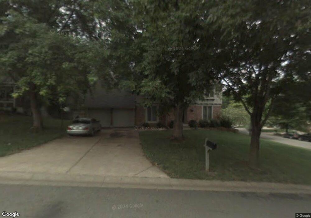
13650 S Locust St Olathe, KS 66062
Estimated Value: $429,015 - $462,000
4
Beds
3
Baths
2,352
Sq Ft
$192/Sq Ft
Est. Value
About This Home
This home is located at 13650 S Locust St, Olathe, KS 66062 and is currently estimated at $450,754, approximately $191 per square foot. 13650 S Locust St is a home located in Johnson County with nearby schools including Tomahawk Elementary School, Frontier Trail Middle School, and Olathe East Sr High School.
Ownership History
Date
Name
Owned For
Owner Type
Purchase Details
Closed on
May 2, 2005
Sold by
Bauman Kolleen B
Bought by
Morris Kevin L and Morris Offie Lynn
Current Estimated Value
Home Financials for this Owner
Home Financials are based on the most recent Mortgage that was taken out on this home.
Original Mortgage
$34,500
Interest Rate
5.6%
Mortgage Type
Stand Alone Second
Purchase Details
Closed on
Dec 6, 2002
Sold by
Kanakares Nicholas W and Kanakares Teresa
Bought by
Bauman Kolleen B
Home Financials for this Owner
Home Financials are based on the most recent Mortgage that was taken out on this home.
Original Mortgage
$168,400
Interest Rate
6.05%
Create a Home Valuation Report for This Property
The Home Valuation Report is an in-depth analysis detailing your home's value as well as a comparison with similar homes in the area
Home Values in the Area
Average Home Value in this Area
Purchase History
| Date | Buyer | Sale Price | Title Company |
|---|---|---|---|
| Morris Kevin L | -- | Continental Title Company | |
| Bauman Kolleen B | -- | Security Land Title Company |
Source: Public Records
Mortgage History
| Date | Status | Borrower | Loan Amount |
|---|---|---|---|
| Closed | Morris Kevin L | $34,500 | |
| Open | Morris Kevin L | $184,000 | |
| Previous Owner | Bauman Kolleen B | $168,400 |
Source: Public Records
Tax History
| Year | Tax Paid | Tax Assessment Tax Assessment Total Assessment is a certain percentage of the fair market value that is determined by local assessors to be the total taxable value of land and additions on the property. | Land | Improvement |
|---|---|---|---|---|
| 2025 | $4,967 | $46,299 | $9,808 | $36,491 |
| 2023 | $4,981 | $43,390 | $7,749 | $35,641 |
| 2022 | $4,134 | $35,121 | $7,749 | $27,372 |
| 2021 | $4,234 | $34,235 | $7,041 | $27,194 |
| 2020 | $4,156 | $33,304 | $6,395 | $26,909 |
| 2019 | $4,179 | $33,258 | $6,395 | $26,863 |
| 2018 | $3,735 | $31,406 | $5,329 | $26,077 |
| 2017 | $3,886 | $30,406 | $5,329 | $25,077 |
| 2016 | $3,595 | $28,865 | $5,329 | $23,536 |
| 2015 | $3,497 | $28,095 | $4,844 | $23,251 |
| 2013 | -- | $25,771 | $4,586 | $21,185 |
Source: Public Records
Map
Nearby Homes
- 15717 W 138th St
- 15716 W 138th Terrace
- 14014 S Cottonwood Dr
- 404 S Winterbrooke Dr
- 1924 E Cedar St
- 14120 S Cottonwood Dr
- 16868 S Cardinal Dr
- 521 S Cardinal Dr
- 17390 S Raintree Dr Unit Bldg I Unit 34
- 17394 S Raintree Dr Unit Bldg I Unit 33
- 13933 S Kaw St
- 25054 W 141st St
- 25031 W 141st St
- Lot 4 W 144th St
- 15052 W 139th St
- 14412 S Cottonwood Dr
- 14509 S Summertree Ln
- 13112 S Brougham Dr
- 16135 S Kaw Dr
- 16151 S Kaw Dr
- 13656 S Locust St
- 16253 W Briarwood Ct
- 13662 S Locust St
- 16349 W Briarwood Ct
- 16301 W Briarwood Ct
- 16347 W Briarwood Ct
- 16252 W Briarwood Ct
- 16213 W 136th Terrace
- 13651 S Locust St
- 16300 W Briarwood Ct
- 13657 S Locust St
- 16311 W Briarwood Ct
- 16351 W Briarwood Ct
- 16207 W 136th Terrace
- 13648 S Locust St
- 16345 W Briarwood Ct
- 16306 W Briarwood Ct
- 16201 W 136th Terrace
- 16321 W Briarwood Ct
- 13706 S Locust St
Your Personal Tour Guide
Ask me questions while you tour the home.