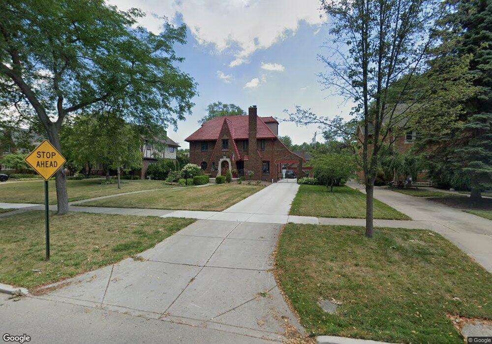
1366 Balfour St Unit Bldg-Unit Grosse Pointe Park, MI 48230
Estimated Value: $686,018 - $827,000
--
Bed
5
Baths
2,870
Sq Ft
$256/Sq Ft
Est. Value
About This Home
This home is located at 1366 Balfour St Unit Bldg-Unit, Grosse Pointe Park, MI 48230 and is currently estimated at $734,255, approximately $255 per square foot. 1366 Balfour St Unit Bldg-Unit is a home located in Wayne County with nearby schools including George Defer Elementary School, Pierce Middle School, and Grosse Pointe South High School.
Ownership History
Date
Name
Owned For
Owner Type
Purchase Details
Closed on
Mar 15, 2021
Sold by
Hilliard Eric and Hilliard Kelly
Bought by
Cunningham Patrick and Cunningham Amanda
Current Estimated Value
Purchase Details
Closed on
Mar 13, 2018
Sold by
Brookfield Relocation Inc
Bought by
Hillard Eric
Purchase Details
Closed on
Oct 22, 2013
Sold by
Defrance William and Defrance Nancy
Bought by
Robarge Christopher
Create a Home Valuation Report for This Property
The Home Valuation Report is an in-depth analysis detailing your home's value as well as a comparison with similar homes in the area
Home Values in the Area
Average Home Value in this Area
Purchase History
| Date | Buyer | Sale Price | Title Company |
|---|---|---|---|
| Cunningham Patrick | $570,000 | Ata National Title Group Llc | |
| Hillard Eric | $496,000 | None Available | |
| Brookfield Relocation Inc | $496,000 | None Available | |
| Robarge Christopher | $320,000 | Greco Title Agency Llc |
Source: Public Records
Tax History Compared to Growth
Tax History
| Year | Tax Paid | Tax Assessment Tax Assessment Total Assessment is a certain percentage of the fair market value that is determined by local assessors to be the total taxable value of land and additions on the property. | Land | Improvement |
|---|---|---|---|---|
| 2025 | $6,625 | $283,300 | $0 | $0 |
| 2024 | $6,625 | $275,900 | $0 | $0 |
| 2023 | $6,326 | $254,300 | $0 | $0 |
| 2022 | $6,010 | $242,200 | $0 | $0 |
| 2021 | $11,569 | $255,800 | $0 | $0 |
| 2019 | $11,905 | $221,500 | $0 | $0 |
| 2018 | $3,911 | $193,500 | $0 | $0 |
| 2017 | $8,796 | $122,900 | $0 | $0 |
| 2016 | $8,194 | $176,900 | $0 | $0 |
| 2015 | $14,637 | $166,900 | $0 | $0 |
| 2013 | $14,180 | $144,300 | $0 | $0 |
| 2012 | $3,921 | $152,000 | $54,000 | $98,000 |
Source: Public Records
Map
Nearby Homes
- 1350 Buckingham Rd
- 1306 Beaconsfield Ave Unit 1308
- 1254 Beaconsfield Ave
- 1425 Bedford Rd
- 1417 Beaconsfield Ave
- 1451 Beaconsfield Ave
- 3430 Bedford St
- 3485 Bedford St
- 3477 Bedford St
- 3636 Buckingham Ave
- 3651 Buckingham Ave
- 3650 Somerset Ave
- 1318 Maryland St
- 3666 Somerset Ave
- 15239 Mack Ave
- 3620 Devonshire Rd
- 1386 Three Mile Dr
- 1316 Maryland St
- 1148 Devonshire Rd
- 3479 Courville St
- 1366 Balfour St
- 1360 Balfour St
- 1372 Balfour St
- 1352 Balfour St
- 1378 Balfour St
- 1351 Berkshire Rd
- 1365 Berkshire Rd
- 1379 Berkshire Rd
- 1371 Berkshire Rd
- 1359 Berkshire Rd
- 1384 Balfour St
- 1344 Balfour St
- 1385 Berkshire Rd Unit Bldg-Unit
- 1385 Berkshire Rd
- 1367 Balfour St
- 1338 Balfour St
- 1361 Balfour St
- 1373 Balfour St
- 1343 Berkshire Rd
- 1353 Balfour St