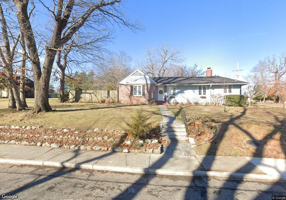
1366 Crest Dr Joplin, MO 64801
Roanoke NeighborhoodEstimated Value: $209,888 - $325,000
4
Beds
2
Baths
2,294
Sq Ft
$116/Sq Ft
Est. Value
About This Home
This home is located at 1366 Crest Dr, Joplin, MO 64801 and is currently estimated at $267,222, approximately $116 per square foot. 1366 Crest Dr is a home located in Jasper County with nearby schools including North Middle School, Joplin High School, and St. Peter's Middle School.
Ownership History
Date
Name
Owned For
Owner Type
Purchase Details
Closed on
Apr 12, 2023
Sold by
Rice Marilyn R
Bought by
Marilyn Ruth Rice Living Trust
Current Estimated Value
Purchase Details
Closed on
Jun 4, 2019
Sold by
Detar Joshua G and Detar Stephanie
Bought by
Rice Marilyn R
Home Financials for this Owner
Home Financials are based on the most recent Mortgage that was taken out on this home.
Original Mortgage
$211,900
Interest Rate
4.1%
Mortgage Type
New Conventional
Purchase Details
Closed on
Jan 16, 2014
Sold by
Storey Mark R
Bought by
Detar Joshua G and Detar Stephanie
Home Financials for this Owner
Home Financials are based on the most recent Mortgage that was taken out on this home.
Original Mortgage
$168,824
Interest Rate
4.47%
Mortgage Type
FHA
Create a Home Valuation Report for This Property
The Home Valuation Report is an in-depth analysis detailing your home's value as well as a comparison with similar homes in the area
Home Values in the Area
Average Home Value in this Area
Purchase History
| Date | Buyer | Sale Price | Title Company |
|---|---|---|---|
| Marilyn Ruth Rice Living Trust | -- | None Listed On Document | |
| Rice Marilyn R | -- | -- | |
| Detar Joshua G | -- | Fatco |
Source: Public Records
Mortgage History
| Date | Status | Borrower | Loan Amount |
|---|---|---|---|
| Previous Owner | Rice Marilyn R | $211,900 | |
| Previous Owner | Detar Joshua G | $168,824 |
Source: Public Records
Tax History
| Year | Tax Paid | Tax Assessment Tax Assessment Total Assessment is a certain percentage of the fair market value that is determined by local assessors to be the total taxable value of land and additions on the property. | Land | Improvement |
|---|---|---|---|---|
| 2025 | $968 | $23,470 | $3,860 | $19,610 |
| 2024 | $968 | $20,970 | $3,860 | $17,110 |
| 2023 | $968 | $20,970 | $3,860 | $17,110 |
| 2022 | $945 | $20,550 | $3,860 | $16,690 |
| 2021 | $939 | $20,550 | $3,860 | $16,690 |
| 2020 | $891 | $19,080 | $3,860 | $15,220 |
| 2019 | $893 | $19,080 | $3,860 | $15,220 |
| 2018 | $867 | $18,600 | $0 | $0 |
| 2017 | $871 | $18,600 | $0 | $0 |
| 2016 | $859 | $18,600 | $0 | $0 |
| 2015 | -- | $18,600 | $0 | $0 |
| 2014 | -- | $18,600 | $0 | $0 |
Source: Public Records
Map
Nearby Homes
- 1324 Fairmont Dr
- 1232 Bramar Dr
- 639 W Jaccard Place
- 1025 Northridge Rd
- 1005 N Moffet Ave
- 802 Hampton Place
- 1302 Cambridge St
- 728 N Pearl Ave
- 624 N Sergeant Ave
- 634 N Byers Ave
- 528 N Sergeant Ave
- 602 N Byers Ave
- 114 W F St
- 530 N Pearl Ave
- 531 N Wall Ave
- 1399 W Empire Ln
- Lot 60-62 N Joplin Ave
- 432 N Joplin Ave
- 5600 N Main Street Rd
- TBD Perkins St
- 1366 Crest Dr Unit 1
- 920 W Manitou St
- 1340 Crest Dr
- 1357 Crest Dr
- 1401 Crestwood Dr
- 1345 Crest Dr
- 1001 W Manitou St
- 1366 Valle Dr
- 1356 Valle Dr
- 1339 Crest Dr
- 1365 Crest Dr
- 1330 Crest Dr
- 1351 Crest Dr
- 1420 Crestwood Dr
- 1328 Bramar Dr
- 1421 Crestwood Dr
- 1421 Crestwood Dr
- 1333 Crest Dr
- 1435 Crestwood Dr
- 1322 Crest Dr
Your Personal Tour Guide
Ask me questions while you tour the home.