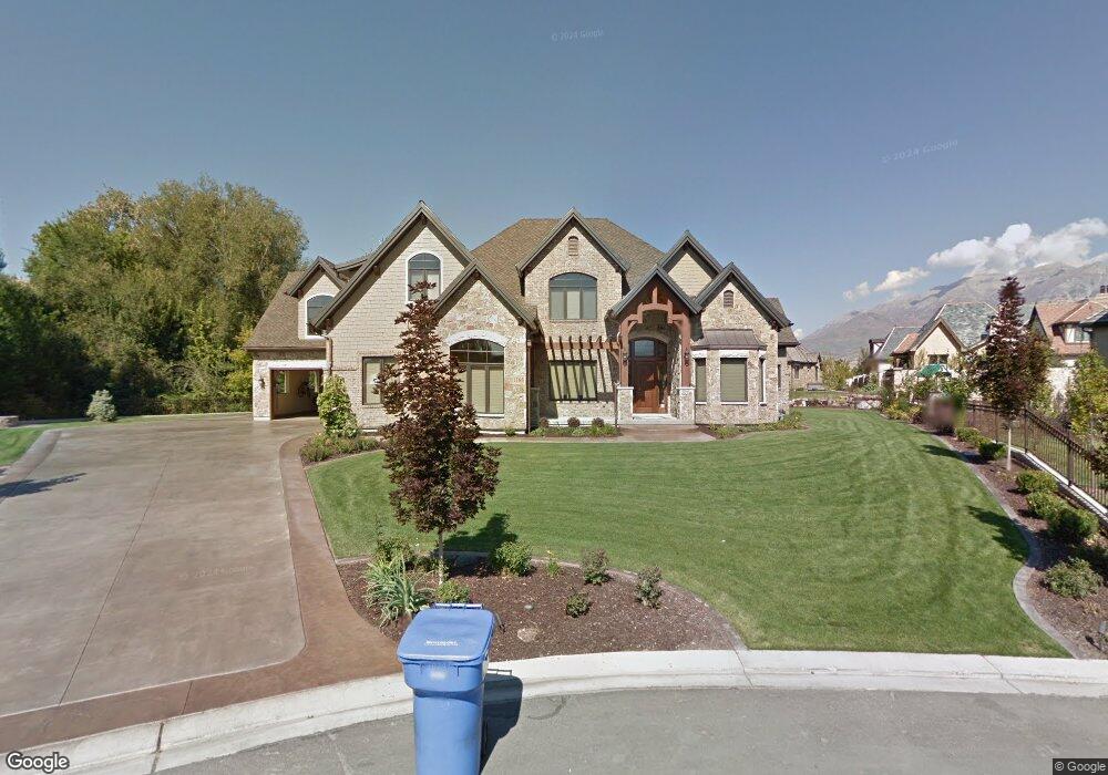
1366 S 1080 E Orem, UT 84097
Hillcrest NeighborhoodEstimated Value: $2,632,347 - $2,986,000
3
Beds
5
Baths
5,014
Sq Ft
$560/Sq Ft
Est. Value
About This Home
This home is located at 1366 S 1080 E, Orem, UT 84097 and is currently estimated at $2,809,174, approximately $560 per square foot. 1366 S 1080 E is a home with nearby schools including Centennial Elementary, Lakeridge Jr High School, and Orem High School.
Ownership History
Date
Name
Owned For
Owner Type
Purchase Details
Closed on
Jan 8, 2025
Sold by
Strate Steve and Strate Linda L
Bought by
Linda And Steve Strate Family Trust and Strate
Current Estimated Value
Purchase Details
Closed on
May 10, 2005
Sold by
Strate Steve
Bought by
Strate Steve and Strate Linda L
Create a Home Valuation Report for This Property
The Home Valuation Report is an in-depth analysis detailing your home's value as well as a comparison with similar homes in the area
Home Values in the Area
Average Home Value in this Area
Purchase History
| Date | Buyer | Sale Price | Title Company |
|---|---|---|---|
| Linda And Steve Strate Family Trust | -- | None Listed On Document | |
| Linda And Steve Strate Family Trust | -- | None Listed On Document | |
| Strate Steve | -- | Provo Land Title Company |
Source: Public Records
Tax History
| Year | Tax Paid | Tax Assessment Tax Assessment Total Assessment is a certain percentage of the fair market value that is determined by local assessors to be the total taxable value of land and additions on the property. | Land | Improvement |
|---|---|---|---|---|
| 2025 | $9,353 | $1,341,395 | -- | -- |
| 2024 | $9,353 | $1,143,670 | $0 | $0 |
| 2023 | $8,209 | $1,078,880 | $0 | $0 |
| 2022 | $7,931 | $1,009,745 | $0 | $0 |
| 2021 | $7,798 | $1,503,900 | $495,500 | $1,008,400 |
| 2020 | $7,541 | $1,429,300 | $430,900 | $998,400 |
| 2019 | $7,252 | $1,429,300 | $430,900 | $998,400 |
| 2018 | $7,259 | $1,366,900 | $413,500 | $953,400 |
| 2017 | $7,382 | $744,645 | $0 | $0 |
| 2016 | $8,005 | $744,645 | $0 | $0 |
| 2015 | $7,519 | $661,485 | $0 | $0 |
| 2014 | $6,628 | $580,415 | $0 | $0 |
Source: Public Records
Map
Nearby Homes
- 1360 S Carterville Rd
- 2939 N Marrcrest Dr W
- 2999 N Marrcrest West Dr
- 431 W 2310 N
- 720 E 1500 S
- 3013 N 100 W
- 691 E 1600 S
- 3057 N 100 W
- 784 E 1700 S
- 3240 Shadowbrook Dr
- 673 E 1650 S
- 158 Woodside Dr
- 111 Candlewood Place
- 3221 Shadowbrook Cir
- 2735 N Country Club Dr
- 2241 N 1060 W
- 3305 N Shadowbrook Cir
- 241 W 2230 N Unit 16
- 223 W 2230 N Unit 14
- 3025 N 250 E
- 1363 S 1080 E
- 1363 S 1080 E Unit 6
- 1386 S 1080 E
- 1342 S 1100 E
- 1342 S 1100 E Unit 16
- 1383 S 1080 E
- 1383 S 1080 E Unit 7J
- 1338 S 1100 E
- 1343 S 1100 E
- 1366 S 1140 E Unit 312
- 1366 S 1140 E
- 1421 S Carterville Rd
- 1380 S 1140 E
- 1045 E 1450 S Unit 3
- 1355 S Carterville Rd
- 1336 S 1100 E
- 1096 E 1450 S Unit 9
- 1096 E 1450 S
- 1312 S 1140 E Unit 14
- 1244 S 1140 E
Your Personal Tour Guide
Ask me questions while you tour the home.