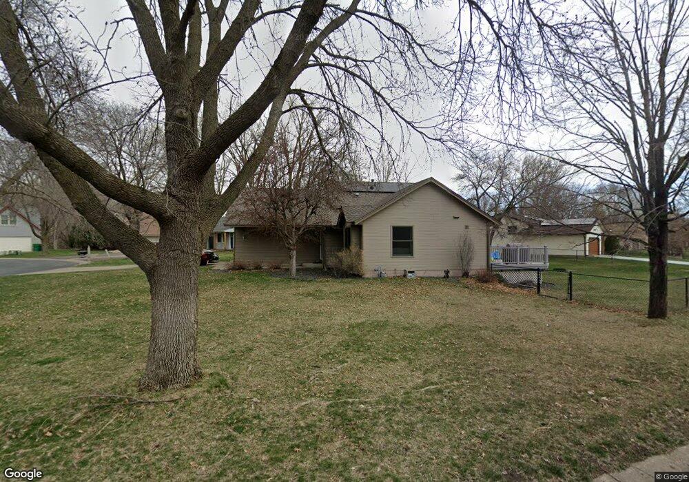
1367 105th Ln NW Coon Rapids, MN 55433
Estimated Value: $327,000 - $372,000
3
Beds
2
Baths
1,201
Sq Ft
$293/Sq Ft
Est. Value
About This Home
This home is located at 1367 105th Ln NW, Coon Rapids, MN 55433 and is currently estimated at $352,307, approximately $293 per square foot. 1367 105th Ln NW is a home located in Anoka County with nearby schools including Lucile Bruner Elementary School, Hamilton Elementary School, and Laughlin Junior/Senior High School.
Ownership History
Date
Name
Owned For
Owner Type
Purchase Details
Closed on
Jun 23, 2020
Sold by
Wright Michelle
Bought by
Thao Mai H and Vue Tou
Current Estimated Value
Home Financials for this Owner
Home Financials are based on the most recent Mortgage that was taken out on this home.
Original Mortgage
$263,625
Outstanding Balance
$233,243
Interest Rate
3.1%
Mortgage Type
New Conventional
Estimated Equity
$119,064
Purchase Details
Closed on
Jul 26, 2018
Sold by
Freeman Roger A and Freeman Mary A
Bought by
Wright Michelle
Home Financials for this Owner
Home Financials are based on the most recent Mortgage that was taken out on this home.
Original Mortgage
$222,300
Interest Rate
4.6%
Mortgage Type
New Conventional
Create a Home Valuation Report for This Property
The Home Valuation Report is an in-depth analysis detailing your home's value as well as a comparison with similar homes in the area
Home Values in the Area
Average Home Value in this Area
Purchase History
| Date | Buyer | Sale Price | Title Company |
|---|---|---|---|
| Thao Mai H | $277,500 | Legacy Title | |
| Wright Michelle | $247,000 | Liberty Title Inc |
Source: Public Records
Mortgage History
| Date | Status | Borrower | Loan Amount |
|---|---|---|---|
| Open | Thao Mai H | $263,625 | |
| Previous Owner | Wright Michelle | $222,300 |
Source: Public Records
Tax History Compared to Growth
Tax History
| Year | Tax Paid | Tax Assessment Tax Assessment Total Assessment is a certain percentage of the fair market value that is determined by local assessors to be the total taxable value of land and additions on the property. | Land | Improvement |
|---|---|---|---|---|
| 2025 | $3,319 | $309,200 | $73,500 | $235,700 |
| 2024 | $3,319 | $319,900 | $85,000 | $234,900 |
| 2023 | $3,037 | $317,200 | $80,000 | $237,200 |
| 2022 | $2,879 | $312,600 | $66,000 | $246,600 |
| 2021 | $2,788 | $265,600 | $67,000 | $198,600 |
| 2020 | $2,741 | $252,200 | $63,000 | $189,200 |
| 2019 | $2,412 | $238,800 | $57,000 | $181,800 |
| 2018 | $2,519 | $207,300 | $0 | $0 |
| 2017 | $2,179 | $195,400 | $0 | $0 |
| 2016 | $2,289 | $172,500 | $0 | $0 |
| 2015 | $2,108 | $172,500 | $46,000 | $126,500 |
| 2014 | -- | $152,600 | $37,700 | $114,900 |
Source: Public Records
Map
Nearby Homes
- 1285 105th Ave NW
- 1285 103rd Ln NW
- 10634 Hummingbird St NW
- 10658 Hummingbird St NW
- 1025 105th Ave NW
- 10705 Unity St NW Unit 6
- 10708 Tamarack St NW Unit 10
- 990 106th Ln NW Unit 29
- 995 106th Ln NW Unit 52
- 1054 109th Ln NW
- 10783 Tamarack Cir NW
- 10511 Redwood St NW
- 10170 Tamarack St NW
- 10478 Quince St NW
- 1900 Coon Rapids Blvd NW Unit 1
- 826 104th Ave NW
- 1063 109th Ave NW
- 1005 Coon Rapids Boulevard Extension NW
- 9967 Egret Blvd NW
- 2001 103rd Ln NW
- 1383 105th Ln NW
- 1351 105th Ln NW
- 1399 105th Ln NW
- 10520 Avocet St NW
- 1378 105th Ln NW
- 1394 105th Ln NW
- 1415 105th Ln NW
- 10531 Avocet St NW
- 1422 105th Ln NW
- 1431 105th Ln NW
- 1434 105th Ln NW
- 1361 105th Ave NW
- 10521 Avocet St NW
- 1371 105th Ave NW
- 1341 105th Ln NW
- 1446 105th Ln NW
- 1458 105th Ln NW
- 1381 105th Ave NW
- 1447 105th Ln NW
- 10511 Avocet St NW