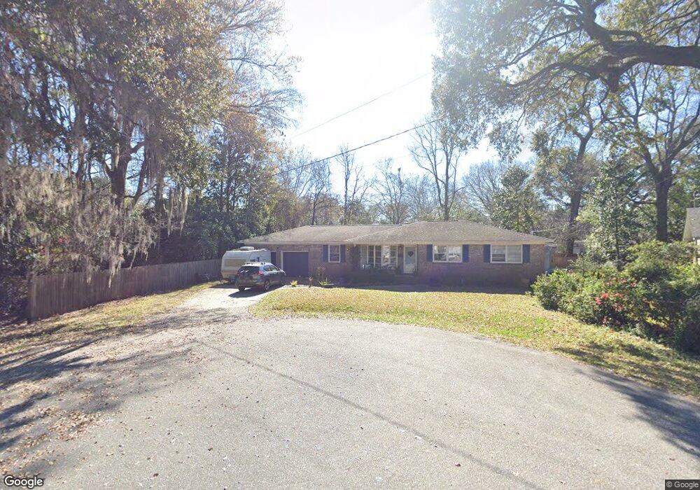
1367 Clearbrook St Unit 1 North Charleston, SC 29405
Park Circle NeighborhoodEstimated Value: $493,000 - $730,000
4
Beds
3
Baths
2,770
Sq Ft
$222/Sq Ft
Est. Value
About This Home
This home is located at 1367 Clearbrook St Unit 1, North Charleston, SC 29405 and is currently estimated at $613,865, approximately $221 per square foot. 1367 Clearbrook St Unit 1 is a home located in Charleston County with nearby schools including North Charleston Elementary School, Allegro Charter School of Music, and Morningside Middle.
Ownership History
Date
Name
Owned For
Owner Type
Purchase Details
Closed on
Jul 1, 2009
Sold by
Us Bank National Association
Bought by
Rust David J and Rust Lauren B
Current Estimated Value
Home Financials for this Owner
Home Financials are based on the most recent Mortgage that was taken out on this home.
Original Mortgage
$162,011
Interest Rate
5.19%
Mortgage Type
FHA
Purchase Details
Closed on
Feb 19, 2009
Sold by
Wilson Duncan I
Bought by
Us Bank National Association
Create a Home Valuation Report for This Property
The Home Valuation Report is an in-depth analysis detailing your home's value as well as a comparison with similar homes in the area
Home Values in the Area
Average Home Value in this Area
Purchase History
| Date | Buyer | Sale Price | Title Company |
|---|---|---|---|
| Rust David J | $165,000 | -- | |
| Us Bank National Association | $2,500 | -- |
Source: Public Records
Mortgage History
| Date | Status | Borrower | Loan Amount |
|---|---|---|---|
| Previous Owner | Rust David J | $162,011 |
Source: Public Records
Tax History Compared to Growth
Tax History
| Year | Tax Paid | Tax Assessment Tax Assessment Total Assessment is a certain percentage of the fair market value that is determined by local assessors to be the total taxable value of land and additions on the property. | Land | Improvement |
|---|---|---|---|---|
| 2024 | $1,371 | $8,730 | $0 | $0 |
| 2023 | $1,371 | $8,730 | $0 | $0 |
| 2022 | $1,311 | $8,730 | $0 | $0 |
| 2021 | $1,364 | $8,730 | $0 | $0 |
| 2020 | $1,398 | $8,730 | $0 | $0 |
| 2019 | $1,240 | $7,590 | $0 | $0 |
| 2017 | $1,168 | $7,590 | $0 | $0 |
| 2016 | $1,128 | $7,590 | $0 | $0 |
| 2015 | $1,181 | $7,590 | $0 | $0 |
| 2014 | $1,015 | $0 | $0 | $0 |
| 2011 | -- | $0 | $0 | $0 |
Source: Public Records
Map
Nearby Homes
- 4412 Holmes Ave
- 4515 Holmes Ave
- 4530 Holly St
- 4566 Durant Ave
- 4350 Rugheimer Ave
- 1213 Chesterfield Rd
- 1174 Leesville St
- 4625 Durant Ave
- 4488 Durant Ave
- 4230 Barnwell Ave
- 4228 Barnwell Ave
- 4226 Barnwell Ave
- 4229 Barnwell Ave
- 1514 Cuyler Ln
- 4543 Mixson Ave
- 4714 Marlboro Rd
- 1181 Park Place S
- 4587 Summey St
- 4577 Summey St
- 4737 Marlboro Rd
- 1367 Clearbrook St
- 1369 Clearbrook St
- 4435 Holmes Ave
- 1310 Mosstree Rd
- 1320 Mosstree Rd
- 4501 Holmes Ave
- 1330 Mosstree Rd
- 4505 Holmes Ave
- 1302 Mosstree Rd
- 4425 Holmes Ave
- 4425 Holmes Ave Unit A
- 4425 Holmes Ave Unit B
- 1377 Clearbrook St
- 1368 Clearbrook St
- 4507 Holmes Ave
- 1340 Mosstree Rd
- 4421 Holmes Ave
- 1376 Clearbrook St
- 4511 Holmes Ave
- 1393 Clearbrook St