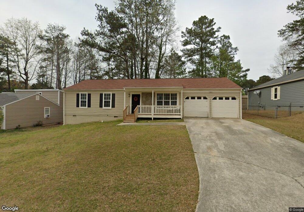
1367 Ling Dr Austell, GA 30168
Estimated Value: $242,000 - $280,881
3
Beds
2
Baths
1,256
Sq Ft
$208/Sq Ft
Est. Value
About This Home
This home is located at 1367 Ling Dr, Austell, GA 30168 and is currently estimated at $261,470, approximately $208 per square foot. 1367 Ling Dr is a home located in Cobb County with nearby schools including Bryant Elementary School, Lindley Middle School, and Pebblebrook High School.
Ownership History
Date
Name
Owned For
Owner Type
Purchase Details
Closed on
Oct 30, 2024
Sold by
Srmz 4 Asset Company 2 Llc and Alto Asset Company 2 Llc
Bought by
Montpelier Assets Llc
Current Estimated Value
Purchase Details
Closed on
Jan 13, 2020
Sold by
Mupr 3 Assets Llc
Bought by
Srmz 4 Asset Co 2 Llc
Purchase Details
Closed on
Sep 3, 2019
Sold by
Cole Karen
Bought by
Mupr 3 Assets Llc
Purchase Details
Closed on
Aug 9, 1995
Sold by
Houston Jr Thomas E Linda
Bought by
Cole Karen P
Create a Home Valuation Report for This Property
The Home Valuation Report is an in-depth analysis detailing your home's value as well as a comparison with similar homes in the area
Home Values in the Area
Average Home Value in this Area
Purchase History
| Date | Buyer | Sale Price | Title Company |
|---|---|---|---|
| Montpelier Assets Llc | $1,282,655 | None Listed On Document | |
| Montpelier Assets Llc | $1,282,655 | None Listed On Document | |
| Srmz 4 Asset Co 2 Llc | $926,162 | -- | |
| Mupr 3 Assets Llc | $125,001 | -- | |
| Cole Karen P | $78,000 | -- |
Source: Public Records
Mortgage History
| Date | Status | Borrower | Loan Amount |
|---|---|---|---|
| Closed | Cole Karen P | $0 |
Source: Public Records
Tax History
| Year | Tax Paid | Tax Assessment Tax Assessment Total Assessment is a certain percentage of the fair market value that is determined by local assessors to be the total taxable value of land and additions on the property. | Land | Improvement |
|---|---|---|---|---|
| 2025 | $2,774 | $92,064 | $24,000 | $68,064 |
| 2024 | $2,776 | $92,064 | $24,000 | $68,064 |
| 2023 | $2,598 | $86,180 | $16,000 | $70,180 |
Source: Public Records
Map
Nearby Homes
- 1395 Ling Dr Unit 2
- 1237 Ling Way
- 1398 Ling Dr
- 1329 Ling Dr
- 1350 Oak Ridge Rd
- 1507 Locust Log Way
- 1163 Park Center Cir
- 6854 Panda Ct Unit A
- 1195 Park Center Cir
- 1194 Park Center Cir
- 6992 Ivy Pointe Row
- 840 Revena Dr
- 1334 Ambercrest Way
- 1603 Pecan Log Place
- 00 Hembree Ln
- 0 Hembree Ln Unit 10633605
- 7254 Silverton Trail
- 1333 Laura Ln
- 1090 Blair Bridge Rd
- 6609 Crossing Creek Point
- 1365 Ling Dr
- 1369 Ling Dr
- 1468 Devon Mill Way
- 1470 Devon Mill Way
- 1363 Ling Dr
- 1466 Devon Mill Way
- 1364 Ling Dr
- 1362 Ling Dr
- 1371 Ling Dr
- 1366 Ling Dr
- 1464 Devon Mill Way
- 1472 Devon Mill Way
- 1360 Ling Dr Unit 2
- 1361 Ling Dr
- 1368 Ling Dr Unit 2
- 1373 Ling Dr Unit 2
- 1358 Ling Dr
- 1474 Devon Mill Way
- 7068 Grinder Ct
- 1359 Ling Dr
Your Personal Tour Guide
Ask me questions while you tour the home.