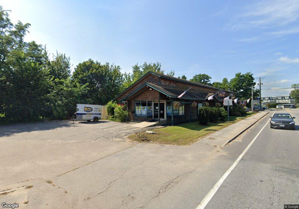
1367 Union Ave Laconia, NH 03246
Estimated Value: $485,594
--
Bed
1
Bath
3,336
Sq Ft
$146/Sq Ft
Est. Value
About This Home
This home is located at 1367 Union Ave, Laconia, NH 03246 and is currently estimated at $485,594, approximately $145 per square foot. 1367 Union Ave is a home located in Belknap County with nearby schools including Laconia Middle School, Laconia High School, and Holy Trinity Catholic School.
Ownership History
Date
Name
Owned For
Owner Type
Purchase Details
Closed on
Jul 2, 2014
Sold by
Seed William H and Seed Pamela F
Bought by
1083 Union Ave Llc
Current Estimated Value
Purchase Details
Closed on
Jan 15, 1999
Sold by
Deslauriers Gary T and Deslauriers Drena J
Bought by
Seed William H and Seed Pamela F
Create a Home Valuation Report for This Property
The Home Valuation Report is an in-depth analysis detailing your home's value as well as a comparison with similar homes in the area
Home Values in the Area
Average Home Value in this Area
Purchase History
| Date | Buyer | Sale Price | Title Company |
|---|---|---|---|
| 1083 Union Ave Llc | $250,000 | -- | |
| 1083 Union Ave Llc | $250,000 | -- | |
| Seed William H | $168,300 | -- | |
| Seed William H | $168,300 | -- |
Source: Public Records
Tax History Compared to Growth
Tax History
| Year | Tax Paid | Tax Assessment Tax Assessment Total Assessment is a certain percentage of the fair market value that is determined by local assessors to be the total taxable value of land and additions on the property. | Land | Improvement |
|---|---|---|---|---|
| 2024 | $6,294 | $461,800 | $179,900 | $281,900 |
| 2023 | $5,315 | $382,100 | $153,800 | $228,300 |
| 2022 | $5,294 | $356,500 | $128,200 | $228,300 |
| 2021 | $6,295 | $333,800 | $119,600 | $214,200 |
| 2020 | $6,583 | $333,800 | $119,600 | $214,200 |
| 2019 | $6,638 | $322,400 | $108,200 | $214,200 |
| 2018 | $6,428 | $308,300 | $102,500 | $205,800 |
| 2017 | $6,364 | $302,600 | $96,800 | $205,800 |
| 2016 | $6,718 | $302,600 | $96,800 | $205,800 |
| 2015 | $6,556 | $295,300 | $101,900 | $193,400 |
| 2014 | $6,615 | $295,300 | $101,900 | $193,400 |
| 2013 | $6,397 | $289,700 | $96,300 | $193,400 |
Source: Public Records
Map
Nearby Homes
- 144 Lake St Unit 11
- 131 Lake St Unit 214
- 131 Lake St Unit 230
- 9 Sargents Place Unit 35
- 9 Sargents Place Unit 84
- 9 Sargents Place Unit 23
- 9 Sargents Place Unit 72
- 9 Sargents Place Unit 113
- 9 Sargents Place Unit 93
- 60 White Oaks Rd Unit 11
- 60 White Oaks Rd Unit 17
- 60 White Oaks Rd Unit 18
- 60 White Oaks Rd Unit 23
- 109 Weirs Blvd Unit 12
- 23 Liscomb Cir Unit 24
- 147 Weirs Blvd Unit 7
- 147 Weirs Blvd Unit 5
- 75 Stark St Unit 3
- 32 David Lewis Rd
- 34 Kristen Dr
- 00 Union Ave
- 122 Lake Shore Rd Unit 122
- 1325 Union Ave
- 1325 Union Avenue Route 3
- 45 Lake St Unit 45
- 1330 Union Ave Unit 7
- 1330 Union Ave Unit 7 (4 North)
- 1330 Union Ave Unit 3 (2nd Floor No
- 1330 Union Ave Unit 5 (3rd Floor No
- 1330 Union Ave Unit 6 (3rd FLOOR SO
- 1330 Union Ave Unit 1
- 1330 Union Ave Unit 2
- 1330 Union Ave Unit 4 (2nd Floor So
- 1330 Union Ave Unit 8 (4th FLOOR SO
- 49 Blaisdell Ave
- 76 Lake St
- 83 Sargents Place
- 98 Sargents Place
- 5 Sargents Place
- 5 Sargents Place Unit 1