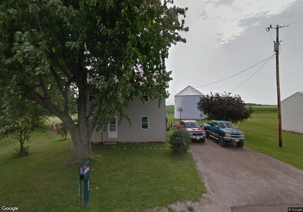
13676 County Road 175 Kenton, OH 43326
Estimated Value: $88,000 - $179,000
3
Beds
1
Bath
1,120
Sq Ft
$116/Sq Ft
Est. Value
About This Home
This home is located at 13676 County Road 175, Kenton, OH 43326 and is currently estimated at $129,841, approximately $115 per square foot. 13676 County Road 175 is a home located in Hardin County with nearby schools including Kenton Elementary School, Kenton Middle School, and Kenton High School.
Ownership History
Date
Name
Owned For
Owner Type
Purchase Details
Closed on
Jun 29, 2023
Sold by
Reuther Shawn
Bought by
Reuther Cindy
Current Estimated Value
Purchase Details
Closed on
Jun 16, 2023
Sold by
Kemmere Roger F and Kemmere Lulu C
Bought by
Reuther Shawn and Reuther Cindy
Purchase Details
Closed on
Jan 6, 2004
Sold by
Elsasser Jack D and Elsasser Cora
Bought by
Kemmere Roger F and Kemmere Lulu C
Home Financials for this Owner
Home Financials are based on the most recent Mortgage that was taken out on this home.
Original Mortgage
$67,000
Interest Rate
8.25%
Mortgage Type
Adjustable Rate Mortgage/ARM
Purchase Details
Closed on
Jan 10, 2000
Bought by
Elsasser Jack D
Purchase Details
Closed on
May 22, 1987
Create a Home Valuation Report for This Property
The Home Valuation Report is an in-depth analysis detailing your home's value as well as a comparison with similar homes in the area
Home Values in the Area
Average Home Value in this Area
Purchase History
| Date | Buyer | Sale Price | Title Company |
|---|---|---|---|
| Reuther Cindy | -- | None Listed On Document | |
| Reuther Cindy | -- | None Listed On Document | |
| Reuther Shawn | $60,000 | None Listed On Document | |
| Kemmere Roger F | -- | -- | |
| Elsasser Jack D | $40,000 | -- | |
| -- | $25,000 | -- |
Source: Public Records
Mortgage History
| Date | Status | Borrower | Loan Amount |
|---|---|---|---|
| Previous Owner | Kemmere Roger F | $67,000 |
Source: Public Records
Tax History Compared to Growth
Tax History
| Year | Tax Paid | Tax Assessment Tax Assessment Total Assessment is a certain percentage of the fair market value that is determined by local assessors to be the total taxable value of land and additions on the property. | Land | Improvement |
|---|---|---|---|---|
| 2024 | $1,427 | $32,640 | $10,860 | $21,780 |
| 2023 | $1,339 | $32,640 | $10,860 | $21,780 |
| 2022 | $1,250 | $26,720 | $7,770 | $18,950 |
| 2021 | $1,254 | $26,720 | $7,770 | $18,950 |
| 2020 | $1,087 | $26,720 | $7,770 | $18,950 |
| 2019 | $890 | $22,650 | $7,560 | $15,090 |
| 2018 | $889 | $22,650 | $7,560 | $15,090 |
| 2017 | $846 | $22,650 | $7,560 | $15,090 |
| 2016 | $724 | $19,570 | $7,040 | $12,530 |
| 2015 | $698 | $19,570 | $7,040 | $12,530 |
| 2014 | $756 | $20,490 | $7,040 | $13,450 |
| 2013 | $763 | $19,680 | $7,040 | $12,640 |
Source: Public Records
Map
Nearby Homes
- 13450 State Route 292
- 320 Letson Ave
- 920 Cooper St
- 11896 Parklane Dr
- 727 S Detroit St
- 639 S Main St
- 115 Scioto St
- 510 Decatur St
- 508 Decatur St
- 530 E Franklin St
- 79 Broadway St
- 513 E Franklin St
- 39 Grape St
- 121 S High St
- 1 C Ct
- 509 E Carrol St
- 414 Robinson Ave
- 215 N Main St
- 0 N Barron St
- 233 N Main St
- 13758 County Road 175
- 13676 Cr
- 13880 County Road 175
- 13915 County Road 175
- 14033 County Road 175
- 14069 County Road 175
- 14105 County Road 175
- 14020 State Route 31
- 14147 County Road 175
- 14084 State Route 31
- 14073 State Route 31
- 14073 State Route 31
- 13146 County Road 175
- 15959 County Road 160
- 14267 State Route 31
- 14200 County Road 175
- 14073 Sr
- 13908 State Route 31
- 13927 State Route 31
- 14252 County Rd