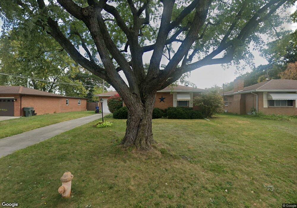
1368 Bronwyn Ave Columbus, OH 43204
Brookshire NeighborhoodEstimated Value: $219,000 - $246,000
3
Beds
2
Baths
1,293
Sq Ft
$181/Sq Ft
Est. Value
About This Home
This home is located at 1368 Bronwyn Ave, Columbus, OH 43204 and is currently estimated at $233,391, approximately $180 per square foot. 1368 Bronwyn Ave is a home located in Franklin County with nearby schools including Binns Elementary School, Wedgewood Middle School, and Briggs High School.
Ownership History
Date
Name
Owned For
Owner Type
Purchase Details
Closed on
Oct 18, 2002
Sold by
Moroney Daniel E and Moroney Jill J
Bought by
Salisbury Jason F and Hess Alison K
Current Estimated Value
Purchase Details
Closed on
Aug 21, 1998
Sold by
Gildow Norma
Bought by
Moroney Daniel E and Thomas Robert D
Home Financials for this Owner
Home Financials are based on the most recent Mortgage that was taken out on this home.
Original Mortgage
$88,446
Interest Rate
6.99%
Mortgage Type
FHA
Purchase Details
Closed on
May 13, 1998
Sold by
Thomas Robert D
Bought by
Moroney Daniel E
Home Financials for this Owner
Home Financials are based on the most recent Mortgage that was taken out on this home.
Original Mortgage
$88,446
Interest Rate
6.99%
Mortgage Type
FHA
Purchase Details
Closed on
Mar 1, 1980
Create a Home Valuation Report for This Property
The Home Valuation Report is an in-depth analysis detailing your home's value as well as a comparison with similar homes in the area
Home Values in the Area
Average Home Value in this Area
Purchase History
| Date | Buyer | Sale Price | Title Company |
|---|---|---|---|
| Salisbury Jason F | $109,500 | -- | |
| Moroney Daniel E | $92,300 | Title First Agency Inc | |
| Moroney Daniel E | -- | Title First Agency Inc | |
| -- | $51,900 | -- |
Source: Public Records
Mortgage History
| Date | Status | Borrower | Loan Amount |
|---|---|---|---|
| Previous Owner | Moroney Daniel E | $88,446 | |
| Previous Owner | Moroney Daniel E | $88,446 |
Source: Public Records
Tax History Compared to Growth
Tax History
| Year | Tax Paid | Tax Assessment Tax Assessment Total Assessment is a certain percentage of the fair market value that is determined by local assessors to be the total taxable value of land and additions on the property. | Land | Improvement |
|---|---|---|---|---|
| 2024 | $3,167 | $70,570 | $14,810 | $55,760 |
| 2023 | $3,127 | $70,560 | $14,805 | $55,755 |
| 2022 | $1,977 | $38,120 | $7,070 | $31,050 |
| 2021 | $1,981 | $38,120 | $7,070 | $31,050 |
| 2020 | $1,983 | $38,120 | $7,070 | $31,050 |
| 2019 | $2,051 | $33,810 | $6,160 | $27,650 |
| 2018 | $1,023 | $33,810 | $6,160 | $27,650 |
| 2017 | $2,050 | $33,810 | $6,160 | $27,650 |
| 2016 | $2,024 | $30,560 | $5,600 | $24,960 |
| 2015 | $919 | $30,560 | $5,600 | $24,960 |
| 2014 | $1,842 | $30,560 | $5,600 | $24,960 |
| 2013 | $1,069 | $35,945 | $6,580 | $29,365 |
Source: Public Records
Map
Nearby Homes
- 2856 Chesfield Dr
- 1248 Gresham Rd
- 2987 Daisy Ln
- 2929 Briggs Rd
- 1520 Fall Brook Rd
- 2547 Rosedale Ave
- 2743 Saint Joseph Ave
- 2610 Spaatz Ave
- 0 S Central Ave
- 1037 Chestershire Rd
- 2743 Bernadette Rd
- 2436 Hardesty Dr S Unit 4
- 2362 Woodbrook Cir N Unit 81
- 1119 Hardesty Place E Unit 1
- 2783-2785 Vanderberg Ave
- 903 S Harris Ave
- 2382 Hardesty Dr S Unit Q-5
- 2337 Hardesty Ct Unit 1
- 2687 Vanderberg Ave
- 2336 Woodbrook Cir N Unit 92 B
- 1360 Bronwyn Ave
- 1376 Bronwyn Ave
- 2748 Hafton Woods Ct
- 2742 Hafton Woods Ct
- 1348 Bronwyn Ave
- 1384 Bronwyn Ave
- 2736 Hafton Woods Ct
- 2754 Hafton Woods Ct
- 1359 Bronwyn Ave
- 1340 Bronwyn Ave
- 2730 Hafton Woods Ct
- 1385 Bronwyn Ave
- 1392 Bronwyn Ave
- 1347 Bronwyn Ave
- 2753 Hafton Woods Ct
- 1332 Bronwyn Ave
- 2805 Briggston Ave
- 1339 Bronwyn Ave
- 2724 Hafton Woods Ct
- 1400 Bronwyn Ave