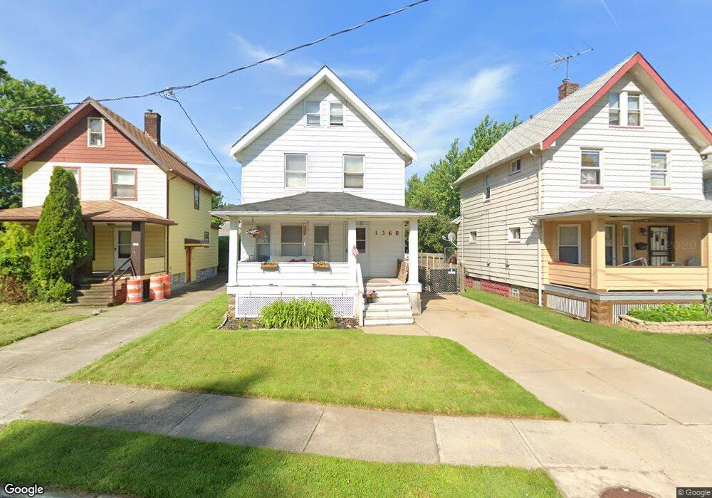
1368 Penhurst Rd Cleveland, OH 44110
South Collinwood NeighborhoodEstimated Value: $76,000 - $83,000
3
Beds
1
Bath
1,300
Sq Ft
$61/Sq Ft
Est. Value
About This Home
This home is located at 1368 Penhurst Rd, Cleveland, OH 44110 and is currently estimated at $79,754, approximately $61 per square foot. 1368 Penhurst Rd is a home located in Cuyahoga County with nearby schools including Noble Academy-Cleveland, Imagine Bella Academy of Excellence, and Lakeshore Intergenerational School.
Ownership History
Date
Name
Owned For
Owner Type
Purchase Details
Closed on
Nov 27, 1990
Sold by
Meek Michael and Meek Mary T
Bought by
Gornik Joseph G
Current Estimated Value
Purchase Details
Closed on
Jun 8, 1987
Sold by
Digiorgi Charles
Bought by
Meek Michael and Meek Mary T
Purchase Details
Closed on
May 30, 1980
Bought by
Digiorgi Charles
Purchase Details
Closed on
Jun 12, 1979
Bought by
Adm Veterans Affairs
Purchase Details
Closed on
Jan 1, 1975
Bought by
Murphy Robert H and Murphy Juanita
Create a Home Valuation Report for This Property
The Home Valuation Report is an in-depth analysis detailing your home's value as well as a comparison with similar homes in the area
Home Values in the Area
Average Home Value in this Area
Purchase History
| Date | Buyer | Sale Price | Title Company |
|---|---|---|---|
| Gornik Joseph G | $42,500 | -- | |
| Meek Michael | $32,000 | -- | |
| Digiorgi Charles | -- | -- | |
| Adm Veterans Affairs | -- | -- | |
| Bloomfield Savings Bank | $10,000 | -- | |
| Murphy Robert H | -- | -- |
Source: Public Records
Tax History
| Year | Tax Paid | Tax Assessment Tax Assessment Total Assessment is a certain percentage of the fair market value that is determined by local assessors to be the total taxable value of land and additions on the property. | Land | Improvement |
|---|---|---|---|---|
| 2025 | $1,648 | $25,130 | $3,570 | $21,560 |
| 2024 | $1,647 | $25,130 | $3,570 | $21,560 |
| 2023 | $1,184 | $15,610 | $2,450 | $13,160 |
| 2022 | $1,177 | $15,610 | $2,450 | $13,160 |
| 2021 | $1,165 | $15,610 | $2,450 | $13,160 |
| 2020 | $1,182 | $13,690 | $2,140 | $11,550 |
| 2019 | $1,093 | $39,100 | $6,100 | $33,000 |
| 2018 | $1,090 | $13,690 | $2,140 | $11,550 |
| 2017 | $1,189 | $14,420 | $2,310 | $12,110 |
| 2016 | $1,180 | $14,420 | $2,310 | $12,110 |
| 2015 | $1,362 | $14,420 | $2,310 | $12,110 |
| 2014 | $1,362 | $16,590 | $2,660 | $13,930 |
Source: Public Records
Map
Nearby Homes
- 1402 E 185th St
- 1311 E 187th St
- 1476 Clermont Rd
- 1514 Clermont Rd
- 19210 Firwood Rd
- 1426 E 175th St
- 1487 E 173rd St
- 1445 E 172nd St
- 1113 E 177th St
- 1222 E 172nd St
- 17216 Grovewood Ave
- 1505 E 172nd St
- 1538 E 173rd St
- 1566 E 195th St
- 18526 Underwood Ave
- 16918 Grovewood Ave
- 1239 E 168th St
- 983 E 179th St
- 1140 E 169th St
- 1109 E 169th St
- 1364 Penhurst Rd
- 1372 Penhurst Rd
- 1360 Penhurst Rd
- 1376 Penhurst Rd
- 1379 Clearaire Rd
- 1358 Penhurst Rd
- 1383 Clearaire Rd
- 1380 Penhurst Rd
- 1387 Clearaire Rd
- 1369 Penhurst Rd
- 1354 Penhurst Rd
- 1373 Penhurst Rd
- 1384 Penhurst Rd
- 1361 Penhurst Rd
- 1391 Clearaire Rd
- 1377 Penhurst Rd
- 1359
- 1359 Penhurst Rd
- 1381 Penhurst Rd
- 1350 Penhurst Rd
Your Personal Tour Guide
Ask me questions while you tour the home.