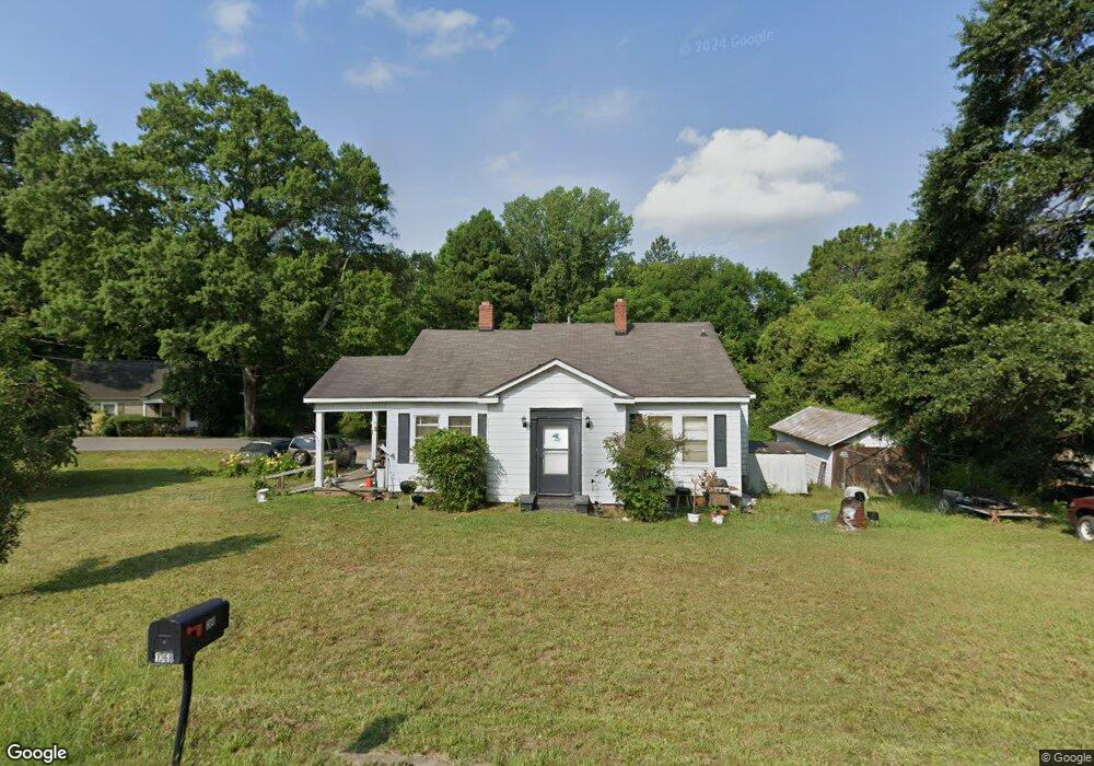
1368 Williams Estate Dr Lancaster, SC 29720
Estimated Value: $121,663 - $232,000
--
Bed
1
Bath
1,344
Sq Ft
$135/Sq Ft
Est. Value
About This Home
This home is located at 1368 Williams Estate Dr, Lancaster, SC 29720 and is currently estimated at $181,916, approximately $135 per square foot. 1368 Williams Estate Dr is a home located in Lancaster County with nearby schools including Brooklyn Springs Elementary School, South Middle School, and Lancaster High School.
Ownership History
Date
Name
Owned For
Owner Type
Purchase Details
Closed on
Dec 9, 2025
Sold by
Rollings Charles Michael
Bought by
Kirk Brandon E and Kirk Teresa A
Current Estimated Value
Purchase Details
Closed on
Oct 15, 2021
Sold by
Rollings Charles Michael and Estate Of Alice Anna Lee Copel
Bought by
Rollings Charles Michael
Purchase Details
Closed on
Oct 10, 2013
Sold by
Melton Ruth M
Bought by
Rollings Alice Foley Copeland
Create a Home Valuation Report for This Property
The Home Valuation Report is an in-depth analysis detailing your home's value as well as a comparison with similar homes in the area
Home Values in the Area
Average Home Value in this Area
Purchase History
| Date | Buyer | Sale Price | Title Company |
|---|---|---|---|
| Kirk Brandon E | -- | None Listed On Document | |
| Rollings Charles Michael | -- | None Available | |
| Rollings Alice Foley Copeland | -- | -- |
Source: Public Records
Tax History Compared to Growth
Tax History
| Year | Tax Paid | Tax Assessment Tax Assessment Total Assessment is a certain percentage of the fair market value that is determined by local assessors to be the total taxable value of land and additions on the property. | Land | Improvement |
|---|---|---|---|---|
| 2024 | $413 | $2,692 | $628 | $2,064 |
| 2023 | $423 | $2,692 | $628 | $2,064 |
| 2022 | $410 | $2,692 | $628 | $2,064 |
| 2021 | $1,312 | $4,038 | $942 | $3,096 |
| 2020 | $365 | $2,380 | $628 | $1,752 |
| 2019 | $805 | $2,380 | $628 | $1,752 |
| 2018 | $774 | $2,380 | $628 | $1,752 |
| 2017 | $357 | $0 | $0 | $0 |
| 2016 | $348 | $0 | $0 | $0 |
| 2015 | $278 | $0 | $0 | $0 |
| 2014 | $278 | $0 | $0 | $0 |
| 2013 | $278 | $0 | $0 | $0 |
Source: Public Records
Map
Nearby Homes
- TBD Williams Estate Dr
- 1429 Williams Estate Dr
- 1334 Williams Estate Dr
- 1453 Old Landsford Rd
- 1257 Springdale Rd
- TBD Old Landsford Rd
- 1451 Kings Cir
- 5.45 acres Memorial Park Rd
- 3.04 acres Memorial Park Rd
- 1319 Jefferson St
- 1747 Summit Ave Unit C
- 1613 Small St
- 1841 Grace Ave
- 1501 Victoria St Unit 11
- 1503 Victoria St
- 1500 Victoria St Unit 4
- 1817 Grace Ave
- 1509 Victoria St Unit 13
- 1801 Grace Ave
- 126 S Jackson Rd
- 1356 Williams Estate Dr
- 721 W Brooklyn Ave
- 0 W Brooklyn Ave Unit 11111955
- 1377 Williams Estate Dr
- 1357 Williams Estate Dr
- 1384 Williams Estate Dr
- 729 W Brooklyn Ave
- 1390 Williams Estate Dr
- 1345 Williams Estate Dr
- 676 W Brooklyn Ave
- 1279 Elmwood Ave
- 734 W Brooklyn Ave
- 1348 Yancey St
- 731 W Brooklyn Ave
- 1356 Yancey St
- 1398 Williams Estate Dr
- 1398 Williams Estate Dr Unit 1/H
- 1338 Yancey St
- 1397 Williams Estate Dr
- 738 W Brooklyn Ave