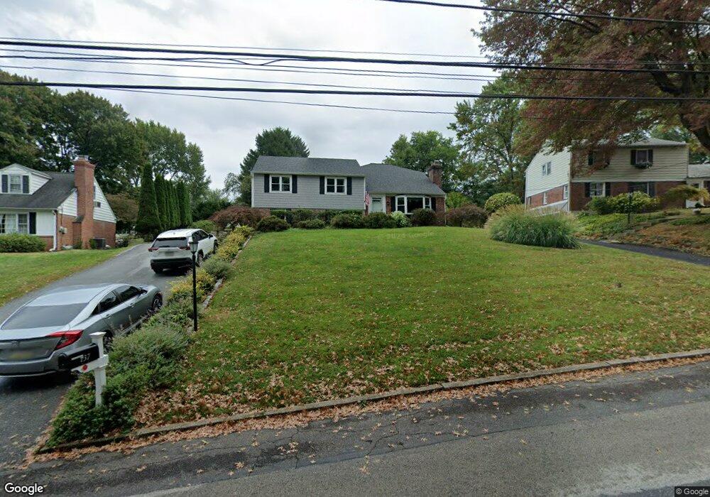
137 Brookside Rd Newtown Square, PA 19073
Estimated Value: $701,000 - $816,000
4
Beds
3
Baths
3,032
Sq Ft
$252/Sq Ft
Est. Value
About This Home
This home is located at 137 Brookside Rd, Newtown Square, PA 19073 and is currently estimated at $765,394, approximately $252 per square foot. 137 Brookside Rd is a home located in Delaware County with nearby schools including Culbertson Elementary School, Paxon Hollow Middle School, and Marple Newtown Senior High School.
Ownership History
Date
Name
Owned For
Owner Type
Purchase Details
Closed on
Oct 25, 2025
Sold by
Tierney Joseph M and Tierney Donna M
Bought by
Tierney Family Trust and Tierney
Current Estimated Value
Purchase Details
Closed on
Aug 22, 1996
Sold by
Schmoll Jean B
Bought by
Tierney Joseph M and Tierney Donna M
Home Financials for this Owner
Home Financials are based on the most recent Mortgage that was taken out on this home.
Original Mortgage
$155,000
Interest Rate
8.11%
Create a Home Valuation Report for This Property
The Home Valuation Report is an in-depth analysis detailing your home's value as well as a comparison with similar homes in the area
Home Values in the Area
Average Home Value in this Area
Purchase History
| Date | Buyer | Sale Price | Title Company |
|---|---|---|---|
| Tierney Family Trust | -- | None Listed On Document | |
| Tierney Joseph M | $178,000 | -- |
Source: Public Records
Mortgage History
| Date | Status | Borrower | Loan Amount |
|---|---|---|---|
| Previous Owner | Tierney Joseph M | $155,000 |
Source: Public Records
Tax History Compared to Growth
Tax History
| Year | Tax Paid | Tax Assessment Tax Assessment Total Assessment is a certain percentage of the fair market value that is determined by local assessors to be the total taxable value of land and additions on the property. | Land | Improvement |
|---|---|---|---|---|
| 2025 | $7,363 | $442,450 | $119,930 | $322,520 |
| 2024 | $7,363 | $442,450 | $119,930 | $322,520 |
| 2023 | $7,131 | $442,450 | $119,930 | $322,520 |
| 2022 | $6,975 | $442,450 | $119,930 | $322,520 |
| 2021 | $10,663 | $442,450 | $119,930 | $322,520 |
| 2020 | $5,506 | $200,740 | $69,420 | $131,320 |
| 2019 | $5,419 | $200,740 | $69,420 | $131,320 |
| 2018 | $5,360 | $200,740 | $0 | $0 |
| 2017 | $5,342 | $200,740 | $0 | $0 |
| 2016 | $1,102 | $200,740 | $0 | $0 |
| 2015 | $1,124 | $200,740 | $0 | $0 |
| 2014 | $1,102 | $200,740 | $0 | $0 |
Source: Public Records
Map
Nearby Homes
- 133 Brookside Rd
- 126 Bryn Mawr Ave
- 135 Bryn Mawr Ave
- 10 Bryn Mawr Ave
- 212 Aronimink Dr
- 66 Northwood Rd
- 31 Barren Rd
- 202 Barren Rd
- 14 Valley View Ln
- 3500 Goshen Rd
- 217 Jeffrey Ln
- 115 Newby Dr
- 204 3rd Ave
- 204 Wedgewood Cir
- 12 Lincoln Ln
- 204 Media Line Rd
- 27 Mary Jane Ln
- 310 Jeffrey Ln
- 334 Foxtail Ln Unit 22D
- 10 Fox Chase Cir
- 139 Brookside Rd
- 135 Brookside Rd
- 141 Brookside Rd
- 140 Ridgefield Rd
- 142 Ridgefield Rd
- 138 Ridgefield Rd
- 136 Brookside Rd
- 132 Brookside Rd
- 144 Ridgefield Rd
- 143 Brookside Rd
- 131 Brookside Rd
- 134 Brookside Rd
- 138 Brookside Rd
- 136 Ridgefield Rd
- 146 Ridgefield Rd
- 130 Brookside Rd
- 145 Brookside Rd
- 129 Brookside Rd
- 140 Brookside Rd
- 148 Ridgefield Rd