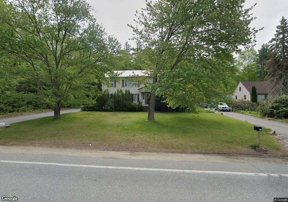
137 Eastern Ave Rochester, NH 03867
Estimated Value: $381,000 - $556,000
7
Beds
4
Baths
3,264
Sq Ft
$150/Sq Ft
Est. Value
About This Home
This home is located at 137 Eastern Ave, Rochester, NH 03867 and is currently estimated at $489,333, approximately $149 per square foot. 137 Eastern Ave is a home located in Strafford County with nearby schools including Chamberlain Street School, Rochester Middle School, and Spaulding High School.
Ownership History
Date
Name
Owned For
Owner Type
Purchase Details
Closed on
Dec 30, 2003
Sold by
Bernabo Lawrence A
Bought by
Donovan Michael and Donovan Tricia
Current Estimated Value
Home Financials for this Owner
Home Financials are based on the most recent Mortgage that was taken out on this home.
Original Mortgage
$382,413
Interest Rate
6.01%
Mortgage Type
Purchase Money Mortgage
Create a Home Valuation Report for This Property
The Home Valuation Report is an in-depth analysis detailing your home's value as well as a comparison with similar homes in the area
Home Values in the Area
Average Home Value in this Area
Purchase History
| Date | Buyer | Sale Price | Title Company |
|---|---|---|---|
| Donovan Michael | $399,000 | -- |
Source: Public Records
Mortgage History
| Date | Status | Borrower | Loan Amount |
|---|---|---|---|
| Open | Donovan Michael | $312,323 | |
| Closed | Donovan Michael | $382,413 |
Source: Public Records
Tax History
| Year | Tax Paid | Tax Assessment Tax Assessment Total Assessment is a certain percentage of the fair market value that is determined by local assessors to be the total taxable value of land and additions on the property. | Land | Improvement |
|---|---|---|---|---|
| 2025 | $6,900 | $451,000 | $126,800 | $324,200 |
| 2024 | $6,697 | $451,000 | $126,800 | $324,200 |
| 2023 | $7,004 | $272,100 | $43,200 | $228,900 |
| 2022 | $6,879 | $272,100 | $43,200 | $228,900 |
| 2021 | $6,707 | $272,100 | $43,200 | $228,900 |
| 2020 | $6,679 | $271,400 | $43,200 | $228,200 |
| 2019 | $6,758 | $271,400 | $43,200 | $228,200 |
| 2018 | $5,420 | $216,300 | $43,200 | $173,100 |
| 2017 | $5,695 | $216,300 | $43,200 | $173,100 |
| 2016 | $6,245 | $221,000 | $43,200 | $177,800 |
| 2015 | $6,221 | $221,000 | $43,200 | $177,800 |
| 2014 | $6,071 | $221,000 | $43,200 | $177,800 |
| 2013 | $6,292 | $238,700 | $57,600 | $181,100 |
| 2012 | $6,130 | $238,700 | $57,600 | $181,100 |
Source: Public Records
Map
Nearby Homes
- 5 Sonata Ct
- 3 Freedom Dr Unit 17
- 9 Freedom Dr Unit Lot 16
- 2 Freedom Dr
- 871 Salmon Falls Rd
- 25 Woodland Green
- 46 Limestone Ln
- 54 Woodland Green
- 35 Brownstone Ln
- 9 Jay Way
- 43 Fieldstone Ln
- 487 Salmon Falls Rd
- 24 Jeremiah Ln
- 524 Salmon Falls Rd
- 64 Pray St
- 17 Copps Dr
- 15 Copps Dr
- 13 Copps Dr
- 68 Moose Ln
- 11 Copps Dr
- 141 Eastern Ave
- 135 Eastern Ave
- 145 Eastern Ave
- 133 Eastern Ave
- 16 Regency Ct
- 30 Rochester Ave
- 284 Eastern Ave
- 284 Eastern Ave Unit A
- 151 Eastern Ave
- 139 Eastern Ave
- 13 Paradis Dr
- 13 Paradise Dr
- 265 Eastern Ave
- 8 Regency Ct
- 10 Regency Ct
- 28 Rochester Ave
- 153 Eastern Ave
- 12 Regency Ct
- 129 Eastern Ave
- 34 Vernon Ave
Your Personal Tour Guide
Ask me questions while you tour the home.