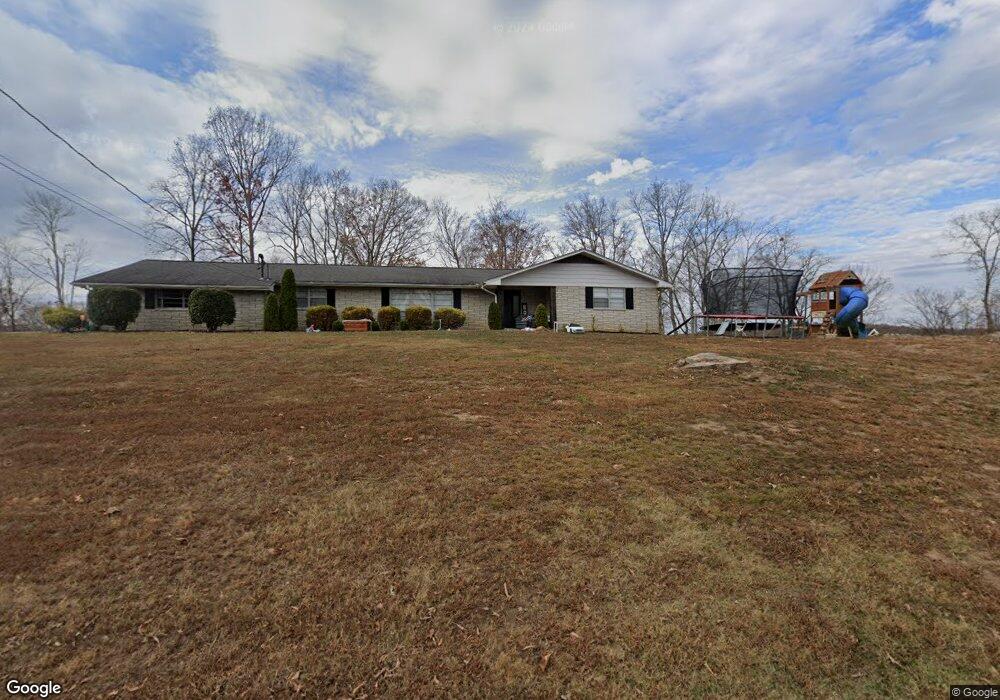
137 Hilltop Ln Powell, TN 37849
South Clinton NeighborhoodEstimated Value: $341,000 - $460,000
--
Bed
3
Baths
2,295
Sq Ft
$171/Sq Ft
Est. Value
About This Home
This home is located at 137 Hilltop Ln, Powell, TN 37849 and is currently estimated at $392,194, approximately $170 per square foot. 137 Hilltop Ln is a home located in Anderson County.
Ownership History
Date
Name
Owned For
Owner Type
Purchase Details
Closed on
Jul 10, 2019
Sold by
Freemamn Dillis D and Hobert B Freemamn Revocable Li
Bought by
Beeler Cory J and Beeler Julie L
Current Estimated Value
Home Financials for this Owner
Home Financials are based on the most recent Mortgage that was taken out on this home.
Original Mortgage
$188,383
Outstanding Balance
$165,311
Interest Rate
3.9%
Mortgage Type
New Conventional
Estimated Equity
$226,883
Purchase Details
Closed on
Mar 24, 2005
Sold by
Freeman H B
Bought by
Moodys Construction Inc
Create a Home Valuation Report for This Property
The Home Valuation Report is an in-depth analysis detailing your home's value as well as a comparison with similar homes in the area
Home Values in the Area
Average Home Value in this Area
Purchase History
| Date | Buyer | Sale Price | Title Company |
|---|---|---|---|
| Beeler Cory J | $186,500 | Admiral Title Inc | |
| Moodys Construction Inc | $10,000 | -- |
Source: Public Records
Mortgage History
| Date | Status | Borrower | Loan Amount |
|---|---|---|---|
| Open | Beeler Cory J | $188,383 |
Source: Public Records
Tax History Compared to Growth
Tax History
| Year | Tax Paid | Tax Assessment Tax Assessment Total Assessment is a certain percentage of the fair market value that is determined by local assessors to be the total taxable value of land and additions on the property. | Land | Improvement |
|---|---|---|---|---|
| 2024 | $1,251 | $47,575 | $5,350 | $42,225 |
| 2023 | $1,251 | $47,575 | $0 | $0 |
| 2022 | $1,251 | $47,575 | $5,350 | $42,225 |
| 2021 | $1,251 | $47,575 | $5,350 | $42,225 |
| 2020 | $1,242 | $47,575 | $5,350 | $42,225 |
| 2019 | $1,287 | $44,525 | $5,350 | $39,175 |
| 2018 | $1,242 | $44,525 | $5,350 | $39,175 |
| 2017 | $1,242 | $44,525 | $5,350 | $39,175 |
| 2016 | $1,242 | $44,525 | $5,350 | $39,175 |
| 2015 | -- | $44,525 | $5,350 | $39,175 |
| 2014 | -- | $44,525 | $5,350 | $39,175 |
| 2013 | -- | $48,175 | $0 | $0 |
Source: Public Records
Map
Nearby Homes
- 132 Edgewood Dr
- 135 Edgewood Heights Ln
- 120 East Cir
- 170 Cedar Cir
- 505 Foust Carney Rd
- 112 Glenn Cir
- 120 West Ln
- 109 Glenn Cir
- 110 Courtland Ln
- 120 Oak Rd
- 3035 W Wolf Valley Rd
- 2215 Clinton Hwy
- 3225 W Wolf Valley Rd
- 0 Powder House Rd
- 225 Over Mountain Ln
- 161 Milligan Ln
- 3275 W Wolf Valley Rd
- 0 St James Ln Unit 1303175
- 0 Saint James Ln Unit 1313852
- 372 Walnut Valley Rd
- 120 Hilltop Ln
- 125 Hilltop Ln
- 141 Hilltop Ln
- 130 Hilltop Ln
- 142 Hilltop Ln
- 112 Hilltop Ln
- 117 Hilltop Ln
- 119 Maple Tree Ln
- 123 Maple Tree Ln
- 316 N Dogwood Rd
- 115 Maple Tree Ln
- 328 N Dogwood Rd
- 312 N Dogwood Rd
- 111 Maple Tree Ln
- 404 N Dogwood Rd
- 1033 Foust Carney Rd
- 131 Maple Tree Ln
- 408 N Dogwood Rd
- 0 N Dogwood Rd Unit 246324
- 0 N Dogwood Rd