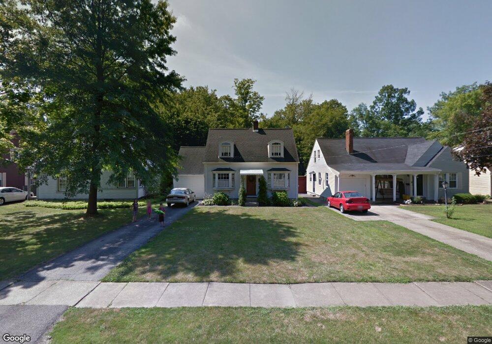
137 Homestead Dr Youngstown, OH 44512
Estimated Value: $107,872 - $123,000
3
Beds
1
Bath
1,028
Sq Ft
$112/Sq Ft
Est. Value
About This Home
This home is located at 137 Homestead Dr, Youngstown, OH 44512 and is currently estimated at $115,218, approximately $112 per square foot. 137 Homestead Dr is a home located in Mahoning County with nearby schools including Boardman Glenwood Junior High School, Boardman High School, and Horizon Science Academy - Youngstown.
Ownership History
Date
Name
Owned For
Owner Type
Purchase Details
Closed on
Feb 23, 2004
Sold by
Brestelli Kristen M and Brestelli Paul T
Bought by
Brestelli Paul T and Brestelli Kristen M
Current Estimated Value
Home Financials for this Owner
Home Financials are based on the most recent Mortgage that was taken out on this home.
Original Mortgage
$64,000
Interest Rate
7.65%
Mortgage Type
New Conventional
Purchase Details
Closed on
Jun 29, 1998
Sold by
Hannon Phyllis
Bought by
Hauck Kristen M and Brestelli Paul T
Purchase Details
Closed on
Jun 22, 1993
Bought by
Macek Paul J
Create a Home Valuation Report for This Property
The Home Valuation Report is an in-depth analysis detailing your home's value as well as a comparison with similar homes in the area
Home Values in the Area
Average Home Value in this Area
Purchase History
| Date | Buyer | Sale Price | Title Company |
|---|---|---|---|
| Brestelli Paul T | -- | Reliable Title | |
| Hauck Kristen M | $50,000 | -- | |
| Macek Paul J | -- | -- |
Source: Public Records
Mortgage History
| Date | Status | Borrower | Loan Amount |
|---|---|---|---|
| Previous Owner | Brestelli Paul T | $64,000 |
Source: Public Records
Tax History Compared to Growth
Tax History
| Year | Tax Paid | Tax Assessment Tax Assessment Total Assessment is a certain percentage of the fair market value that is determined by local assessors to be the total taxable value of land and additions on the property. | Land | Improvement |
|---|---|---|---|---|
| 2024 | $1,272 | $25,010 | $4,190 | $20,820 |
| 2023 | $1,255 | $25,010 | $4,190 | $20,820 |
| 2022 | $1,087 | $16,530 | $3,830 | $12,700 |
| 2021 | $1,087 | $16,530 | $3,830 | $12,700 |
| 2020 | $1,093 | $16,530 | $3,830 | $12,700 |
| 2019 | $1,089 | $14,630 | $3,390 | $11,240 |
| 2018 | $931 | $14,630 | $3,390 | $11,240 |
| 2017 | $928 | $14,630 | $3,390 | $11,240 |
| 2016 | $1,140 | $17,810 | $3,790 | $14,020 |
| 2015 | $1,117 | $17,810 | $3,790 | $14,020 |
| 2014 | $1,121 | $17,810 | $3,790 | $14,020 |
| 2013 | $1,106 | $17,810 | $3,790 | $14,020 |
Source: Public Records
Map
Nearby Homes
- 175 Homestead Dr
- 148 Clifton Dr
- 83 Beechwood Dr
- 127 Melrose Ave
- 94 Beechwood Dr
- 28 Terrace Dr
- 81 Melrose Ave
- 94 Shadyside Dr
- 4508 Southern Blvd
- 4504 Southern Blvd
- 60 Shadyside Dr
- 0 Indianola Rd
- 167 Afton Ave
- 4552 New England Blvd
- 149 Argyle Ave
- 429 Tudor Ln
- 30 Pinehurst Ave
- 329 Afton Ave
- 4307 Helena Ave
- 4312 Helena Ave
- 141 Homestead Dr
- 145 Homestead Dr
- 129 Homestead Dr
- 149 Homestead Dr
- 125 Homestead Dr
- 121 Homestead Dr
- 155 Homestead Dr
- 140 Homestead Dr
- 136 Homestead Dr
- 144 Homestead Dr
- 148 Homestead Dr
- 128 Homestead Dr
- 117 Homestead Dr
- 152 Homestead Dr
- 161 Homestead Dr
- 124 Homestead Dr
- 113 Homestead Dr
- 120 Homestead Dr
- 160 Homestead Dr
- 167 Homestead Dr