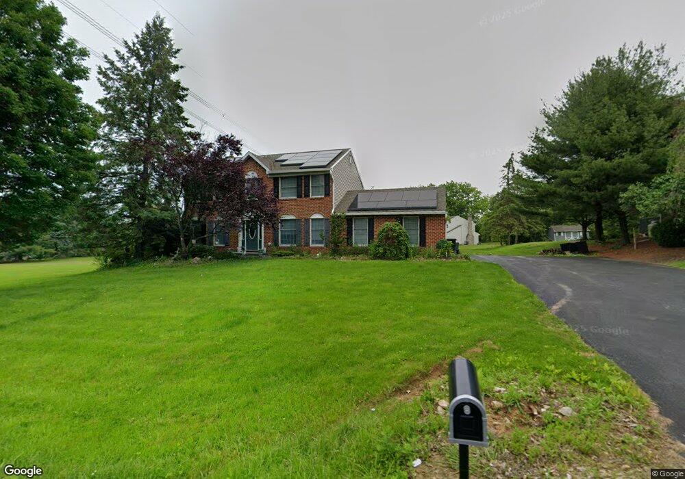
137 Krocks Rd Allentown, PA 18104
Upper Macungie Township NeighborhoodEstimated Value: $497,840 - $595,000
4
Beds
3
Baths
1,937
Sq Ft
$285/Sq Ft
Est. Value
About This Home
This home is located at 137 Krocks Rd, Allentown, PA 18104 and is currently estimated at $551,460, approximately $284 per square foot. 137 Krocks Rd is a home located in Lehigh County with nearby schools including Highland Elementary School, Tussing Elementary School, and Cetronia Elementary School.
Ownership History
Date
Name
Owned For
Owner Type
Purchase Details
Closed on
Apr 30, 2003
Sold by
Jones Susan G
Bought by
Schlenker Warren T and Schlenker Kay
Current Estimated Value
Home Financials for this Owner
Home Financials are based on the most recent Mortgage that was taken out on this home.
Original Mortgage
$120,000
Interest Rate
5.84%
Mortgage Type
Purchase Money Mortgage
Purchase Details
Closed on
Mar 28, 1996
Sold by
Searfoss William E and Searfoss Carole J
Bought by
Jones Susan G
Purchase Details
Closed on
Jan 4, 1994
Sold by
Cmc Development Corporation
Bought by
Searfoss William E and Searfoss Carole J
Purchase Details
Closed on
Mar 11, 1993
Sold by
Lehigh Valley Land Association Inc
Bought by
Cmc Development Corporation
Purchase Details
Closed on
Jun 29, 1988
Bought by
Lehigh Valley Land Association Inc
Create a Home Valuation Report for This Property
The Home Valuation Report is an in-depth analysis detailing your home's value as well as a comparison with similar homes in the area
Home Values in the Area
Average Home Value in this Area
Purchase History
| Date | Buyer | Sale Price | Title Company |
|---|---|---|---|
| Schlenker Warren T | $228,000 | -- | |
| Jones Susan G | $161,000 | -- | |
| Searfoss William E | $158,500 | -- | |
| Cmc Development Corporation | $1,184,000 | -- | |
| Lehigh Valley Land Association Inc | $1,522,500 | -- |
Source: Public Records
Mortgage History
| Date | Status | Borrower | Loan Amount |
|---|---|---|---|
| Closed | Schlenker Warren T | $120,000 |
Source: Public Records
Tax History Compared to Growth
Tax History
| Year | Tax Paid | Tax Assessment Tax Assessment Total Assessment is a certain percentage of the fair market value that is determined by local assessors to be the total taxable value of land and additions on the property. | Land | Improvement |
|---|---|---|---|---|
| 2025 | $5,992 | $276,900 | $71,400 | $205,500 |
| 2024 | $5,765 | $276,900 | $71,400 | $205,500 |
| 2023 | $5,627 | $276,900 | $71,400 | $205,500 |
| 2022 | $5,602 | $276,900 | $205,500 | $71,400 |
| 2021 | $5,602 | $276,900 | $71,400 | $205,500 |
| 2020 | $5,602 | $276,900 | $71,400 | $205,500 |
| 2019 | $5,483 | $276,900 | $71,400 | $205,500 |
| 2018 | $5,375 | $276,900 | $71,400 | $205,500 |
| 2017 | $5,297 | $276,900 | $71,400 | $205,500 |
| 2016 | -- | $276,900 | $71,400 | $205,500 |
| 2015 | -- | $276,900 | $71,400 | $205,500 |
| 2014 | -- | $276,900 | $71,400 | $205,500 |
Source: Public Records
Map
Nearby Homes
- 5137 Schantz Rd Unit The Jackson
- The Kennedy Plan at The Reserve at Surrey Court
- The Jefferson - Front Entry Plan at The Reserve at Surrey Court
- 5137 Schantz Rd Unit The Kennedy
- 5137 Schantz Rd Unit The Roosevelt
- The Jackson - Front Entry Plan at The Reserve at Surrey Court
- 5137 Schantz Rd Unit The Madison
- The Monroe Plan at The Reserve at Surrey Court
- 5137 Schantz Rd Unit The Monroe
- The Roosevelt - Front Entry Plan at The Reserve at Surrey Court
- The Madison Plan at The Reserve at Surrey Court
- 5137 Schantz Rd Unit The Jefferson
- 5821 Daniel St
- 241 Snapdragon Way
- 6126 Palomino Dr
- 247 Milkweed Dr
- 4622 Woodbrush Way
- 5926 Holiday Dr
- 270 Milkweed Dr
- 365 Pennycress Rd