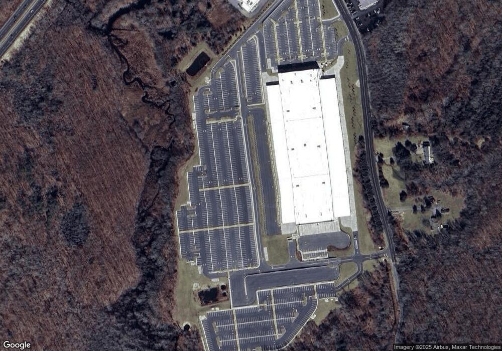
137 Lathrop Rd Plainfield, CT 06374
Studio
--
Bath
202,044
Sq Ft
5,980,788
Sq Ft Lot
About This Home
This home is located at 137 Lathrop Rd, Plainfield, CT 06374. 137 Lathrop Rd is a home located in Windham County with nearby schools including Plainfield Memorial School, Plainfield Central Middle School, and Plainfield High School.
Ownership History
Date
Name
Owned For
Owner Type
Purchase Details
Closed on
Jan 26, 2022
Sold by
We 137 Lathrop Road Llc
Bought by
Exeter Plainfield Land
Purchase Details
Closed on
Jun 28, 2021
Sold by
137 Lathrop Road Llc
Bought by
Exeter Plainfield Land
Purchase Details
Closed on
Nov 2, 2017
Sold by
Bvs Plainfield Investo
Bought by
We 137 Lathrop Road Ll
Create a Home Valuation Report for This Property
The Home Valuation Report is an in-depth analysis detailing your home's value as well as a comparison with similar homes in the area
Home Values in the Area
Average Home Value in this Area
Purchase History
| Date | Buyer | Sale Price | Title Company |
|---|---|---|---|
| Exeter Plainfield Land | -- | None Available | |
| Exeter Plainfield Land | -- | None Available | |
| Exeter Plainfield Land | -- | None Available | |
| Exeter Plainfield Land | -- | None Available | |
| Exeter Plainfield Land | -- | None Available | |
| Exeter Plainfield Land | -- | None Available | |
| We 137 Lathrop Road Ll | -- | -- | |
| We 137 Lathrop Road Ll | -- | -- |
Source: Public Records
Mortgage History
| Date | Status | Borrower | Loan Amount |
|---|---|---|---|
| Previous Owner | We 137 Lathrop Road Ll | $1,750,000 | |
| Previous Owner | We 137 Lathrop Road Ll | $200,000 | |
| Previous Owner | We 137 Lathrop Road Ll | $750,000 |
Source: Public Records
Tax History
| Year | Tax Paid | Tax Assessment Tax Assessment Total Assessment is a certain percentage of the fair market value that is determined by local assessors to be the total taxable value of land and additions on the property. | Land | Improvement |
|---|---|---|---|---|
| 2025 | $489,803 | $21,075,850 | $2,084,540 | $18,991,310 |
| 2024 | $470,624 | $21,075,850 | $2,084,540 | $18,991,310 |
| 2023 | $468,305 | $21,075,850 | $2,084,540 | $18,991,310 |
| 2022 | $37,930 | $12,278,170 | $956,550 | $11,321,620 |
| 2021 | $39,524 | $1,311,770 | $1,311,770 | $0 |
| 2020 | $39,392 | $1,311,770 | $1,311,770 | $0 |
| 2019 | $39,392 | $1,311,770 | $1,311,770 | $0 |
| 2018 | $38,907 | $1,311,770 | $1,311,770 | $0 |
| 2017 | $71,359 | $2,256,770 | $2,256,770 | $0 |
| 2016 | $68,831 | $2,256,770 | $2,256,770 | $0 |
| 2015 | $67,274 | $2,256,770 | $2,256,770 | $0 |
| 2014 | $67,274 | $2,256,770 | $2,256,770 | $0 |
Source: Public Records
Map
Nearby Homes
- 0 West Pkwy
- 83 Kate Downing Rd
- 0 Dow Rd Unit 24128109
- 40 Tarbox Rd
- 0 Pond St Unit 24037041
- 11 Brookside
- 383 Lathrop Rd
- 0A Norwich Rd
- 00 Norwich Rd
- 33 Railroad Ave
- 34 Pleasant St Unit 6
- 34 Pleasant St Unit 4
- 34 Pleasant St Unit 3
- 34 Pleasant St Unit 7
- 34 Pleasant St Unit 8
- 34 Pleasant St Unit 5
- 46 Pleasant St Unit 48
- 36 Plainfield Pike
- 230 Cemetery Rd
- 29 Old Canterbury Rd
- 134 Lathrop Rd
- 128 Lathrop Rd
- 0 Smith Lots 115c 014a & 115e 0035& 115e 0017 Rd Unit 170134317
- 186 Lathrop Rd
- 196 Lathrop Rd
- 211 Lathrop Rd
- 210 Lathrop Rd
- 57 Pratt Rd
- 41 Pratt Rd
- 120 Kate Downing Rd
- 197 Lathrop Rd
- 0 Lathrop Rd
- 46 Pratt Rd
- 226 Lathrop Rd
- 110 Kate Downing Rd
- 100 Kate Downing Rd
- 56 Pratt Rd
- 68 Pratt Rd
- 4 West Pkwy
- 0 Lathrop Road Extension Unit E258919
Your Personal Tour Guide
Ask me questions while you tour the home.