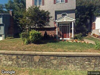
137 Maple St Melrose, MA 02176
Wyoming NeighborhoodEstimated Value: $967,634 - $1,134,000
3
Beds
2
Baths
2,916
Sq Ft
$359/Sq Ft
Est. Value
About This Home
This home is located at 137 Maple St, Melrose, MA 02176 and is currently estimated at $1,047,659, approximately $359 per square foot. 137 Maple St is a home located in Middlesex County with nearby schools including Lincoln Elementary School, Roosevelt Elementary School, and Winthrop Elementary School.
Ownership History
Date
Name
Owned For
Owner Type
Purchase Details
Closed on
Nov 30, 2023
Sold by
Giordano Ft and Giordano
Bought by
Giordano Ft and Giordano
Current Estimated Value
Purchase Details
Closed on
Nov 20, 2003
Sold by
Giordano Nicholas A and Giordano Raffaela M
Bought by
Giordano Ft and Giordano
Purchase Details
Closed on
Jul 13, 1972
Bought by
Giordano Ft
Create a Home Valuation Report for This Property
The Home Valuation Report is an in-depth analysis detailing your home's value as well as a comparison with similar homes in the area
Home Values in the Area
Average Home Value in this Area
Purchase History
| Date | Buyer | Sale Price | Title Company |
|---|---|---|---|
| Giordano Ft | -- | None Available | |
| Giordano Ft | -- | -- | |
| Giordano Ft | -- | -- |
Source: Public Records
Tax History Compared to Growth
Tax History
| Year | Tax Paid | Tax Assessment Tax Assessment Total Assessment is a certain percentage of the fair market value that is determined by local assessors to be the total taxable value of land and additions on the property. | Land | Improvement |
|---|---|---|---|---|
| 2025 | $81 | $820,700 | $464,200 | $356,500 |
| 2024 | $7,947 | $800,300 | $450,600 | $349,700 |
| 2023 | $7,464 | $716,300 | $409,600 | $306,700 |
| 2022 | $7,329 | $693,400 | $409,600 | $283,800 |
| 2021 | $7,099 | $648,300 | $382,300 | $266,000 |
| 2020 | $6,712 | $607,400 | $341,300 | $266,100 |
| 2019 | $6,286 | $581,500 | $315,400 | $266,100 |
| 2018 | $6,263 | $552,800 | $286,700 | $266,100 |
| 2017 | $5,815 | $492,800 | $273,100 | $219,700 |
| 2016 | $5,816 | $471,700 | $266,200 | $205,500 |
| 2015 | $5,581 | $430,600 | $232,100 | $198,500 |
| 2014 | $5,356 | $403,300 | $204,800 | $198,500 |
Source: Public Records
Map
Nearby Homes
- 80 Baxter St
- 31 Poplar St
- 40-42 Tappan St
- 40 Holland Rd
- 63 Lynn Fells Pkwy
- 45 Vinton St
- 24 Otis St
- 126 W Wyoming Ave
- 122 W Wyoming Ave Unit B
- 38-40 Hurd St
- 115 W Emerson St Unit 102
- 14 Aaron St
- 148 Myrtle St Unit 1
- 26 W Wyoming Ave Unit 1D
- 40 Upland Rd
- 63 W Emerson St Unit 4
- 447 Pleasant St
- 43 Warwick Rd
- 340 Main St Unit 502
- 27 Winthrop St Unit 27